MyTopo
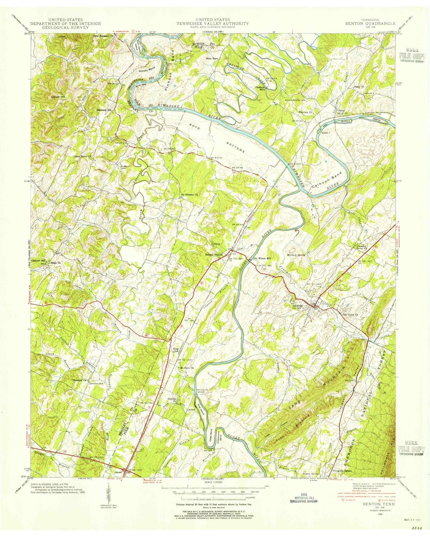
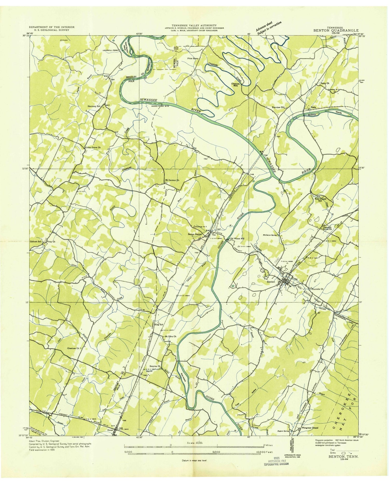
Classic USGS Benton Tennessee 7.5'x7.5' Topo Map
Couldn't load pickup availability
Historical USGS topographic quad map of Benton in the state of Tennessee. Map scale may vary for some years, but is generally around 1:24,000. Print size is approximately 24" x 27"
This quadrangle is in the following counties: Bradley, McMinn, Polk.
The map contains contour lines, roads, rivers, towns, and lakes. Printed on high-quality waterproof paper with UV fade-resistant inks, and shipped rolled.
Contains the following named places: Bacon Branch, Baker Chapel Cemetery, Barns Ferry, Benton, Benton Elementary School, Benton First Baptist Church, Benton Memorial Gardens, Benton Police Department, Benton Post Office, Benton Station, Benton Station Baptist Church, Boyd Bottoms, C C Blankenship Dam, C C Blankenship Lake, Calhoun Bend, Calhoun Branch, Cassada Pond, Cates Bend, Chestuee Church, Chestuee Creek, Chestuee Methodist Church Cemetery, Chestuee Mills, Chilcutt Cemetery, Chilcutt Chapel, Chilcutt High School, Clark Branch, Climer Branch, Cook Spring, Cooks Ferry, Coon Denton Island, Council Baptist Church, Davis Branch, Fairview Church, Fetzer Branch, Fourmile Creek, Frog Hollow Branch, Fry Branch, Gates Creek, Gatlin Branch, Grief, Guinn Island, Harmony School, Harris Spring, Helderbrand Ford, Hildebrand Bend, Hoskins Dam, Hoskins Lake, John Hale Branch, Kings School, Little Chestuee Creek, Little Mountain, Locust Hill, London Branch, Longwill Ferry, Lowery Branch, Lowery Cemetery, Matlock Valley, McClary Islands, McClary Spring, Mount Hermon Church, Mount Olive Church, Nancy Ward Cemetery, Ocoee River, Old Ocoee Church, Old Wilson Mill, Osment Bend, Parker Branch, Patty, Paul Branch, Pinhook Bend, Pleasant Grove Baptist Church, Polk County Courthouse, Polk County High School, Polk County Sheriff's Office, Price Store, Purselley Cemetery, Raht Chapel Branch, Red Hills, Reynolds Bridge, Rice Island, Rock Branch, Rogers Branch, Rogers Spring, Ross Chapel School, Rural / Metro Ambulance Polk County, Sand Mountain, Shumaker Branch, Sink Spring Branch, Smoky Bend, Smyrna Church, Smyrna Spring Branch, South Chestuee Creek, Spearman Branch, Todd Hollow, Todd Mountain, Town of Benton, Union Grove Cemetery, Union Grove Church, Victory Church, Walden Branch, WBIN-AM (Benton), Welcome Valley Baptist Church, West Polk County Fire and Rescue, West Polk County Fire and Rescue Station 7, Workman Island, Zion Church