
MyTopo
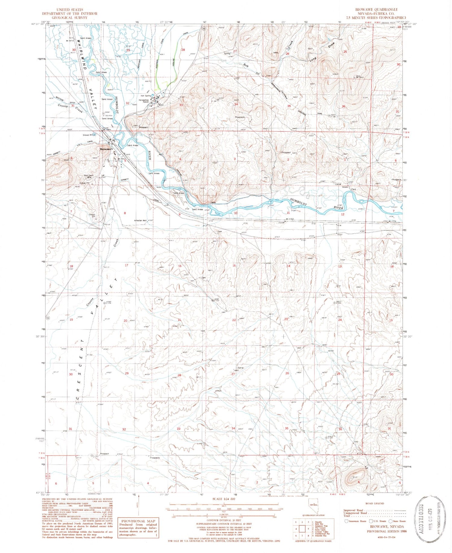
Classic USGS Beowawe Nevada 7.5'x7.5' Topo Map
Couldn't load pickup availability
Historical USGS topographic quad map of Beowawe in the state of Nevada. Map scale may vary for some years, but is generally around 1:24,000. Print size is approximately 24" x 27"
This quadrangle is in the following counties: Eureka.
The map contains contour lines, roads, rivers, towns, and lakes. Printed on high-quality waterproof paper with UV fade-resistant inks, and shipped rolled.
Contains the following named places: Anderson Canal, Beaowawe Gate, Beowawe, Beowawe Elementary School, Beowawe Indian Cemetery, Beowawe Mining District, Beowawe Post Office, Beowawe Volunteer Fire Department, Bob Creek, Corbett Canal, Dwyer Dam, Gravelly Ford, Gravelly Ford Post Office, Highline Canal, Horseshoe Ranch, Horseshoe Ranch Springs, Horseshoe Station, Johnson Ranch, Long Draw, Maidens Grave Cemetery, Pioneers Grave, Red Devil Mine


