MyTopo
Classic USGS Berea Creek East Nebraska 7.5'x7.5' Topo Map
Regular price
$16.95
Regular price
Sale price
$16.95
Unit price
per
Couldn't load pickup availability
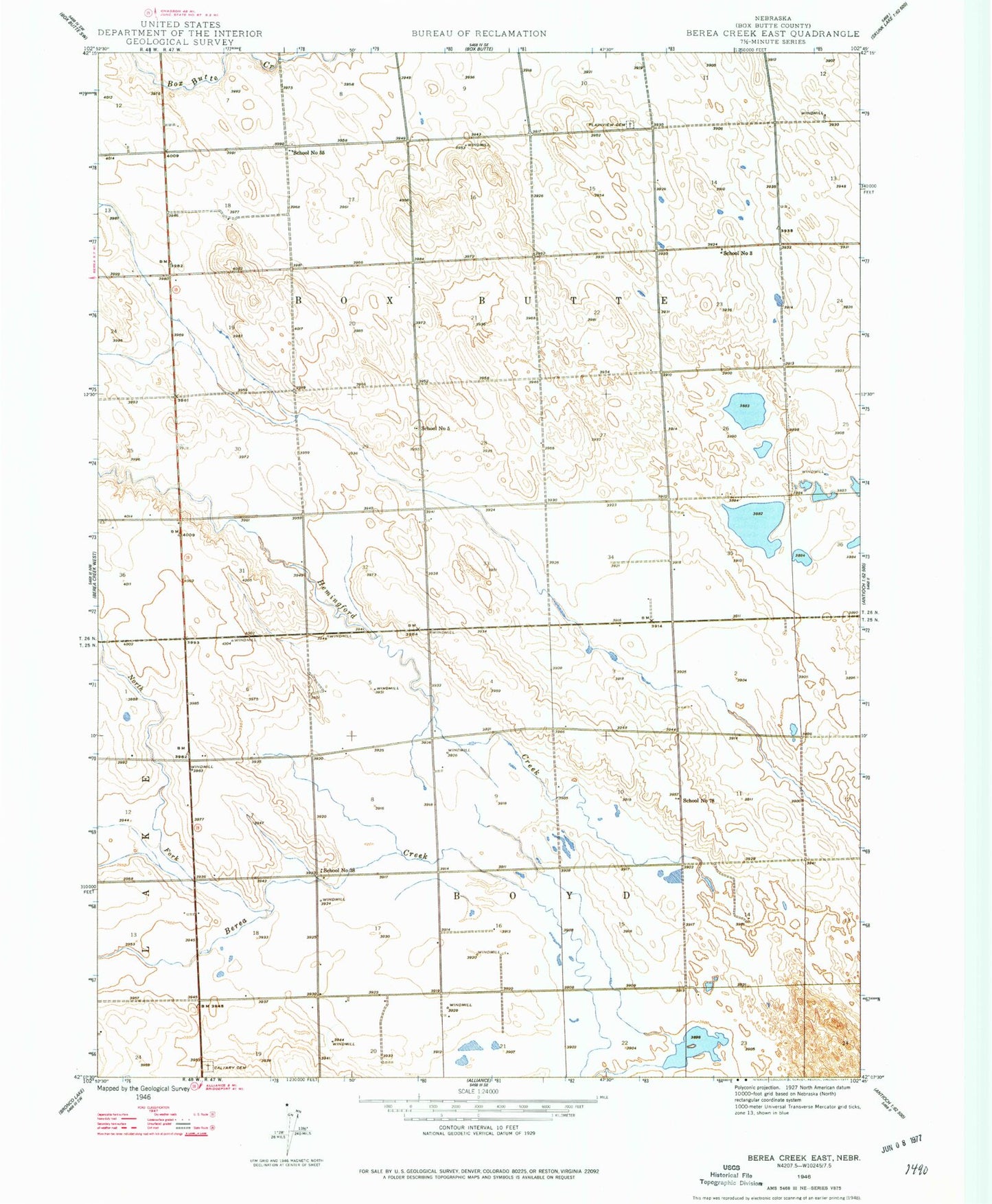
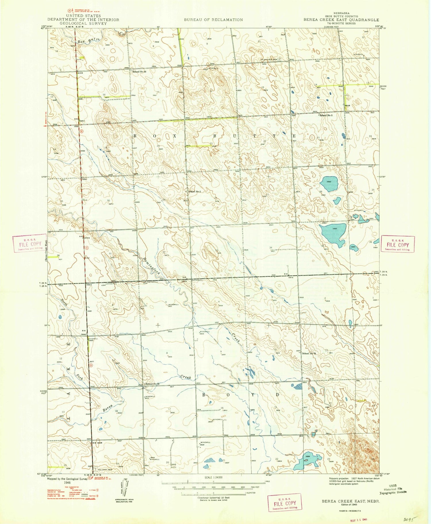
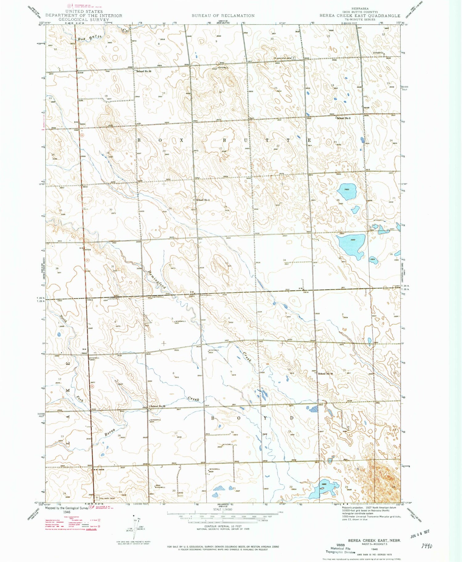
Historical USGS topographic quad map of Berea Creek East in the state of Nebraska. Map scale may vary for some years, but is generally around 1:24,000. Print size is approximately 24" x 27"
This quadrangle is in the following counties: Box Butte.
The map contains contour lines, roads, rivers, towns, and lakes. Printed on high-quality waterproof paper with UV fade-resistant inks, and shipped rolled.
Contains the following named places: Berea Creek, Calvary Cemetery, Carhenge, Fairview Cemetery, Hemingford Creek, North Fork Berea Creek, School Number 3, School Number 38, School Number 5, School Number 55, School Number 78, Zochol Feedlot