MyTopo
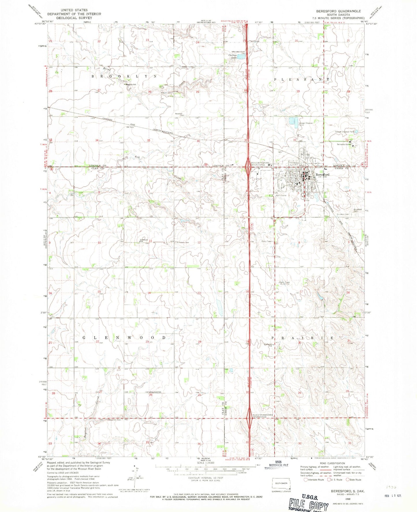
Classic USGS Beresford South Dakota 7.5'x7.5' Topo Map
Couldn't load pickup availability
Historical USGS topographic quad map of Beresford in the state of South Dakota. Map scale may vary for some years, but is generally around 1:24,000. Print size is approximately 24" x 27"
This quadrangle is in the following counties: Clay, Lincoln, Union.
The map contains contour lines, roads, rivers, towns, and lakes. Printed on high-quality waterproof paper with UV fade-resistant inks, and shipped rolled.
Contains the following named places: Beresford, Beresford Cemetery, Beresford City Hall, Beresford Community Ambulance Service, Beresford Elementary School, Beresford Fire Department, Beresford High School, Beresford Memorial Park Cemetery, Beresford Middle School, Beresford Police Department, Beresford Post Office, Beresford Public Library, Bethesda Cemetery, Bethesda Homes, Bonine Cemetery, Brooklyn, Brooklyn Cemetery, Brooklyn Church, Brooklyn School, Canton Dam, Carlson Lake, City of Beresford, Danefield School, Danefield Seventh Day Advent Cemetery, Emmanuel Lutheran Cemetery, Glenwood, Glenwood School, Houde Cemetery, Klostergaard Dam, Larsen Cemetery, Saint John's Cemetery, Saint Peters Cemetery, Seventh Day Adventist Church, Stewart Dam, Sunnyside School, Township of Glenwood, ZIP Code: 57004