MyTopo
Classic USGS Berge Peak Idaho 7.5'x7.5' Topo Map
Regular price
$16.95
Regular price
Sale price
$16.95
Unit price
per
Couldn't load pickup availability
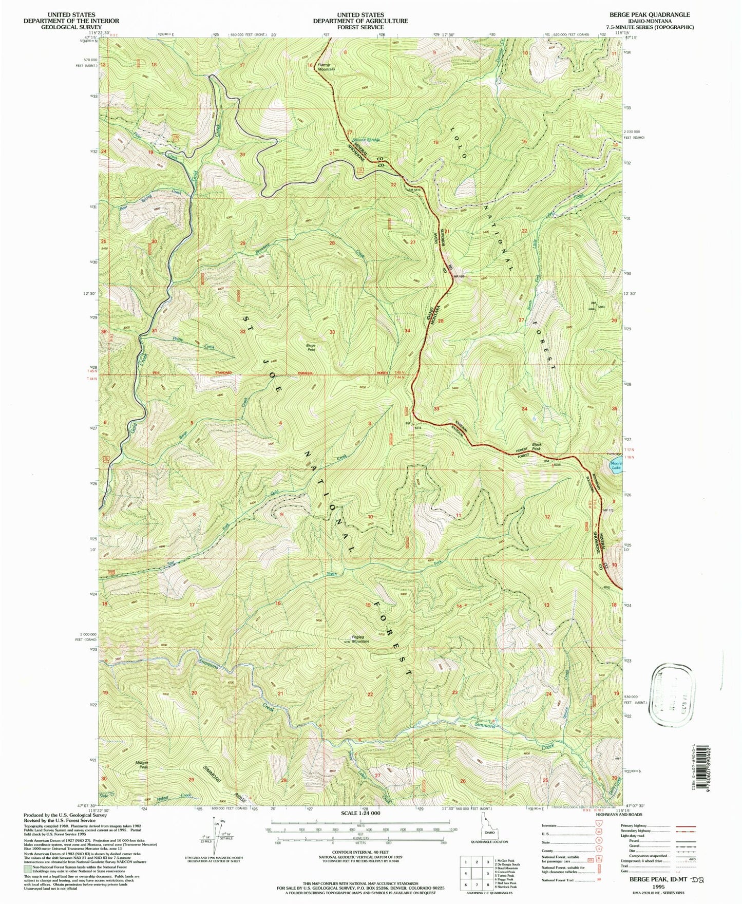
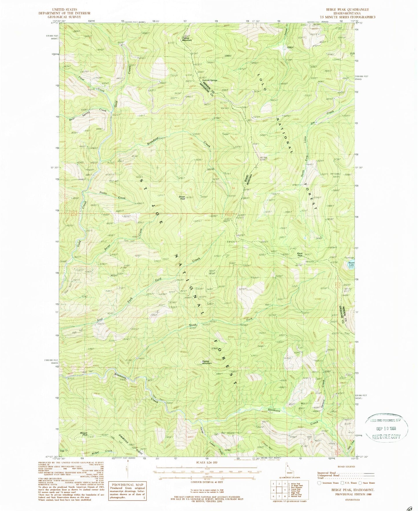
Historical USGS topographic quad map of Berge Peak in the states of Idaho, Montana. Map scale may vary for some years, but is generally around 1:24,000. Print size is approximately 24" x 27"
This quadrangle is in the following counties: Mineral, Shoshone.
The map contains contour lines, roads, rivers, towns, and lakes. Printed on high-quality waterproof paper with UV fade-resistant inks, and shipped rolled.
Contains the following named places: Bear Spring Creek, Berge Creek, Berge Peak, Black Peak, Broadaxe Creek, Dolly Creek, Flattop Mountain, Float Creek, Leg Bone Ridge, Midget Peak, Moore Lake, North Fork Simmons Creek, Pegleg Mountain, Pretty Creek, Spruce Creek, Summit Springs, Three Lakes Creek