MyTopo
Classic USGS Bergholz Ohio 7.5'x7.5' Topo Map
Couldn't load pickup availability
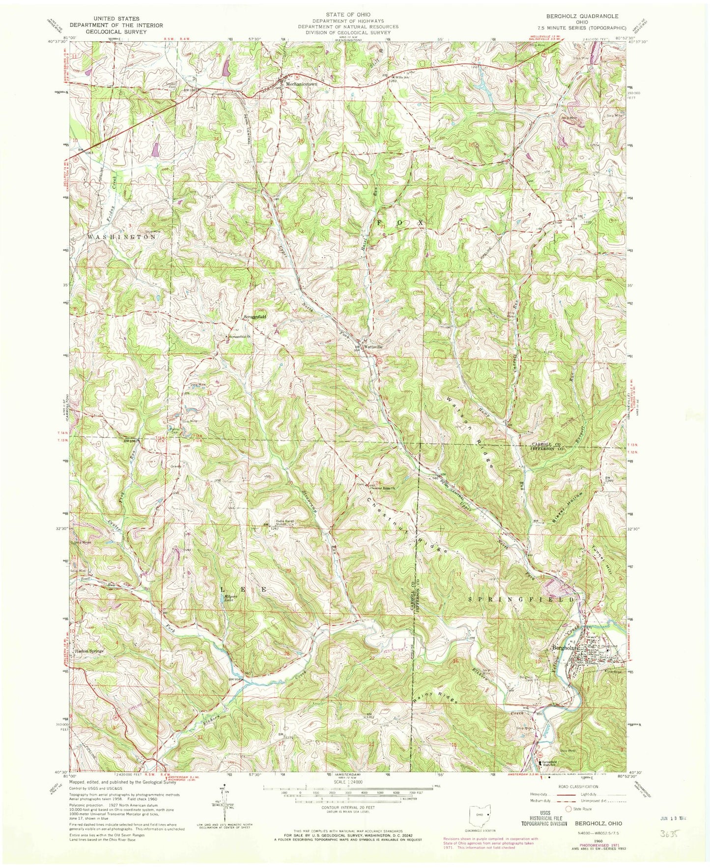
Historical USGS topographic quad map of Bergholz in the state of Ohio. Map scale may vary for some years, but is generally around 1:24,000. Print size is approximately 24" x 27"
This quadrangle is in the following counties: Carroll, Jefferson.
The map contains contour lines, roads, rivers, towns, and lakes. Printed on high-quality waterproof paper with UV fade-resistant inks, and shipped rolled.
Contains the following named places: Bergholz, Bergholz Cemetery, Bergholz Post Office, Bergholz Squad, Bergholz Volunteer Fire Company, Blazer Hollow, Burgett Run, Carroll Run, Center Fork, Chestnut Ridge Cemetery, Chestnut Ridge Church, Corinth - Mechanicstown Cemetery, Elkhorn Creek, Fox Township Volunteer Fire Department, Frog Run, Hazel Run, Hump Run, Kilgore Lake, McClain Field, McGauran Cemetery, Mechanicstown, Mechanicstown Post Office, Palmer Cemetery, Rainy Ridge, Scroggsfield, Scroggsfield Cemetery, Scroggsfield Church, Scroggsfield Post Office, Snyder Cemetery, Springfield High School, Strawcamp Run, Township of Fox, Township of Lee, Trail Run, Tunnel Hill, Upper North Fork, Village of Bergholz, Watson Ridge, Wattsville, Wattsville Post Office, Wells - Jackman Cemetery, Willis Elementary School