MyTopo
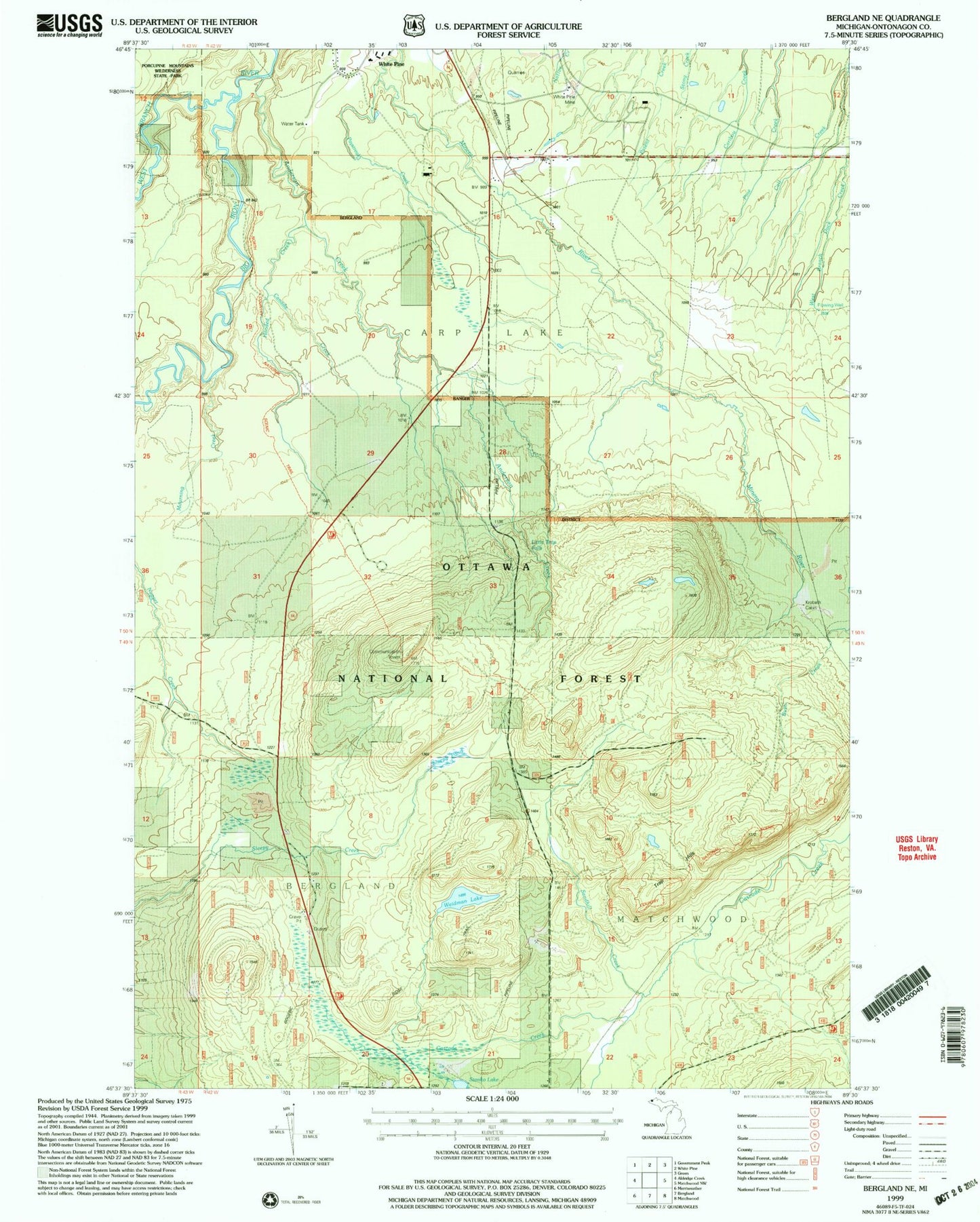
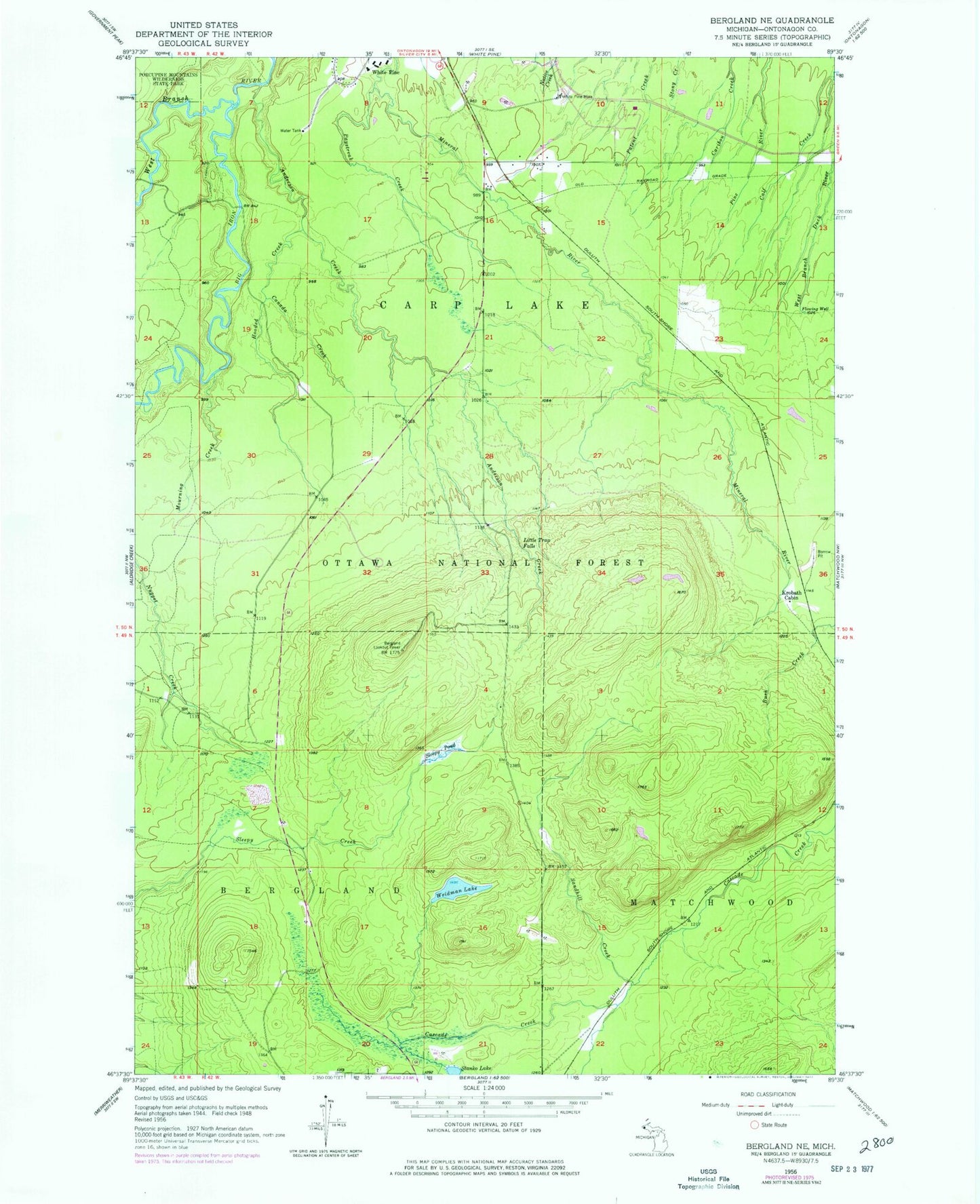
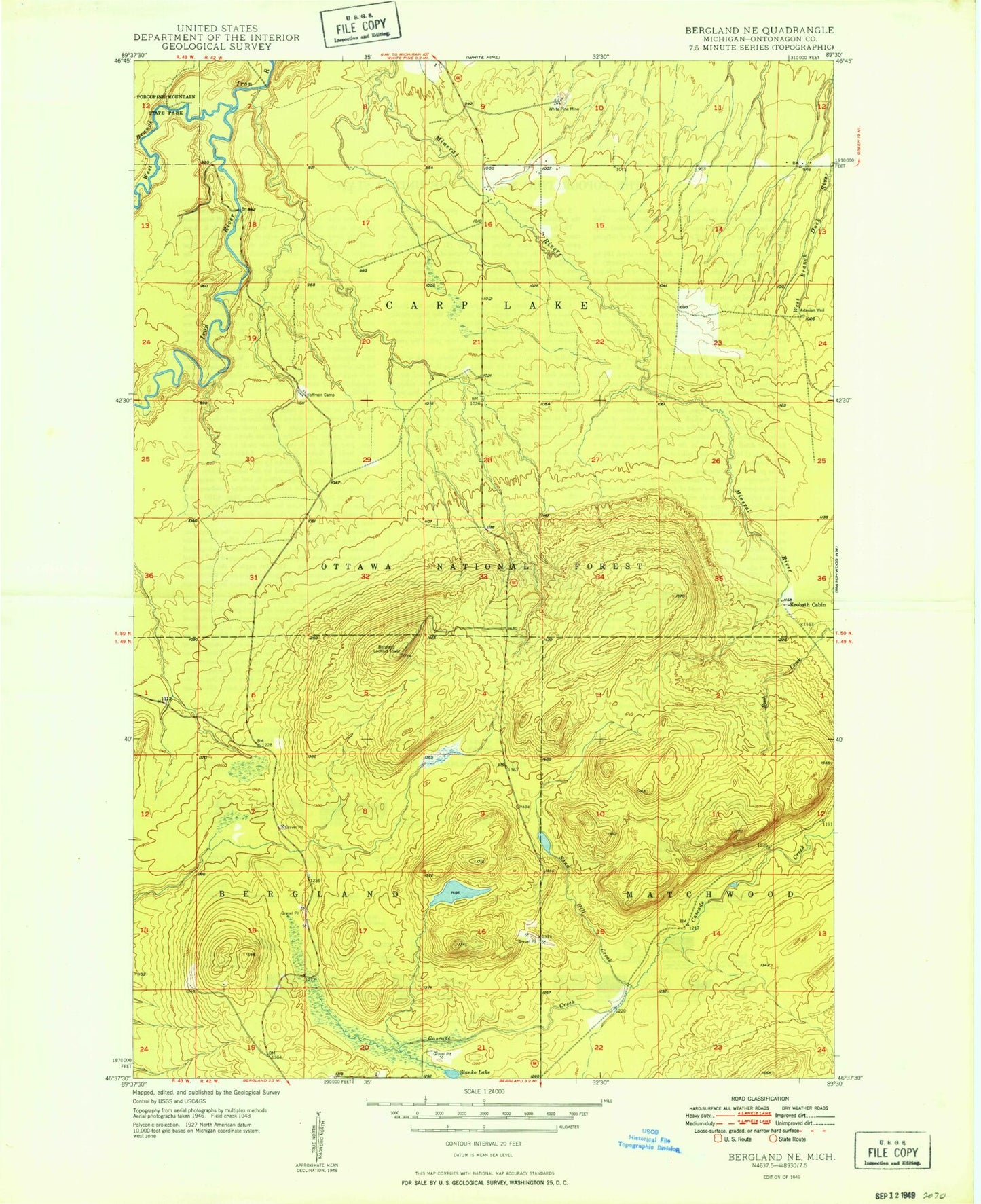
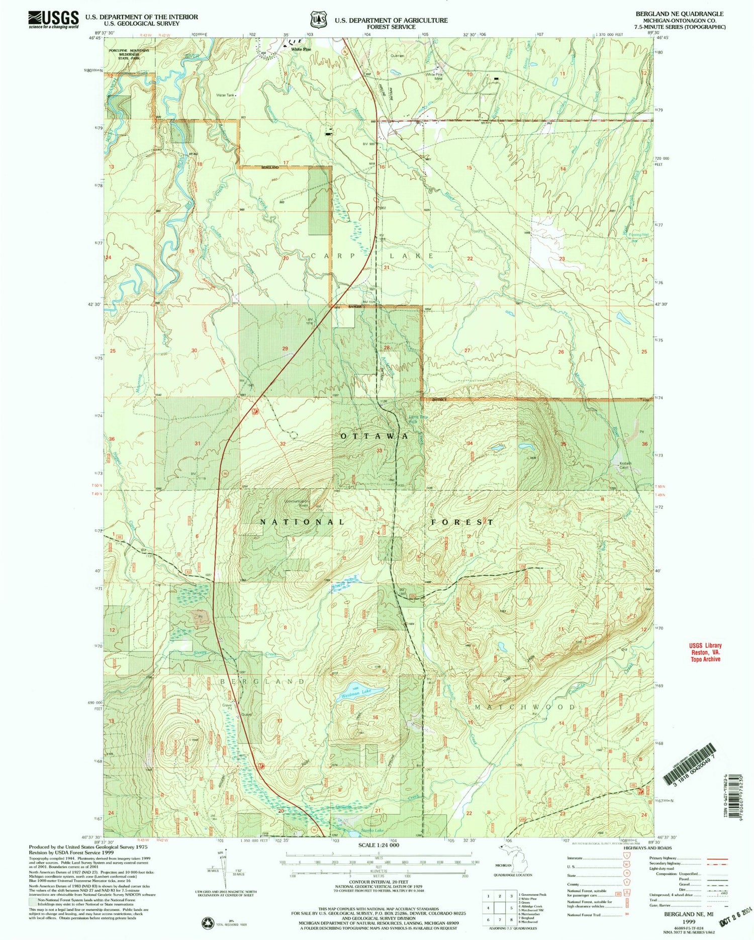
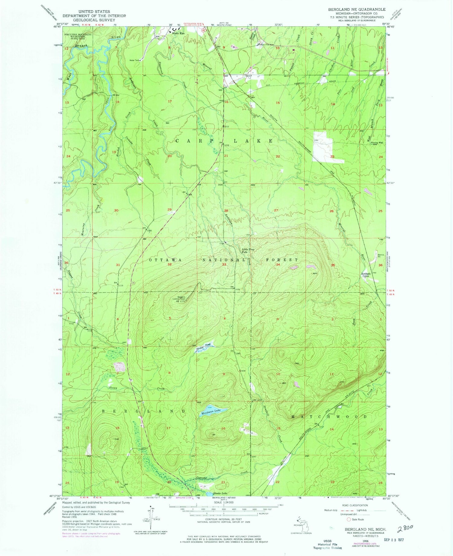
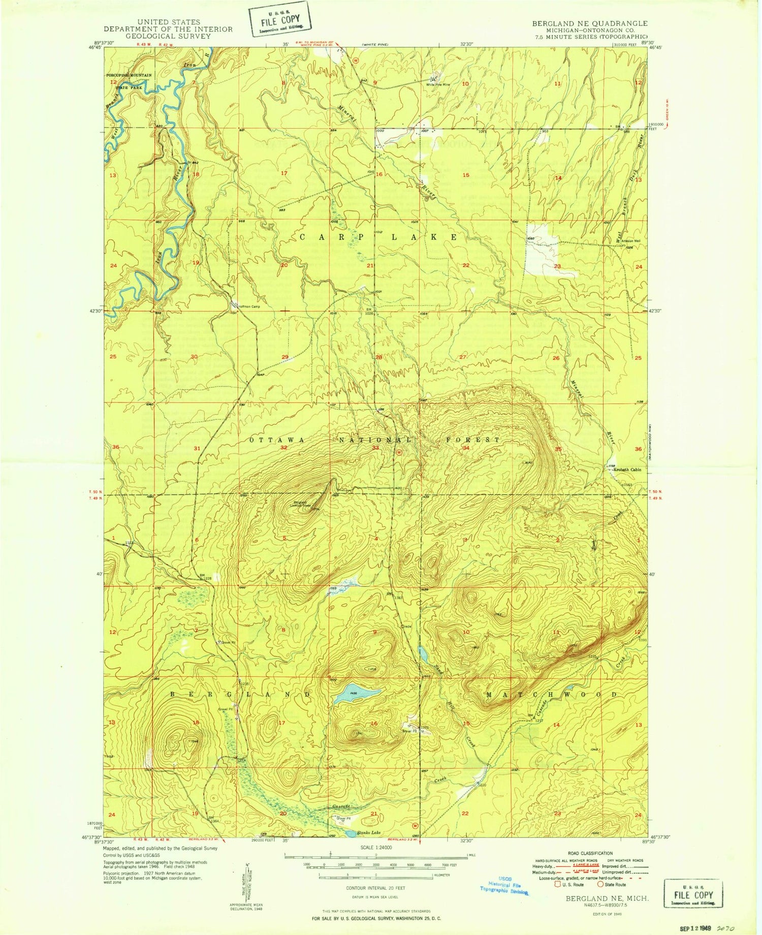
Classic USGS Bergland NE Michigan 7.5'x7.5' Topo Map
Couldn't load pickup availability
Historical USGS topographic quad map of Bergland NE in the state of Michigan. Typical map scale is 1:24,000, but may vary for certain years, if available. Print size: 24" x 27"
This quadrangle is in the following counties: Ontonagon.
The map contains contour lines, roads, rivers, towns, and lakes. Printed on high-quality waterproof paper with UV fade-resistant inks, and shipped rolled.
Contains the following named places: Anderson Creek, Calf Creek, Hooded Creek, Little Trap Falls, Stanko Lake, Weidman Lake, White Pine Mine, West Branch Iron River, Canada Creek, Krobath Cabin, Loggerhead Creek, Mourning Creek, Paystreak Creek, Sandhill Creek, Sleepy Pond, Trap Hills, Bergland Lookout Tower, White Pine Census Designated Place, Anderson Creek, Calf Creek, Hooded Creek, Little Trap Falls, Stanko Lake, Weidman Lake, White Pine Mine, West Branch Iron River, Canada Creek, Krobath Cabin, Loggerhead Creek, Mourning Creek, Paystreak Creek, Sandhill Creek, Sleepy Pond, Trap Hills, Bergland Lookout Tower, White Pine Census Designated Place