MyTopo
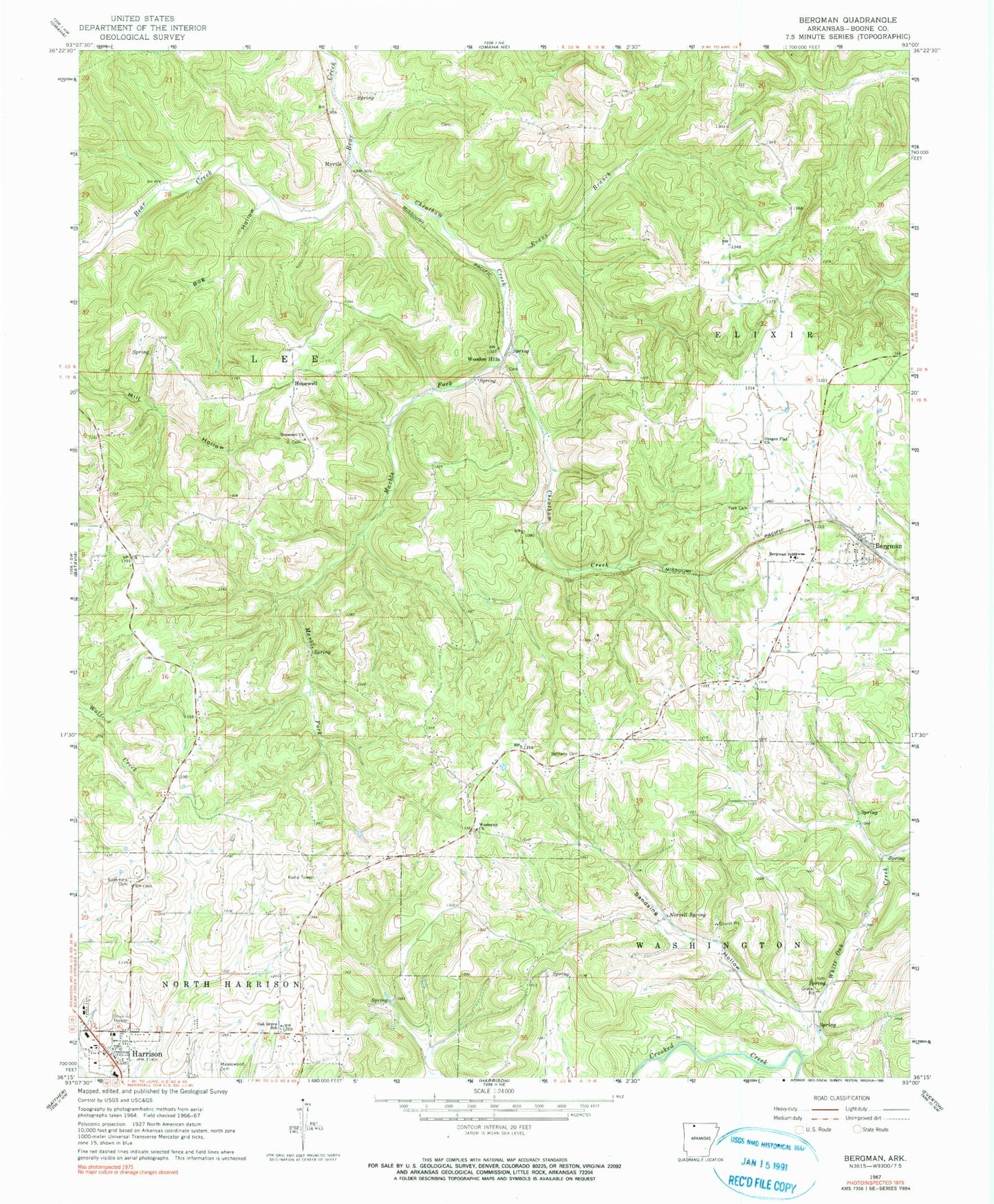
Classic USGS Bergman Arkansas 7.5'x7.5' Topo Map
Couldn't load pickup availability
Historical USGS topographic quad map of Bergman in the state of Arkansas. Map scale is 1:24000. Print size is approximately 24" x 27"
This quadrangle is in the following counties: Boone.
The map contains contour lines, roads, rivers, towns, and lakes. Printed on high-quality waterproof paper with UV fade-resistant inks, and shipped rolled.
Contains the following named places: Bergman, Bergman Assembly of God Church, Bergman Elementary School, Bergman Fire Department Station 2, Bergman High School, Bergman Post Office, Bergman Volunteer Fire Department Station 1, Bethany Cemetery, Bog Hollow, Boone County, Cheatham Creek, Cottonwood Rural Fire Department Station 1, Evans Branch, Gooch Hollow, Harrison Christian Academy, Harrison Fire Department Station 2, Hopewell, Hopewell Baptist Church, KCWD-FM (Harrison), Marble Fork, Myrtle, Northvale Shopping Center, Norvell Spring, Oak Grove School, Open Door Baptist Church, Oregon (historical), Oregon Flat Baptist Church, Ozark Mall Shopping Center, Sandsing Hollow, Summers Cemetery, Town of Bergman, Township of Elixir, Township of Lee, Township of Washington (historical), Wesleyan Church, White Oak Creek, Wooden Hills, York Cemetery