
MyTopo
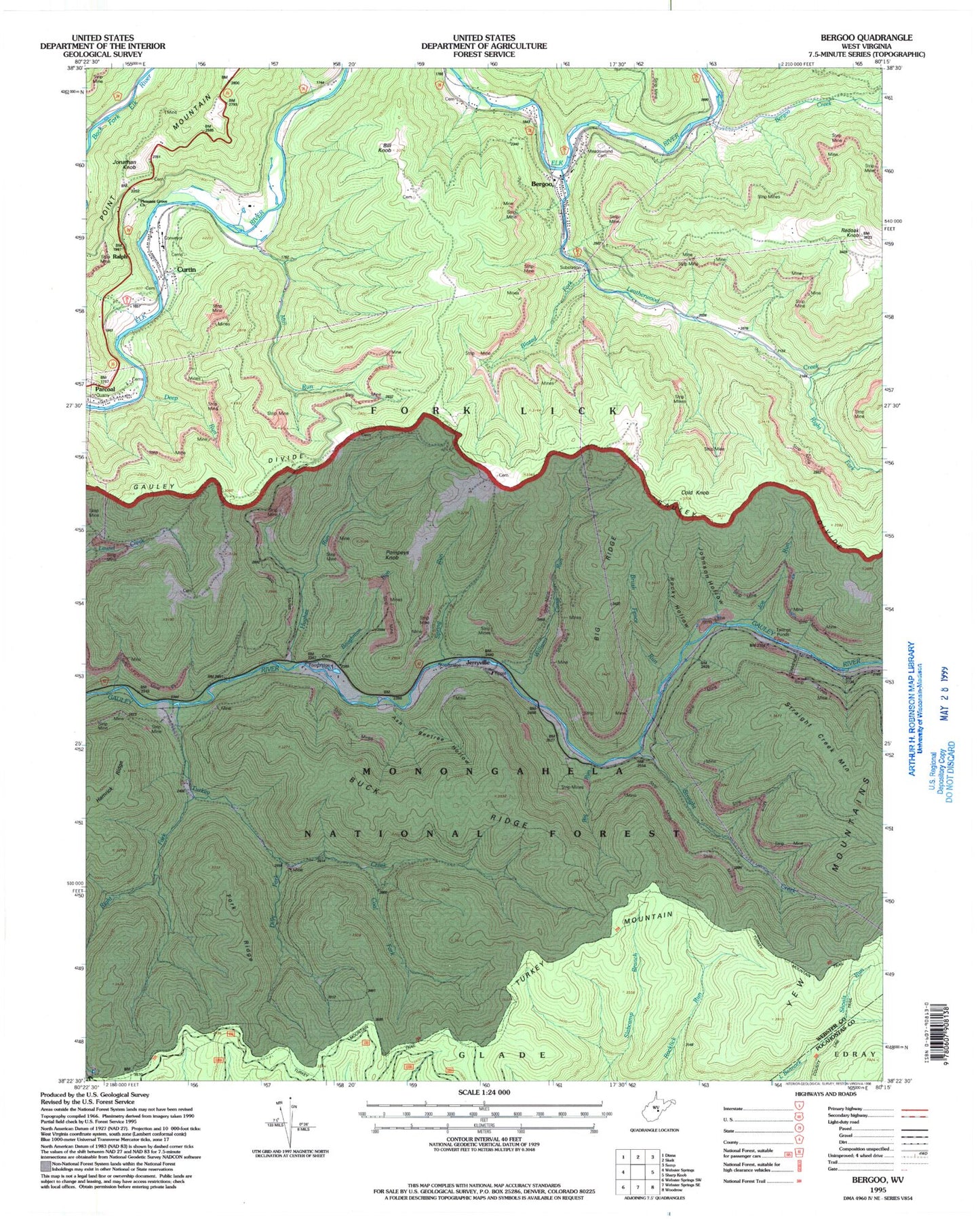
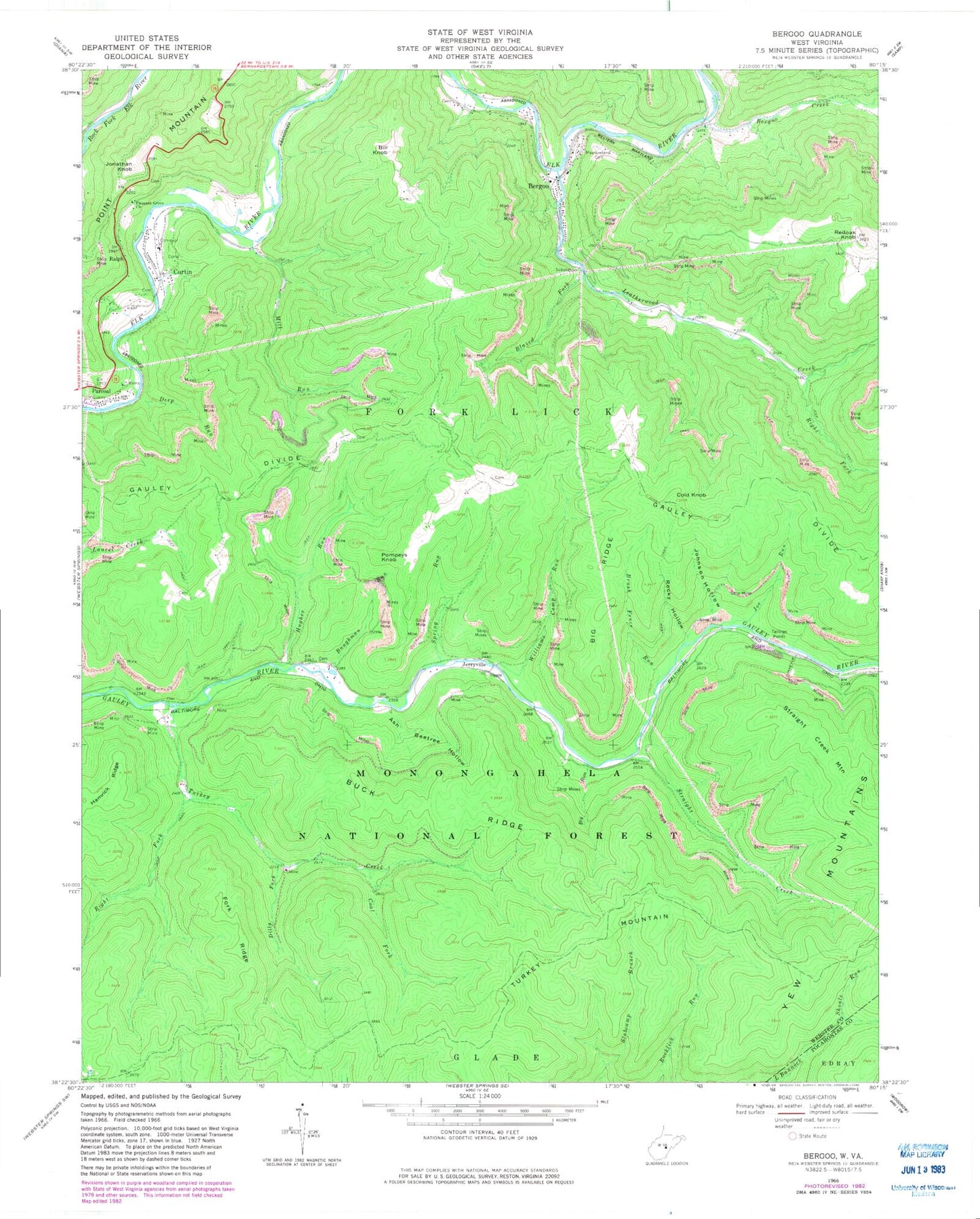
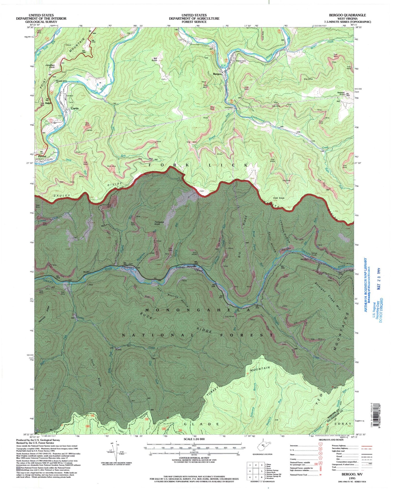
Classic USGS Bergoo West Virginia 7.5'x7.5' Topo Map
Couldn't load pickup availability
Historical USGS topographic quad map of Bergoo in the state of West Virginia. Typical map scale is 1:24,000, but may vary for certain years, if available. Print size: 24" x 27"
This quadrangle is in the following counties: Pocahontas, Webster.
The map contains contour lines, roads, rivers, towns, and lakes. Printed on high-quality waterproof paper with UV fade-resistant inks, and shipped rolled.
Contains the following named places: Ash Beetree Hollow, Baughman Run, Bergoo Creek, Big Ridge, Big Run, Bill Knob, Blazed Fork, Brush Fence Run, Buck Ridge, Coal Fork, Cold Knob, Deep Run, Dilly Fork, Drybed Run, Fork Ridge, Hughes Run, Joe Run, Johnson Hollow, Leatherwood Creek, Meadowland Cemetery, Mill Run, Pleasant Grove Church, Ralph, Redoak Knob, Right Fork Leatherwood Creek, Right Fork Turkey Creek, Rocky Hollow, Spring Run, Straight Creek, Straight Creek Mountain, Turkey Creek, Williams Camp Run, Twin Branch Trail, Turkey Mountain Trail, Bergoo, Curtin, Jerryville, Jonathan Knob, Parcoal, Pompeys Knob, Gwen Wyatt Spring, Bergoo Post Office, Bill Knob School (historical), Hughes Run School (historical), Mill Run School (historical), Redoak School (historical), Saint Marys School (historical), Bergoo Census Designated Place, Curtin Census Designated Place, Parcoal Census Designated Place, Union Cemetery, Union Cemetery