MyTopo
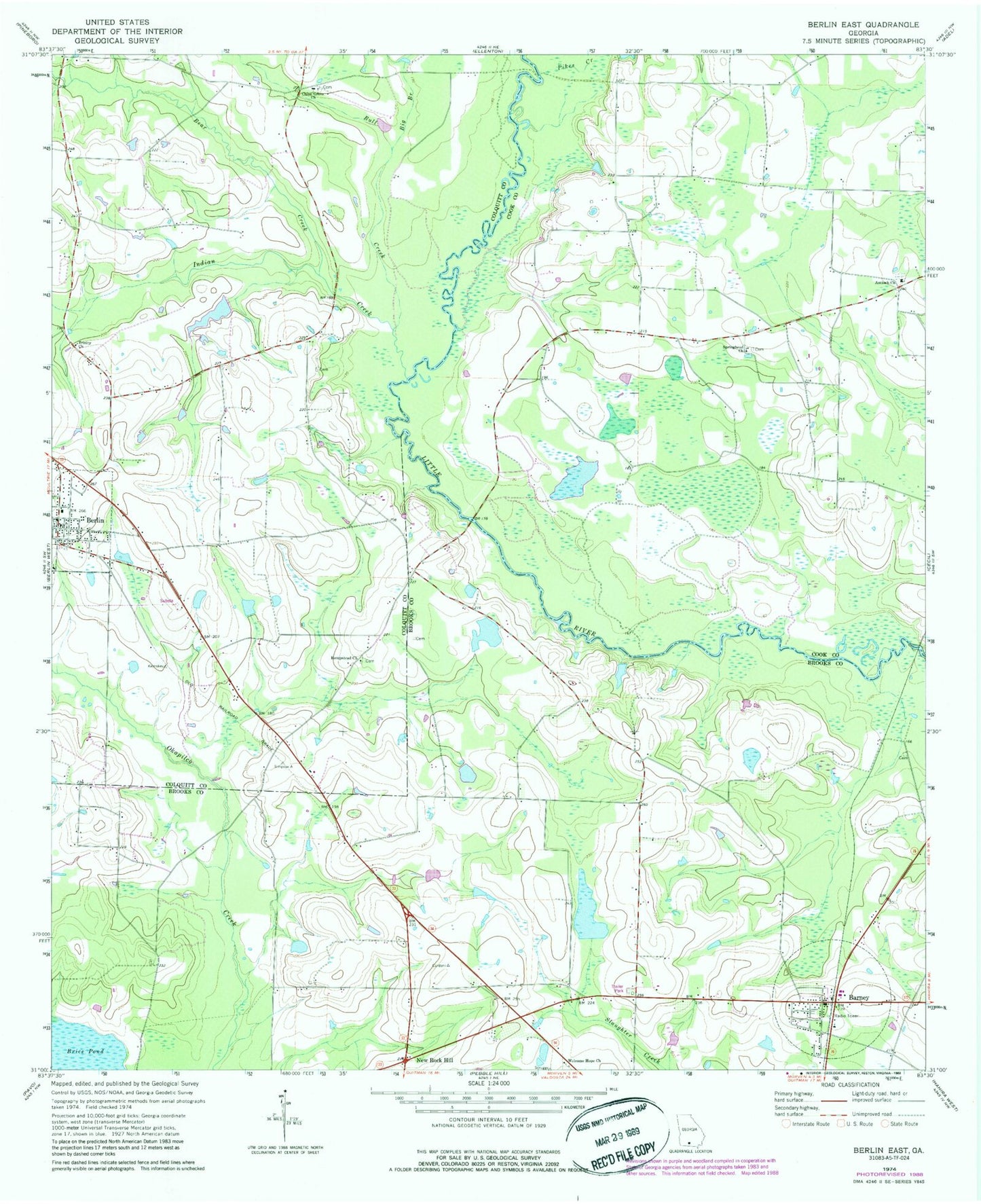
Classic USGS Berlin East Georgia 7.5'x7.5' Topo Map
Couldn't load pickup availability
Historical USGS topographic quad map of Berlin East in the state of Georgia. Map scale may vary for some years, but is generally around 1:24,000. Print size is approximately 24" x 27"
This quadrangle is in the following counties: Brooks, Colquitt, Cook.
The map contains contour lines, roads, rivers, towns, and lakes. Printed on high-quality waterproof paper with UV fade-resistant inks, and shipped rolled.
Contains the following named places: Alderman Pond, Antioch Cemetery, Antioch Church, Barney, Barney Division, Barney Post Office, Bear Creek, Berlin, Berlin Elementary School, Berlin Police Department, Berlin Post Office, Big Branch, Bull Creek, Burney Bridge, Burton Lake, Burton Lake Dam, Cardin Lake, Cardin Lake Dam, China Grove Church, City of Berlin, Coloquitt County Volunteer Firefighters Association Fire Station 31 Berlin, County Line School, Hempstead Church, Hempstead Church Cemetery, Indian Creek, McConnell Bridge, New Rock Hill, Old Rock Hill, Pikes Creek, Pine Grove Church, Rock Hill School, Ryall Pond, Springhead Church, Strickland Cemetery, Trinity Church, Welcome Hope Church, ZIP Code: 31722