MyTopo
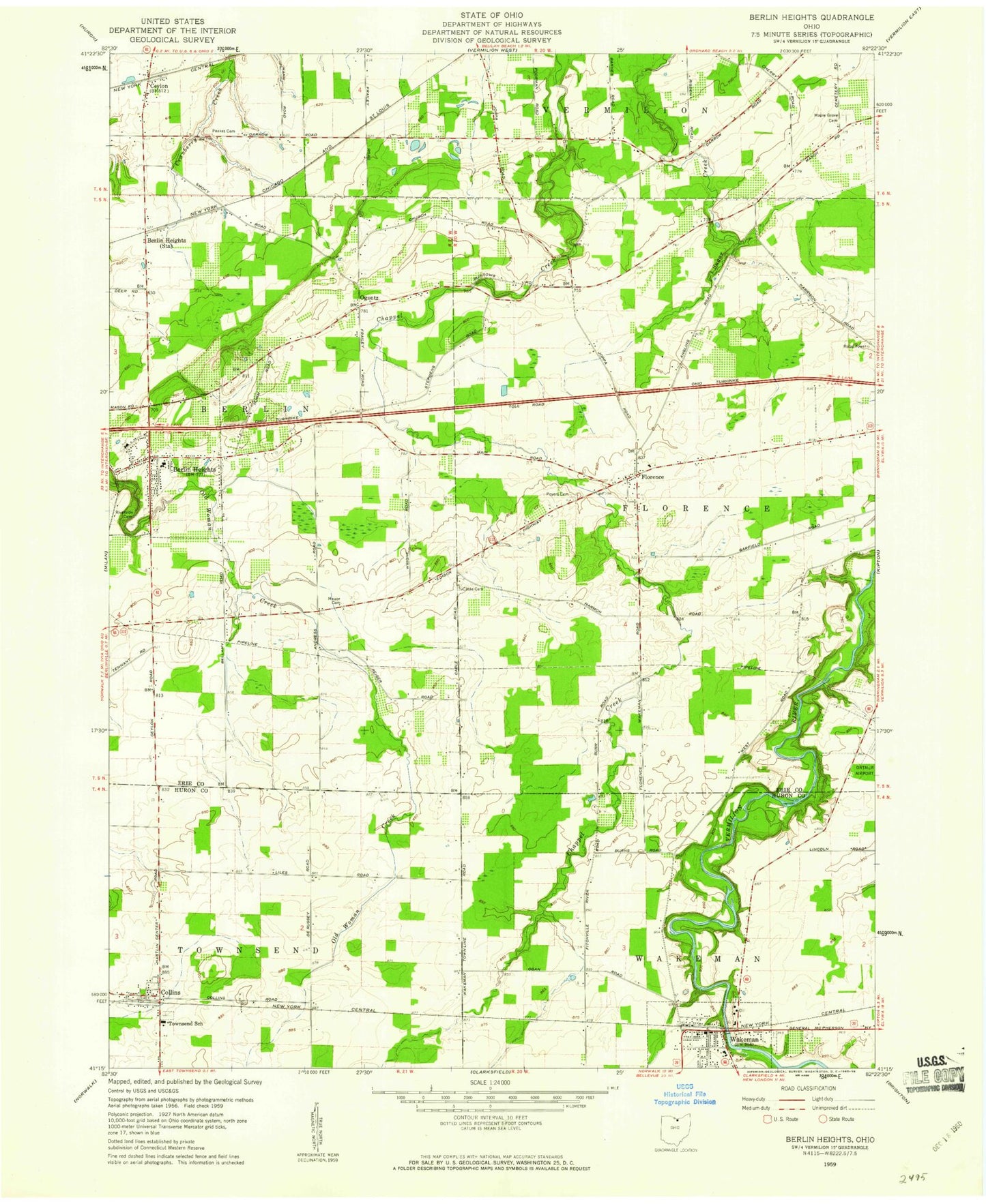
Classic USGS Berlin Heights Ohio 7.5'x7.5' Topo Map
Couldn't load pickup availability
Historical USGS topographic quad map of Berlin Heights in the state of Ohio. Map scale may vary for some years, but is generally around 1:24,000. Print size is approximately 24" x 27"
This quadrangle is in the following counties: Erie, Huron.
The map contains contour lines, roads, rivers, towns, and lakes. Printed on high-quality waterproof paper with UV fade-resistant inks, and shipped rolled.
Contains the following named places: Berlin Heights, Berlin Heights Baptist Cemetery, Berlin Heights Baptist Church, Berlin Heights Fire Department, Berlin Heights Police Department, Berlin Heights Post Office, Berlin Heights Station, Berlin Township Public Library, Berlin-Milan Middle School, Burnham Orchards, Cable Cemetery, Ceylon, Ceylon Post Office, Citizens Ambulance Service, Collins, Collins Cemetery, Collins Census Designated Place, Collins Methodist Church, Collins Post Office, Coultrips Dairy Farm, Denton Farm Cemetery, Edison Woods Reserve, First Congregational United Church of Christ, Florence, Florence Cemetery, Florence Christian Church, Florence Corners School, Florence Post Office, Joppa, Lakeview United Methodist Church, Maple Grove Cemetery, Ogontz, Ogontz Post Office, Peakes Cemetery, Poyer Cemetery, Quarry Hill Orchards, Riverside Cemetery, Saint Mary Catholic Cemetery, Sheefel Mobile Home Park, Soviak Orchards, Townsend School, Township of Berlin, Township of Florence, Village of Berlin Heights, Village of Wakeman, Wakeman, Wakeman Elementary School, Wakeman Police Department, Wakeman Post Office, West End Cemetery, Willow Brook Farms of Wakeman, WNZN-FM (Lorain), ZIP Code: 44814