MyTopo
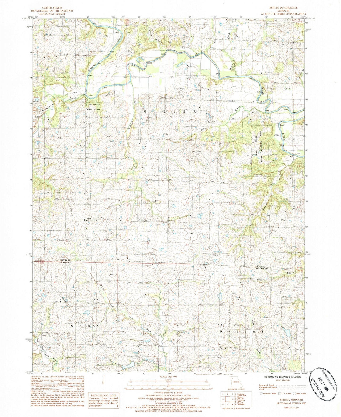
Classic USGS Berlin Missouri 7.5'x7.5' Topo Map
Couldn't load pickup availability
Historical USGS topographic quad map of Berlin in the state of Missouri. Map scale may vary for some years, but is generally around 1:24,000. Print size is approximately 24" x 27"
This quadrangle is in the following counties: DeKalb, Gentry.
The map contains contour lines, roads, rivers, towns, and lakes. Printed on high-quality waterproof paper with UV fade-resistant inks, and shipped rolled.
Contains the following named places: Andy Denton Public Access, Beach Branch, Berlin, Berlin Cemetery, Brushy Creek, Campbell Creek, Concord School, Crawford Bridge, Elam Bend State Wildlife Area, Elsworth School, Grandview School, Grindstone-Lost-Muddy Creek Watershed Dam D-22, Grindstone-Lost-Muddy Creek Watershed Dam D-23, Hickory Creek, Jestes Lake, Jestes Lake Dam, Jolly Creek, Lake Mar-Lou, Limestone School, Nance Dam, Oak Grove School, Osborne Bridge, Rattlesnake School, Red Star School, Township of Miller, Wheeler Creek