
MyTopo
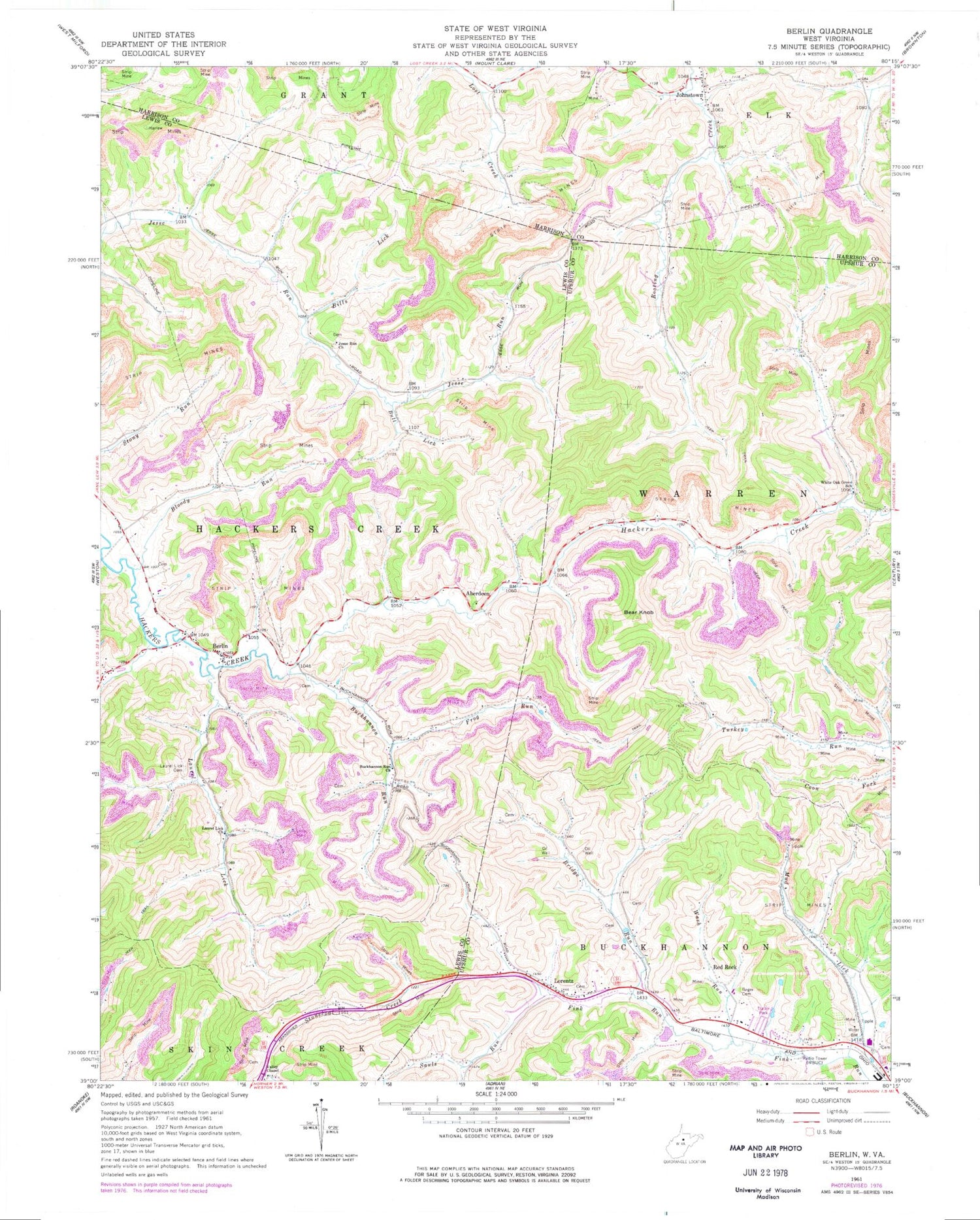
Classic USGS Berlin West Virginia 7.5'x7.5' Topo Map
Couldn't load pickup availability
Historical USGS topographic quad map of Berlin in the state of West Virginia. Map scale may vary for some years, but is generally around 1:24,000. Print size is approximately 24" x 27"
This quadrangle is in the following counties: Harrison, Lewis, Upshur.
The map contains contour lines, roads, rivers, towns, and lakes. Printed on high-quality waterproof paper with UV fade-resistant inks, and shipped rolled.
Contains the following named places: Aberdeen, Bear Knob, Berlin, Bills Lick, Blake School, Bloody Run, Bridge Run, Bridge Run School, Buckhannon Run, Buckhannon Run Church, Buckhannon Run School, Bull Lick, Frog Run, Jesse Run Cemetery, Jesse Run Church, Johnstown, Johnstown United Methodist Church, Johnstown Volunteer Fire Department, Laurel Lick, Laurel Lick Cemetery, Laurel Lick Church, Lorentz, Lorentz Methodist Protestant Church, Lorentz Post Office, Mick Hill School, Morrison Cemetery, Mud Lick, Mudlick School, New Johnstown Cemetery, Old Johnstown Cemetery, Red Rock, Reger Cemetery, Rooting Creek School, Sauls Run, Upper Jesse Run School, Valley Chapel, Walnut Grove School, Wash Run, WBUC-AM (Buckhannon), White Oak, White Oak Grove School, Whiteoak Grove School


