
MyTopo
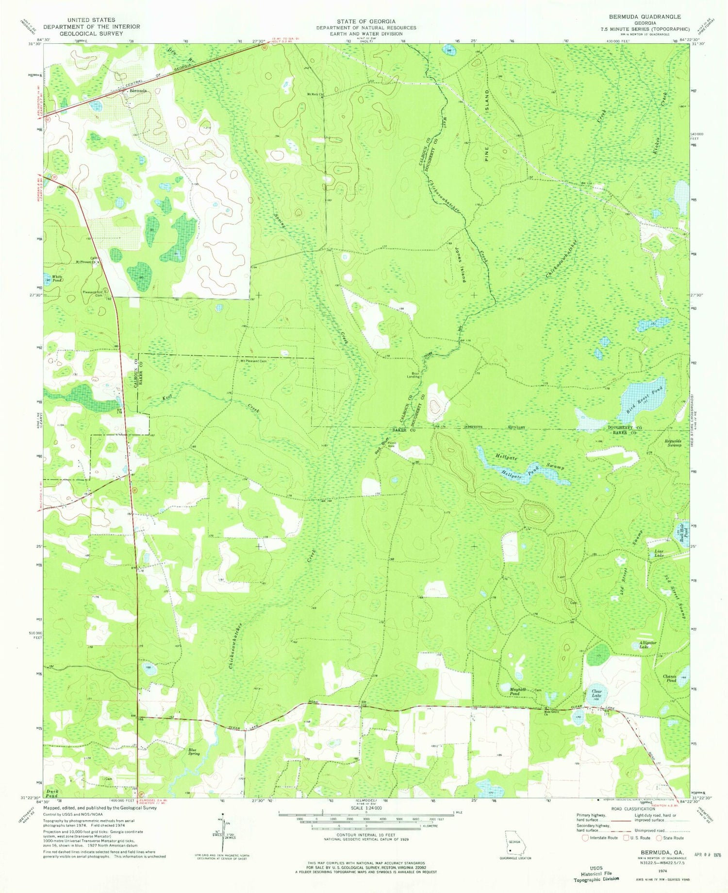
Classic USGS Bermuda Georgia 7.5'x7.5' Topo Map
Couldn't load pickup availability
Historical USGS topographic quad map of Bermuda in the state of Georgia. Map scale may vary for some years, but is generally around 1:24,000. Print size is approximately 24" x 27"
This quadrangle is in the following counties: Baker, Calhoun, Dougherty.
The map contains contour lines, roads, rivers, towns, and lakes. Printed on high-quality waterproof paper with UV fade-resistant inks, and shipped rolled.
Contains the following named places: Alligator Lake, Bermuda, Bird Roost Pond, Blue Spring, Clear Lake, Dry Branch, Fortysecond Street Swamp, Hellgate Pond, Hellgate Swamp, Jones Island, Keel Creek, Kiokee Creek, Liar Lake, Mayhall Pond, Mole Grove Church, Mount Mary Church, Mount Pleasant Cemetery, Mount Pleasant Church, Pine Island, Pleasant Hill Cemetery, Red Bluff, Rock Hole Pond, Saint Pauls Church, Spring Creek, Twentythird Street Swamp, West Chickasawhatchee Creek, White Pond


