MyTopo
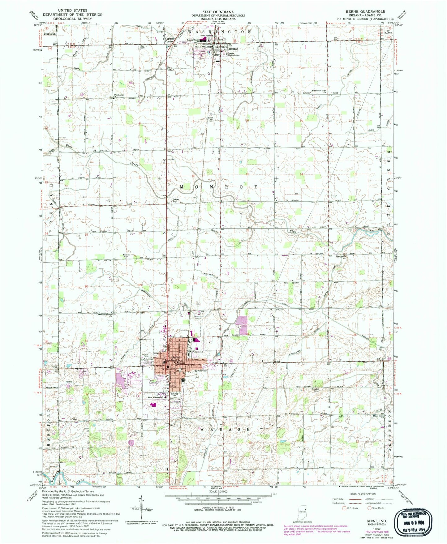
Classic USGS Berne Indiana 7.5'x7.5' Topo Map
Couldn't load pickup availability
Historical USGS topographic quad map of Berne in the state of Indiana. Map scale may vary for some years, but is generally around 1:24,000. Print size is approximately 24" x 27"
This quadrangle is in the following counties: Adams.
The map contains contour lines, roads, rivers, towns, and lakes. Printed on high-quality waterproof paper with UV fade-resistant inks, and shipped rolled.
Contains the following named places: Adams Central Elementary School, Adams Central High School, Adams Central Middle School, Adams County, Bella Vista Farms, Berne, Berne Elementary School, Berne Fire Department, Berne Police Department, Berne Post Office, Christian Mission Church, City of Berne, Coppess Corner, Crawford Cemetery, Duer Ditch, Farlow Ditch, First Missionary Church, Four-H Park, Friends Meetinghouse, Fuch Ditch, Gates Ditch, Graber Cemetery, Habegger Ditch, Hendericks Ditch, Hoosier Cemetery, Irish Acres Dairy, Jamstutz Ditch, Johnson Ditch, Lehman Park, Lotter Farms, Maple Grove Church, Martz Ditch, Mazelin Cemetery, Monroe, Monroe Post Office, Monroe Volunteer Fire Department, Peel Ditch, Pleasant Valley Church, Ray Cemetery, Schugg Ditch, Smith Cemetery, Smith Ditch, Smith Shoemaker Ditch, Sommer Farm, Spring Hill Church, Sprunger Ditch, Sprungers South Adams County Airstrip, Swartz Ditch, Town of Monroe, Township of Monroe, Winchester Church, Wittmer Number One Ditch, Wittmer Number Two Ditch, ZIP Codes: 46711, 46772