MyTopo
Classic USGS Bernice Louisiana 7.5'x7.5' Topo Map
Couldn't load pickup availability
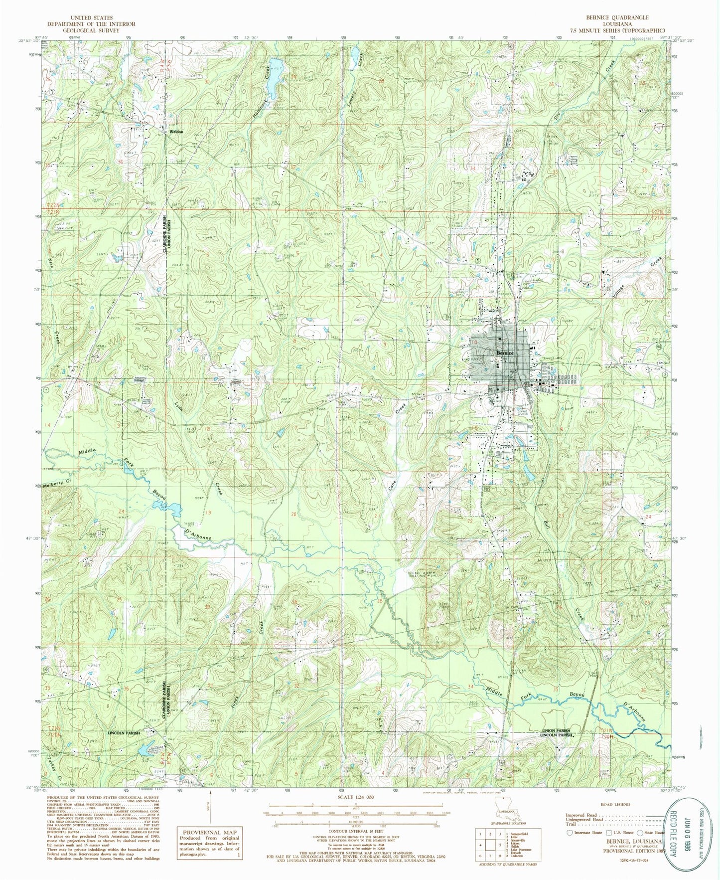
Historical USGS topographic quad map of Bernice in the state of Louisiana. Map scale may vary for some years, but is generally around 1:24,000. Print size is approximately 24" x 27"
This quadrangle is in the following counties: Claiborne, Lincoln, Union.
The map contains contour lines, roads, rivers, towns, and lakes. Printed on high-quality waterproof paper with UV fade-resistant inks, and shipped rolled.
Contains the following named places: Alabama Methodist Church, Alabama-Weldon Cemetery, Bernice, Bernice Cemetery, Bernice High School, Bernice Police Department, Bernice Post Office, Bernice Volunteer Fire Department, Bull Creek, Bull Creek Gas Field, Cane Creek, Cane Ridge, Harmony Chapel Cemetery, Harmony Chapel United Methodist Church, Hopewell Cemetery, Hunt, Jones Cemetery, Jones Creek, Lindsay Dam, Lindsays Pond, Lynn Creek, Lynn Creek Gas Field, Mount Olive Cemetery, Mount Olive Oil and Gas Field, Mount Tabor School, Mulberry Creek, New Bethel Church, New Land Church, Nick Creek, Pine Grove Church, Pisgah, Pisgah Church, Reeves Memorial Medical Center, Town of Bernice, Tubbs Cemetery, Weldon, Weldon Baptist Church, ZIP Code: 71222