MyTopo
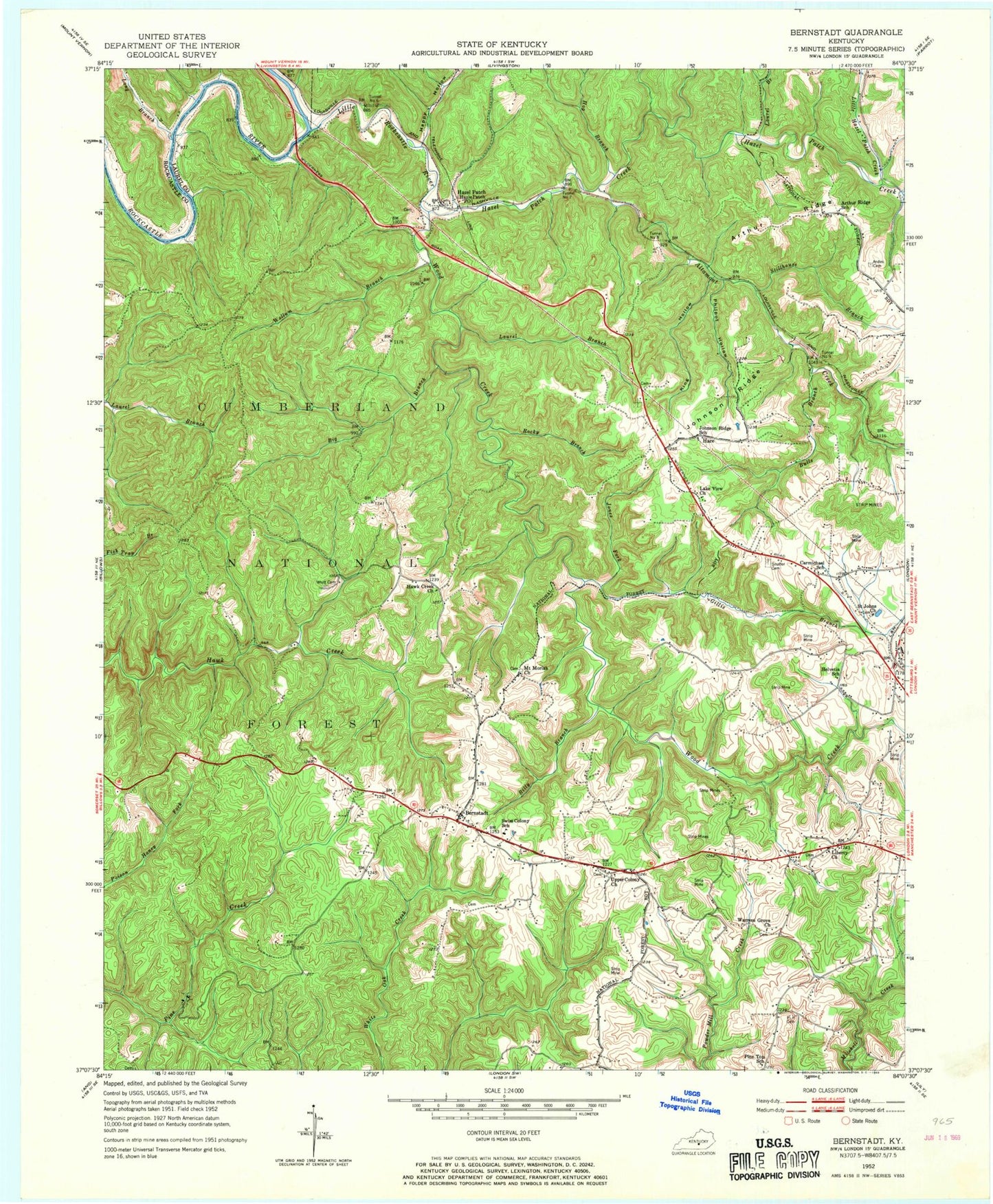
Classic USGS Bernstadt Kentucky 7.5'x7.5' Topo Map
Couldn't load pickup availability
Historical USGS topographic quad map of Bernstadt in the state of Kentucky. Map scale may vary for some years, but is generally around 1:24,000. Print size is approximately 24" x 27"
This quadrangle is in the following counties: Laurel, Rockcastle.
The map contains contour lines, roads, rivers, towns, and lakes. Printed on high-quality waterproof paper with UV fade-resistant inks, and shipped rolled.
Contains the following named places: Altamont Creek, Andes Cemetery, Arthur Ridge, Begley Hollow, Bernstadt, Big Branch, Billy Branch, Bulls Branch, Carmichael Community Pentecostal Church, Colony Division, Colony Elementary School, Daniel Boone Motocross Park, East Bernstadt Division, East Bernstadt Fire Department, Faulkners Railroad Station, GG Heliport, Gillis Branch, Happy Hollow, Hare, Hawk Creek Church, Hazel Patch, Hazel Patch Creek, Hazel Patch Post Office, Hellard Branch, Hog Branch, Johnson Ridge, Johnson Ridge School, Jones Fork, King Hollow, Lake View Church, Laurel Branch, Liberty Baptist Church, Little Hazel Patch Creek, Little Rockcastle River, Long Branch, Milburn Hollow, Mount Moriah Church, Old Dog Patch, Philpot Hollow, Pine Top Church, Rockcastle River Bridge, Rocky Branch, Saint Johns Church, Shetland Creek, Snuffer Cemetery, Stillhouse Branch, Swiss Colony Volunteer Fire Department, Swiss Colony Volunteer Fire Department Station 2, Tunnel Number 6, Tunnel Number 7, Tunnel Number 8, Tunnel Number 9, Upper Colony Church, Warrens Grove Church, Whitt Cemetery, Wollum Branch, Wood Creek, Wood Creek Lake, ZIP Code: 40741