MyTopo
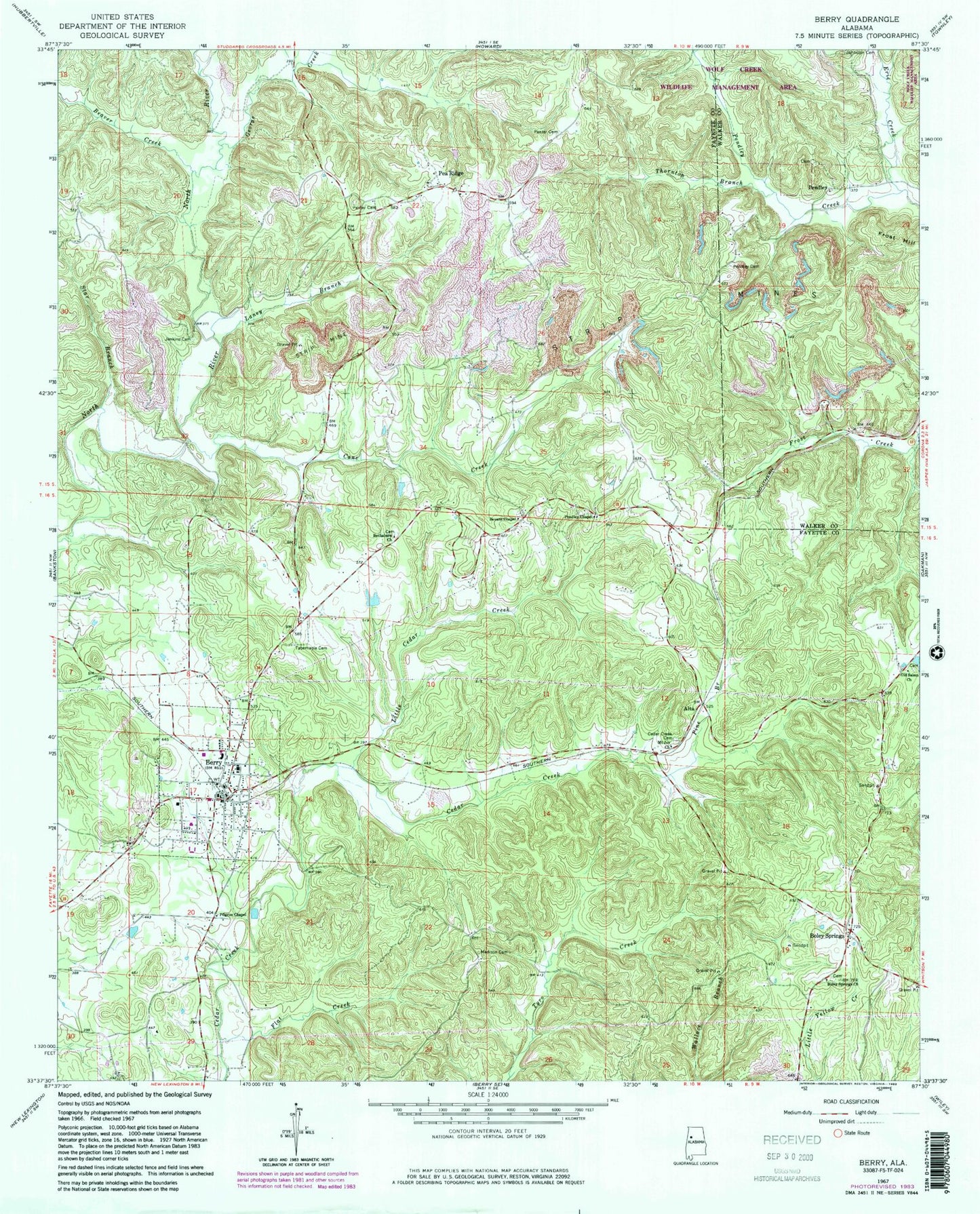
Classic USGS Berry Alabama 7.5'x7.5' Topo Map
Couldn't load pickup availability
Historical USGS topographic quad map of Berry in the state of Alabama. Map scale may vary for some years, but is generally around 1:24,000. Print size is approximately 24" x 27"
This quadrangle is in the following counties: Fayette, Walker.
The map contains contour lines, roads, rivers, towns, and lakes. Printed on high-quality waterproof paper with UV fade-resistant inks, and shipped rolled.
Contains the following named places: Alabama Christian College, Alta, Alta Cemetery, Alta Church, Arbor Springs Church, Beaven Cemetery, Beaver Creek, Berry, Berry Baptist Church, Berry Church of Christ, Berry City Cemetery, Berry Division, Berry Elementary School, Berry High School, Berry Methodist Church, Berry Police Department, Berry Post Office, Berry Volunteer Fire Department, Bethabara Cemetery, Bethabara Church, Bevans Chapel, Boley Church, Boley Spring School, Boley Springs, Boley Springs Cemetery, Boley Springs Church, Boley Volunteer Fire Department, Calvary Church, Cane Creek, Cedar Creek Cemetery, Corona Number 20 Mine, Erie Creek, Flat Creek, Fred Webster Stadium, Frost Hill, George Creek, Jenkins Cemetery, Laney Branch, Little Cedar Creek, Madison Cemetery, Mount Joy Church, Nazarene Church of Berry, New Hope Cemetery, New Hope Church, Oak Grove School, Old Salem Church, Panter Cemetery, Pea Ridge, Pea Ridge Church of Christ, Pea Ridge Number 1 Mine, Pendley, Pendley Cemetery, Pendley Chapel, Pendley's Chapel Cemetery, Pilgrim Chapel, Pine Branch, Salem Cemetery, Star Branch, Tabernacle Cemetery, Tabernacle Church, Thornton Branch, Town of Berry