MyTopo
Classic USGS Berryville Illinois 7.5'x7.5' Topo Map
Couldn't load pickup availability
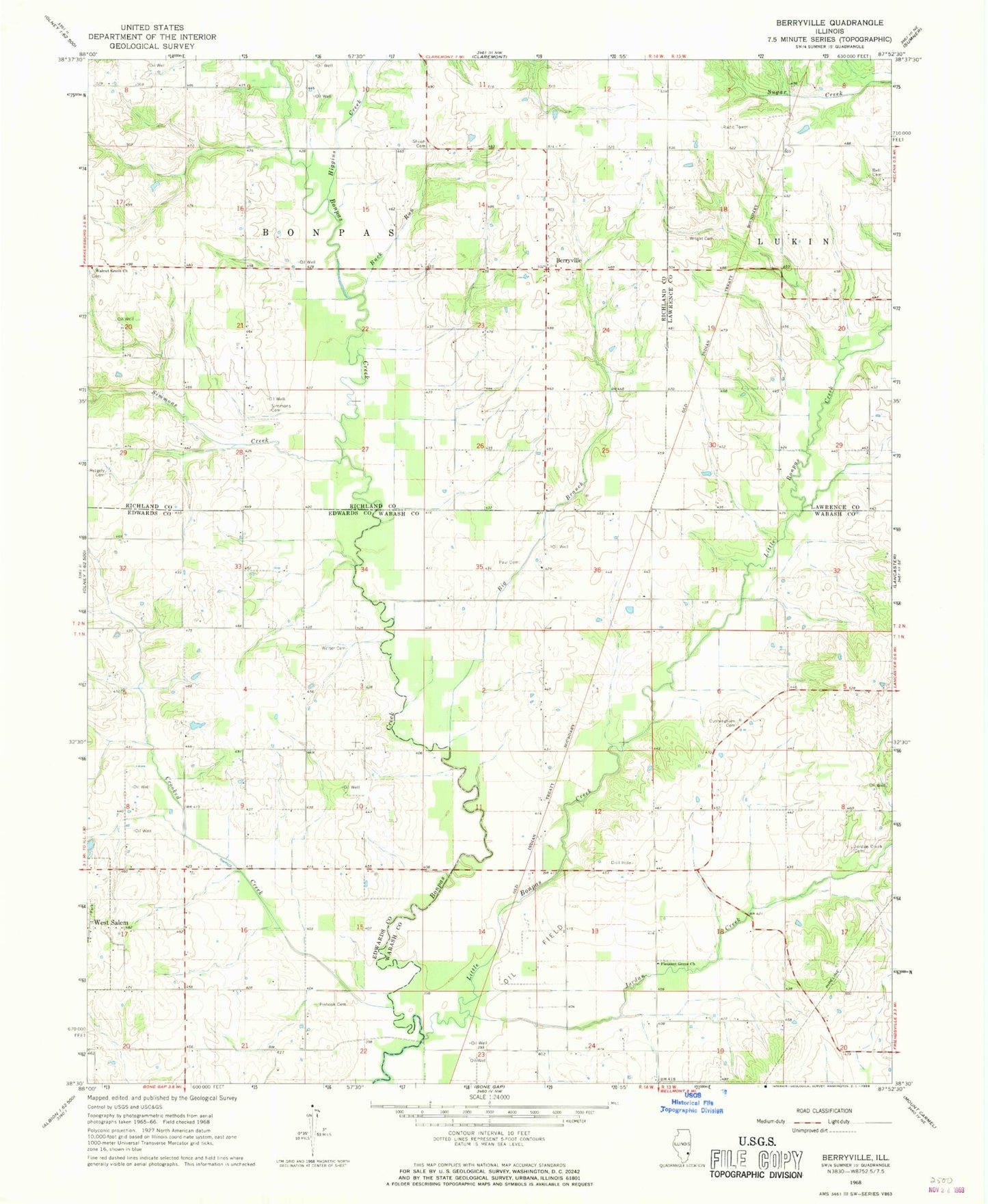
Historical USGS topographic quad map of Berryville in the state of Illinois. Map scale may vary for some years, but is generally around 1:24,000. Print size is approximately 24" x 27"
This quadrangle is in the following counties: Edwards, Lawrence, Richland, Wabash.
The map contains contour lines, roads, rivers, towns, and lakes. Printed on high-quality waterproof paper with UV fade-resistant inks, and shipped rolled.
Contains the following named places: Bell Cemetery, Berryville, Big Branch, Buck Run, Burton School, Claremont - Bonpas Fire Protection District Station 2, Crooked Creek, Cunningham Cemetery, Gates School, Higgins Creek, Jordan Creek, Jordan Creek Cemetery, Lancaster Election Precinct, Little Bonpas Creek, Long Prairie School, Mills Prairie, Mills Prairie School, Mundy School, Paul Cemetery, Pinhook Cemetery, Pleasant Grove Church, Redhead School, Ridgely Cemetery, Salem Number 1 Election Precinct, Shiloh Number 1 Cemetery, Simmons Creek, Smith Cemetery, Township of Bonpas, Victory School, Walnut Grove Cemetery, Walnut Grove Church, Welser Cemetery, Whites School, Wright Cemetery, ZIP Code: 62419