MyTopo
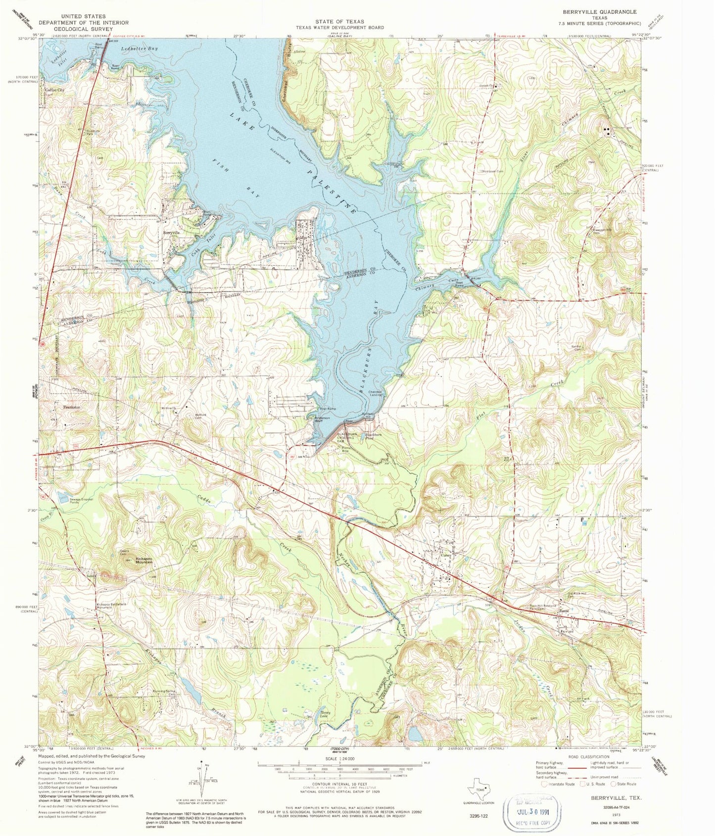
Classic USGS Berryville Texas 7.5'x7.5' Topo Map
Couldn't load pickup availability
Historical USGS topographic quad map of Berryville in the state of Texas. Map scale may vary for some years, but is generally around 1:24,000. Print size is approximately 24" x 27"
This quadrangle is in the following counties: Anderson, Cherokee, Henderson.
The map contains contour lines, roads, rivers, towns, and lakes. Printed on high-quality waterproof paper with UV fade-resistant inks, and shipped rolled.
Contains the following named places: Aero Estates Airport, Anderson Bluff, Berryville, Berryville City Hall, Berryville Community Church, Berryville Volunteer Fire Department, Blackburn Bay, Blackburn Crossing Dam, Blackburn Pond, Caddo Creek, Caney Branch, Cherokee Bluffs, Cherokee Landing, Chimney Cove, Cobb Creek, Cobb Inlet, Coffee City, Corinth Church, Cuney, Cuney Police Department, Cuney Post Office, Dunn Creek, Fish Bay, Flat Creek, Hilltop Baptist Church, Honey Lake, Jordan Creek, Kickapoo Battlefield Monument, Kickapoo Mountain, Lake Palestine, Lake Palestine East Volunteer Fire Department, Ledbetter Bay, Ledbetter Creek, Ledbetter Inlet, Mount Olive Church, Old Rock Hill Cemetery, Owens Cemetery, Paradise Point Airport, Pleasant Hill Cemetery, Reese, Renfro Cemetery, Rock Hill Restland Park, Running Spring Cemetery, Shadybrook Census Designated Place, Stone Chimney Creek, Thompson Cemetery, Town of Berryville, Town of Cuney, Tucker Lake, Tucker Lake Dam, Wofford Cemetery, ZIP Code: 75759