MyTopo
Classic USGS Bertha Minnesota 7.5'x7.5' Topo Map
Couldn't load pickup availability
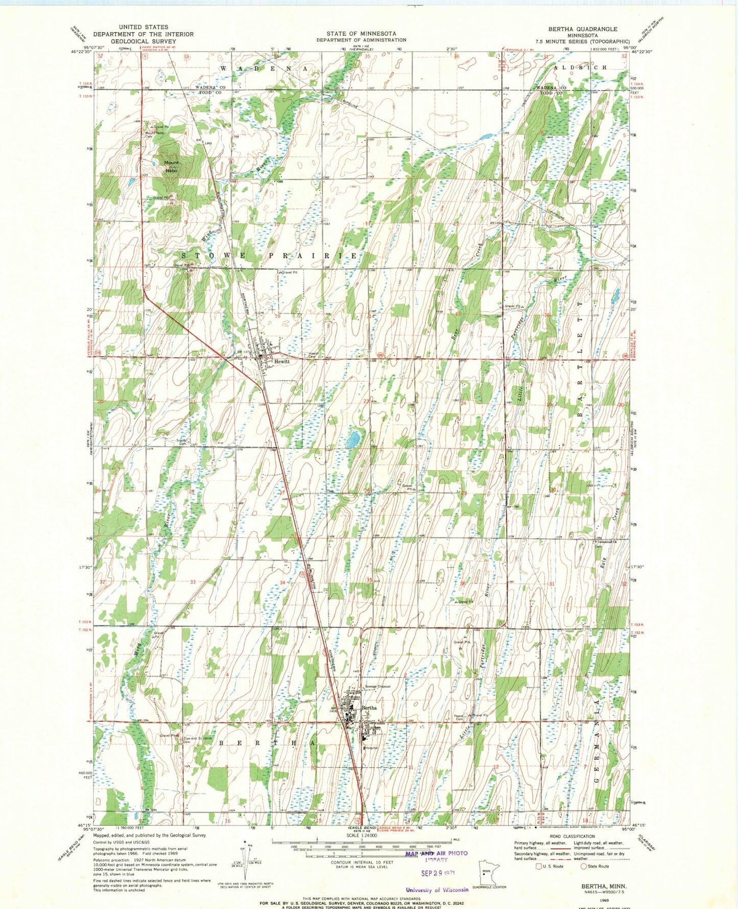
Historical USGS topographic quad map of Bertha in the state of Minnesota. Map scale may vary for some years, but is generally around 1:24,000. Print size is approximately 24" x 27"
This quadrangle is in the following counties: Todd, Wadena.
The map contains contour lines, roads, rivers, towns, and lakes. Printed on high-quality waterproof paper with UV fade-resistant inks, and shipped rolled.
Contains the following named places: Bear Creek, Bertha, Bertha City Hall, Bertha Fire Department, Bertha Hewitt Schools, Bertha Medical Clinic, Bertha Police Department, Bertha Post Office, Bertha Wayside Park, Church of God, Church of the Nazarene, City of Bertha, City of Hewitt, County Ditch Number Fifteen, Faith United Church of Christ, Hewitt, Hewitt Cemetery, Hewitt Fire Department, Hewitt Post Office, Hewitt Rest Area, Immanuel Cemetery, Immanuel Church, Kramer Dam, Kramers Lake, Mount Nebo, Mount Nebo Cemetery, Peace Cemetery, Saint Joseph's Church, Saint Paul's Lutheran Church, Township of Stowe Prairie, Trinity Cemetery, United Methodist Church, Zion and Saint Johns Cemetery