
MyTopo
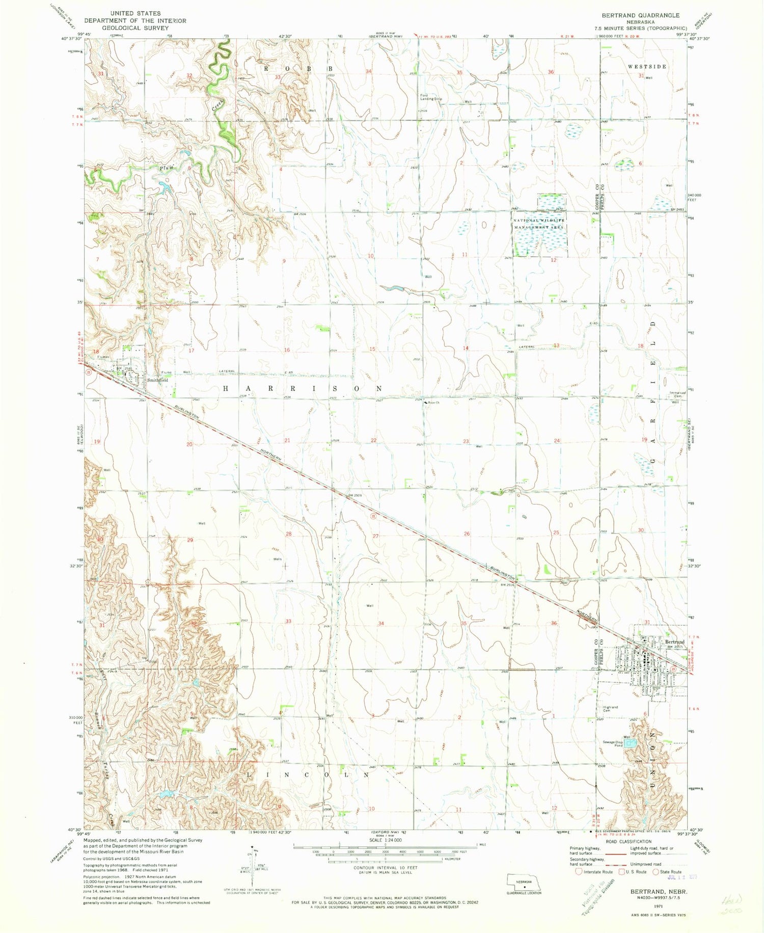
Classic USGS Bertrand Nebraska 7.5'x7.5' Topo Map
Couldn't load pickup availability
Historical USGS topographic quad map of Bertrand in the state of Nebraska. Map scale may vary for some years, but is generally around 1:24,000. Print size is approximately 24" x 27"
This quadrangle is in the following counties: Gosper, Phelps.
The map contains contour lines, roads, rivers, towns, and lakes. Printed on high-quality waterproof paper with UV fade-resistant inks, and shipped rolled.
Contains the following named places: Adullam Lutheran Church, Agri Co-op Elevator, Bertrand, Bertrand City and Rural Fire Department, Bertrand Historical Marker, Bertrand Nursing Home, Bertrand Park, Bertrand Post Office, Bertrand Public Schools, Election Precinct 9, Hanson Field, Harrison Election Precinct, Highland Cemetery, Hi-Line Golf Course, Hope Church, Immanuel Cemetery, Immanuel Lutheran Church, Saint John Catholic Church, Saint Pauls Lutheran Church, Smithfield, Smithfield Post Office, Township of Harrison, United Methodist Church, Victor Lake Federal Waterfowl Production Area, Village of Bertrand, Village of Smithfield, ZIP Code: 68976


