MyTopo
Classic USGS Berwick Mississippi 7.5'x7.5' Topo Map
Couldn't load pickup availability
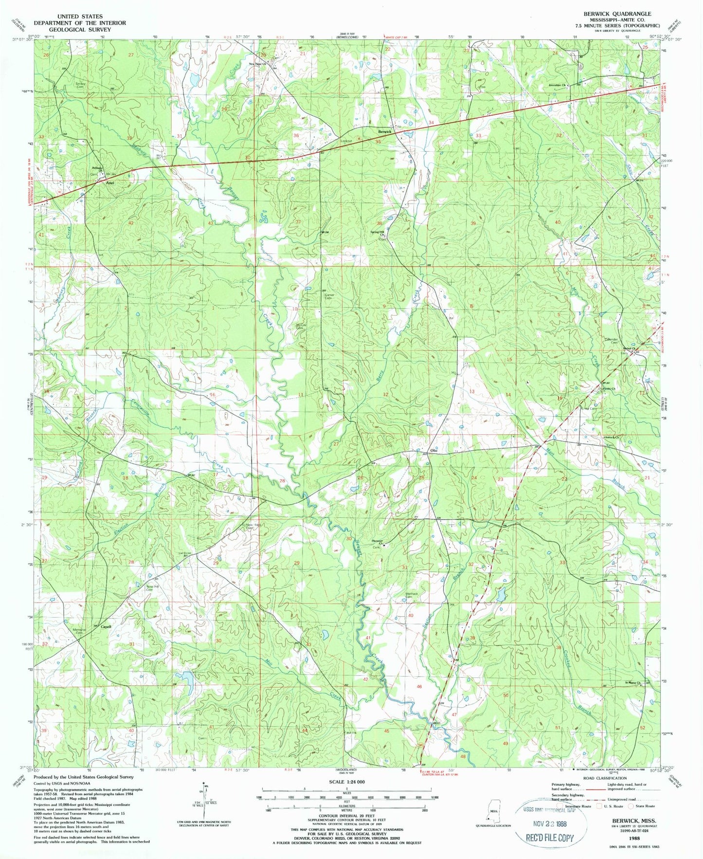
Historical USGS topographic quad map of Berwick in the state of Mississippi. Map scale may vary for some years, but is generally around 1:24,000. Print size is approximately 24" x 27"
This quadrangle is in the following counties: Amite.
The map contains contour lines, roads, rivers, towns, and lakes. Printed on high-quality waterproof paper with UV fade-resistant inks, and shipped rolled.
Contains the following named places: Antioch Cemetery, Antioch Church, Ariel, Berry Creek, Berwick, Bethany Church, Bethany Institute, Bethany Presbyterian Church Cemetery, Bethel Baptist Church, Bethel Cemetery, Callender Cemetery, Capell, Centreville Creek, Crawford Branch, Crawford Cemetery, Dixon Cemetery, Duck Cemetery, Dunn - Hefner Cemetery, Ebenezer Baptist Church, Ebenezer Baptist Church Cemetery, Ebenezer Cemetery, Election Branch, Ellis Creek, Forest School, Garner Cemetery, Hermon Jackson Lake Dam, Hughes Store, Issac Jackson Cemetery, Jerusalem Cemetery, Jerusalem Church, John F Piker Lake Dam, McCoy Cemetery, Memorial Cemetery, Mill Creek, Millers Store, New Hope Baptist Church, New Hope Cemetery, New Hope Church, Olio, Rainey Cemetery, Ramsey Creek, Rose Hill Cemetery, Rose Hill Church, Saint Marys Church, Seabury Creek, Section Branch, Smiley Cemetery, Smylie Cemetery, Spears Cemetery, Spring Hill Cemetery, Spring Hill Church, Street Volunteer Fire Department, Supervisor District 2, Talbot School, Thomas Causey Cemetery, Tolers, Unity Cemetery, Unity Church, White Store, William Jackson Cemetery, Womack Cemetery