MyTopo
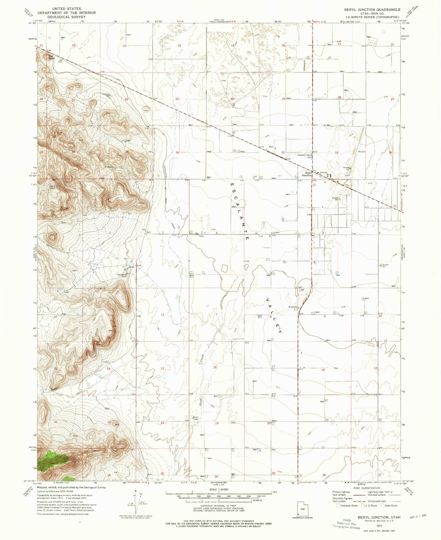
Classic USGS Beryl Junction Utah 7.5'x7.5' Topo Map
Regular price
$16.95
Regular price
Sale price
$16.95
Unit price
per
Couldn't load pickup availability
Historical USGS topographic quad map of Beryl Junction in the state of Utah. Map scale may vary for some years, but is generally around 1:24,000. Print size is approximately 24" x 27"
This quadrangle is in the following counties: Iron.
The map contains contour lines, roads, rivers, towns, and lakes. Printed on high-quality waterproof paper with UV fade-resistant inks, and shipped rolled.
Contains the following named places: Beryl Baptist Church, Beryl Fire Department, Beryl Junction, Beryl Junction Airport, Beryl Junction Census Designated Place, Escalante Mine, Escalante Mine Canal, Escalante Valley Elementary School, John McGarry Memorial Park Cemetery, Pinon Park Wash, Shoal Creek, The Point