MyTopo
Classic USGS Bessemer Michigan 7.5'x7.5' Topo Map
Couldn't load pickup availability
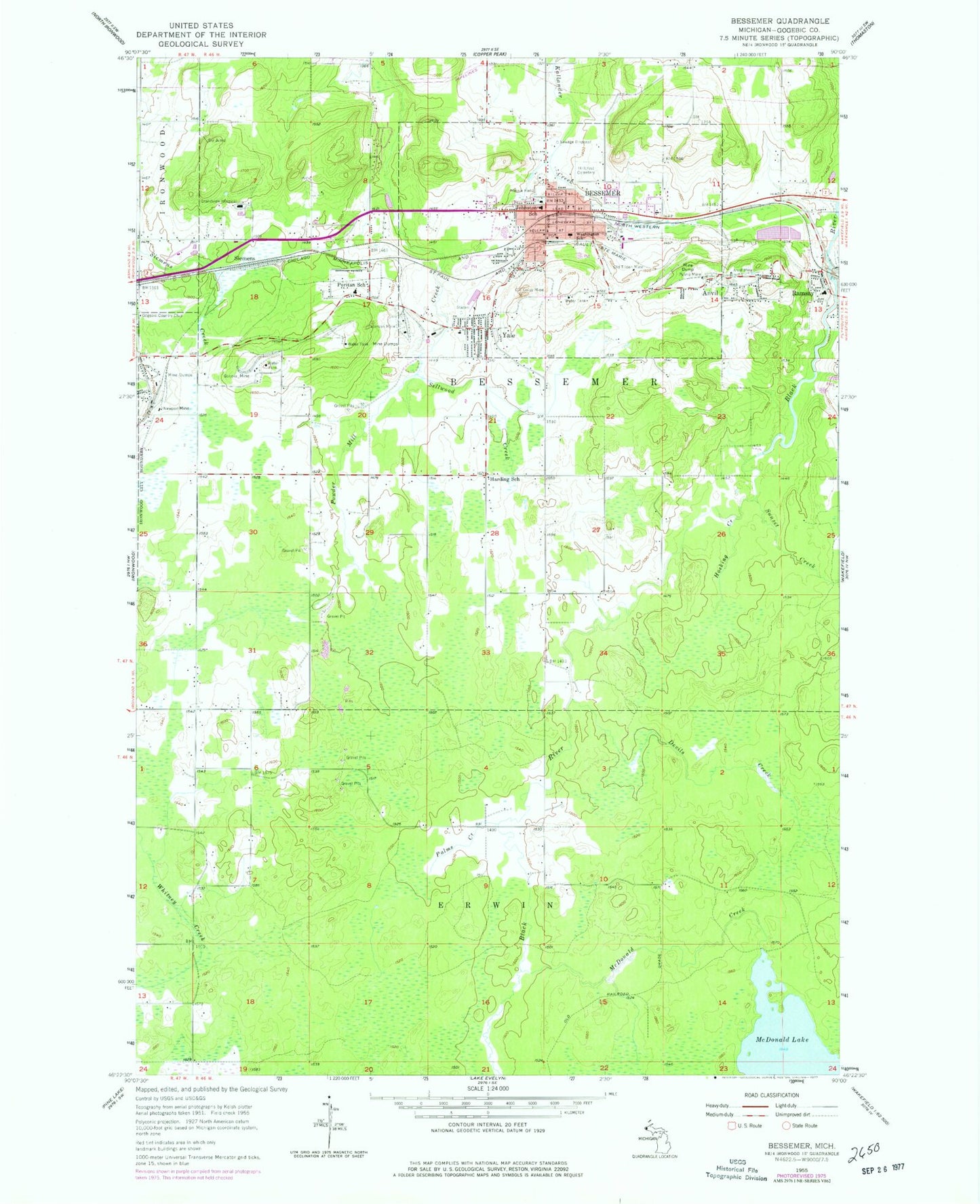
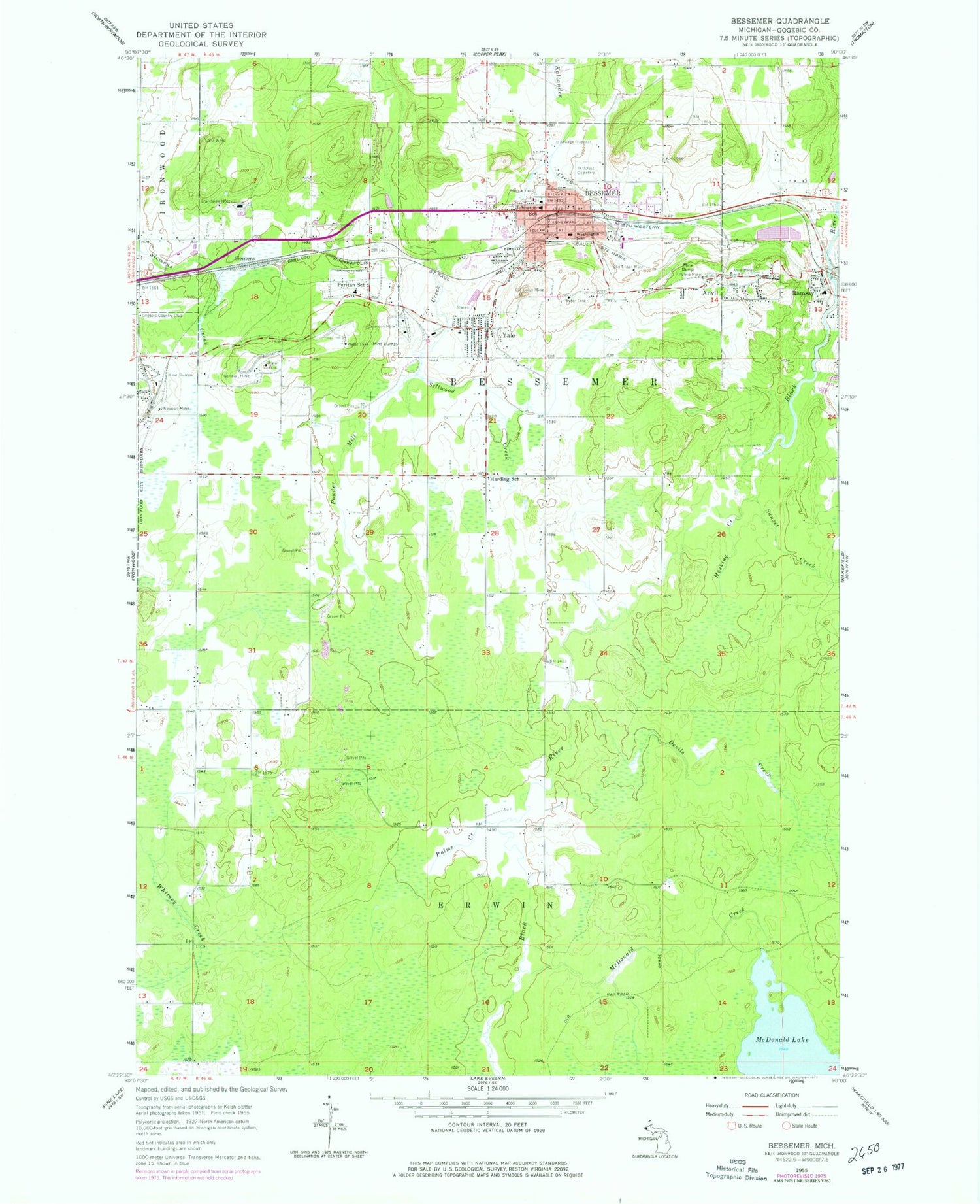
Historical USGS topographic quad map of Bessemer in the state of Michigan. Map scale may vary for some years, but is generally around 1:24,000. Print size is approximately 24" x 27"
This quadrangle is in the following counties: Gogebic.
The map contains contour lines, roads, rivers, towns, and lakes. Printed on high-quality waterproof paper with UV fade-resistant inks, and shipped rolled.
Contains the following named places: Alpine Trailer Park and Campground, Anvil, Anvil Location Post Office, Anvil Mine, Bessemer, Bessemer Fire Department, Bessemer Post Office, Bessemer Public Library, Bessemer Station, Bessemer Township Volunteer Fire Department, City of Bessemer, Cornerstone Christian Church, Devils Creek, Duluth Clinic, Geneva Mine, Gogebic Country Club, Gogebic County Courthouse, Gogebic County Sheriff's Office, Gogebic Iron Range Historical Marker, Grand View Clinic, Grand View Hospital, Granite Falls, Harding School, Hillcrest Cemetery, Hosking Creek, Johnston School, Keepers of the Faith Church, Living Water Missionary Church, Massie Field, McDonald Creek, McDonald Lake, Newport Mine, Old Colby Mine, Old Tilden Mine, Our Redeemer Lutheran Church, Palms Creek, Palms Mine, Peterson Mine, Puritan Post Office, Puritan School, Ramsay Post Office, Ramsay Station, Saint Sebastian Church, Sellwood Creek, Seventh-Day Adventist Church, Sharon Lutheran Church, Siemens, South Shore Orthopedics, Sunset Creek, Township of Erwin, Washington Elementary School, WUPM-FM (Ironwood), Yale, ZIP Code: 49911