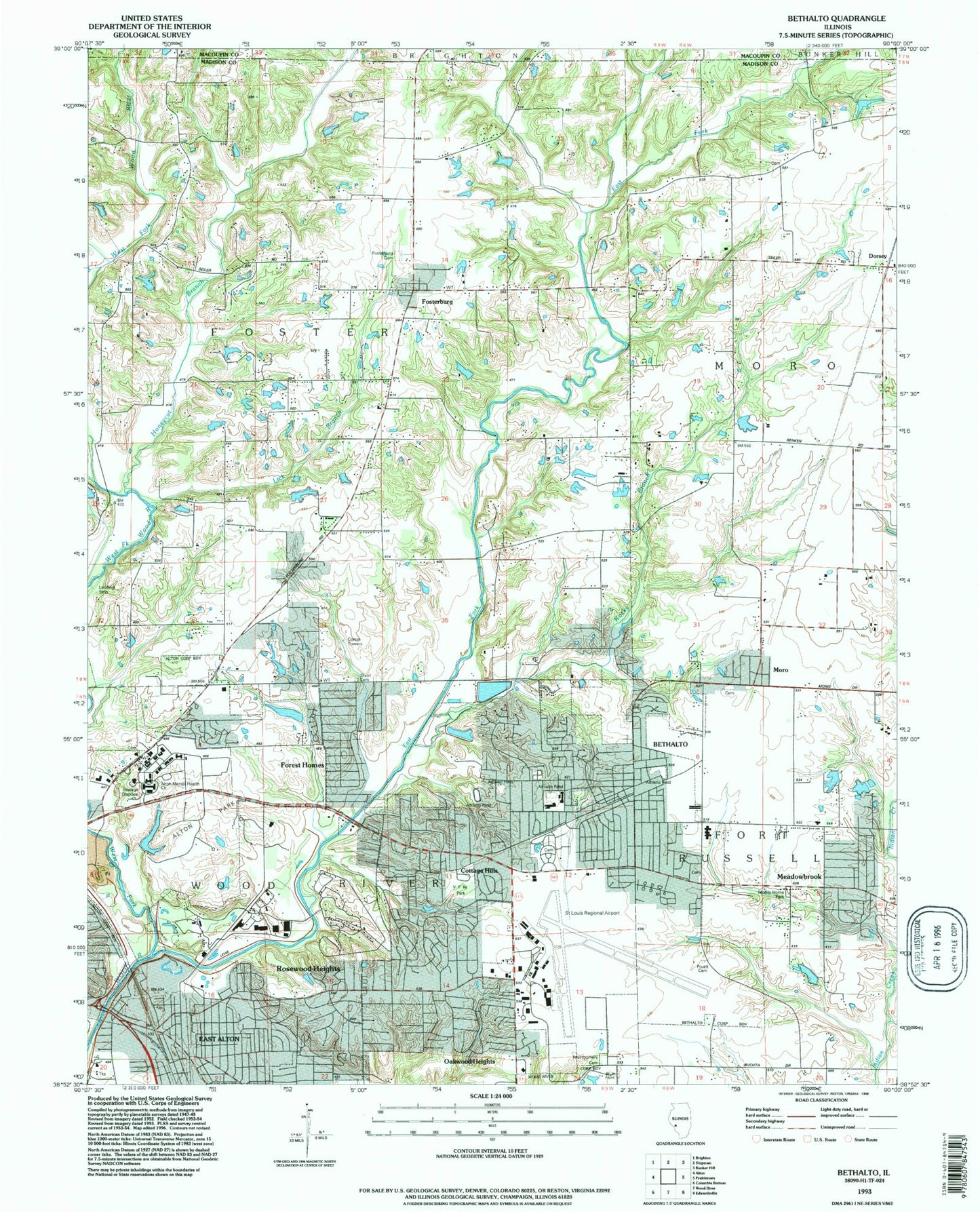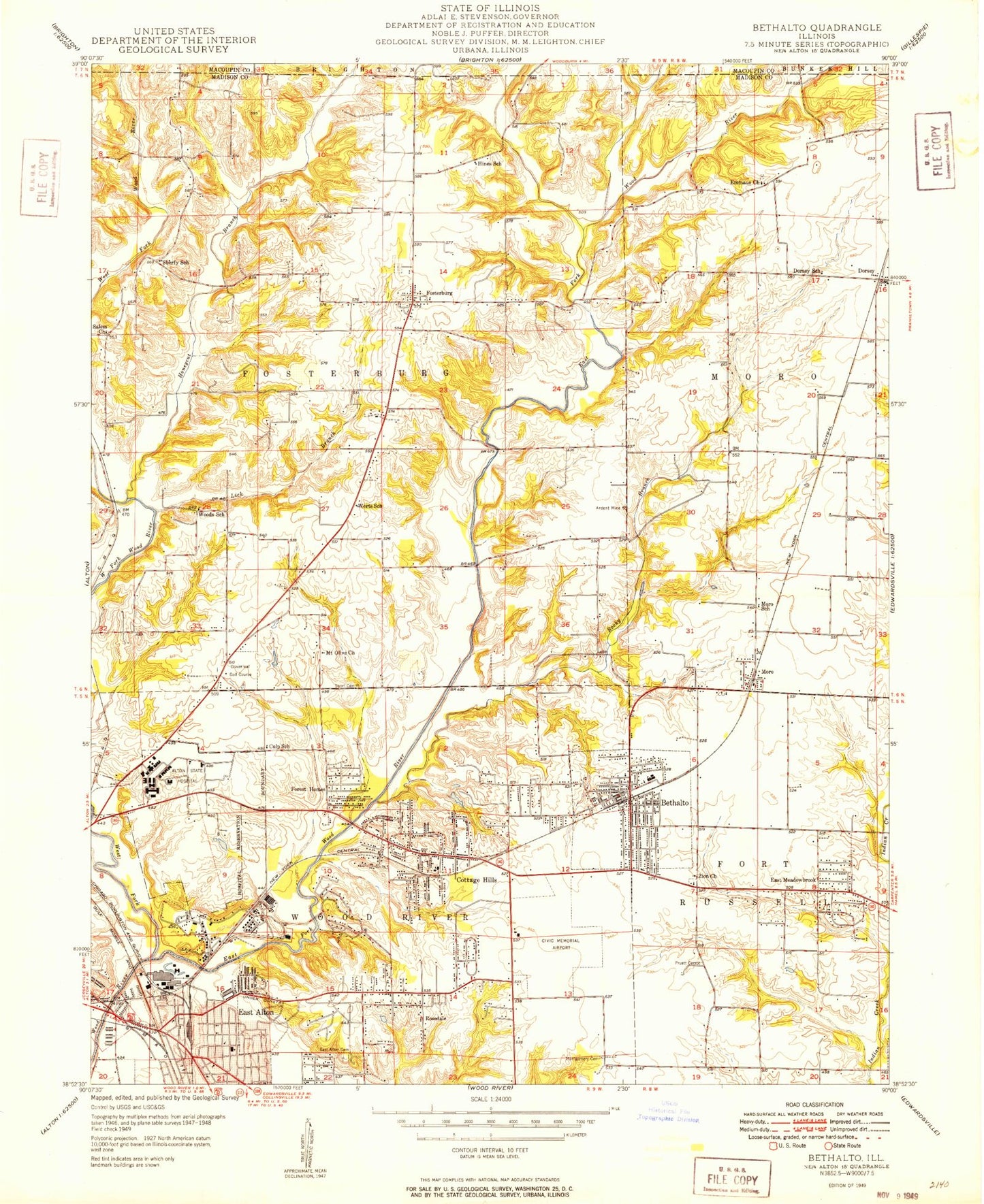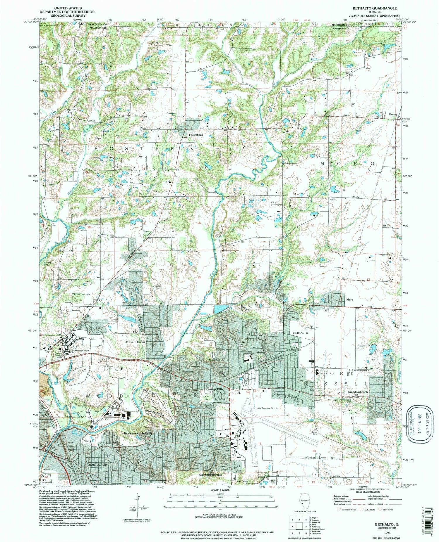
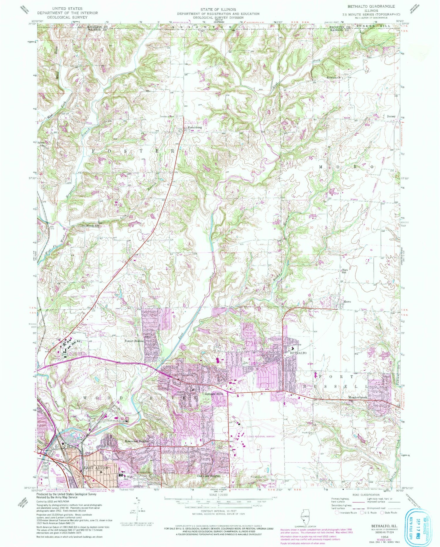

MyTopo
Classic USGS Bethalto Illinois 7.5'x7.5' Topo Map
Couldn't load pickup availability
Historical USGS topographic quad map of Bethalto in the state of Illinois. Map scale may vary for some years, but is generally around 1:24,000. Print size is approximately 24" x 27"
This quadrangle is in the following counties: Macoupin, Madison.
The map contains contour lines, roads, rivers, towns, and lakes. Printed on high-quality waterproof paper with UV fade-resistant inks, and shipped rolled.
Contains the following named places: Airport Plaza Shopping Center, Alton Junction, Alton Memorial Emergency Medical Services, Alton Mental Health Center, Alton Park, Alton State Hospital Cemetery, Belk Park, Bethalto, Bethalto City Cemetery, Bethalto City Hall, Bethalto East Elementary School, Bethalto Fire Department, Bethalto Park, Bethalto Police Department, Bethalto Post Office, Bethalto Public Library, Bethalto Sixth Grade Center, Bethalto West Elementary School, Civic Memorial High School, Cloverleaf Golf Course, Cottage Hills, Cottage Hills Elementary School, Cottage Hills Fire Protection District, Cottage Hills Post Office, Culp School, Dorsey, Dorsey Post Office, Dorsey School, Dorsey Volunteer Fire Department, Downing Pond, Downing Pond Dam, East Alton, East Alton City Hall, East Alton Fire Department, East Alton Middle School, East Alton Police Department, East Alton Post Office, East Fork Wood River, Eastgate Plaza Shopping Center, Eastwood Elementary School, Emmaus Church, Emmaus Lutheran Church Cemetery, Forest Homes, Fosterburg, Fosterburg Cemetery, Fosterburg Fire Protection District Station 1, Fosterburg Town Hall, Francis G Blair Elementary School, Hines School, Honeycut Branch, Khoury League Park, Kutter Park, Lick Branch, Lincoln Elementary School, Meadowbrook, Meadowbrook Elementary School, Meadowbrook Volunteer Fire Department, Milton Cemetery, Montgomery Cemetery, Moro, Moro Census Designated Place, Moro Post Office, Moro School, Mount Olive Church, Oakwood Heights, Olin Corporation Fire Department, Paradise Lake Dam, Paridise Lake, Pruett Family Cemetery, Rocky Branch, Rose Lawn Memory Gardens, Rosedale, Rosewood Heights, Rosewood Heights Census Designated Place, Rosewood Heights Fire Protection District, Saint Louis Regional Airport Fire Department, Salem Baptist Cemetery, Salem Church, Sherry School, Short Cemetery, Simpson Attendance Center, Spencer T Olin Golf Course, St Louis Regional Airport, Township of Foster, Township of Wood River, Van Preter Park, Veterans of Foreign Wars Park, Village of Bethalto, Village of East Alton, Washington Elementary School, WBBY Radio, WCEO-AM (Wood River), Werts School, West Fork Wood River, Wilbur Trimpe Junior High School, Wood River Township Park, Woodland Hill Cemetery, Woods, Woods School, ZIP Codes: 62010, 62018, 62024