MyTopo
Classic USGS Bethany Missouri 7.5'x7.5' Topo Map
Couldn't load pickup availability
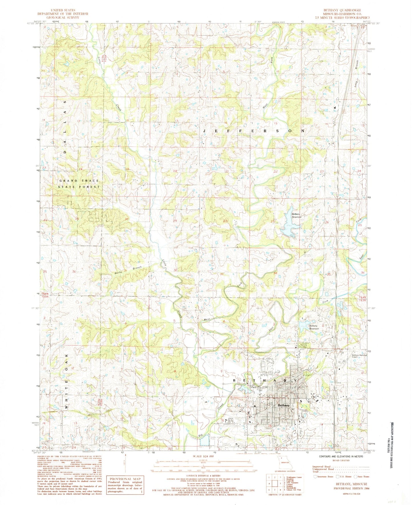
Historical USGS topographic quad map of Bethany in the state of Missouri. Map scale may vary for some years, but is generally around 1:24,000. Print size is approximately 24" x 27"
This quadrangle is in the following counties: Harrison.
The map contains contour lines, roads, rivers, towns, and lakes. Printed on high-quality waterproof paper with UV fade-resistant inks, and shipped rolled.
Contains the following named places: Belle School, Bethany, Bethany City Reservoir Dam, Bethany Fire Department, Bethany Memorial Airport, Bethany Post Office, Bowman, Buck Branch, City of Bethany, Dale Cemetery, East Fork Big Creek, Globe School, Grand Trace State Forest, Harrison County Community Hospital, Harrison County Farm, Harrison County Sheriff's Office, Hazel Valley Church, Little Creek, Lorrain School, Mahaska School, McCollum School, Morris Chapel, Mount Taber School, New City Lake, North Central Career Center, Oakland Church, Old Bethany City Lake, Pecks Branch, Phillebaum Cemetery, Rocky Branch, Russ Cemetery, Shady Grove Church, South Harrison Elementary School, South Harrison Junior Senior High School, South Pine School, Star School, Township of Bethany, Township of Jefferson, Union Chapel, West Fork Big Creek, White Fawn School, ZIP Code: 64424