MyTopo
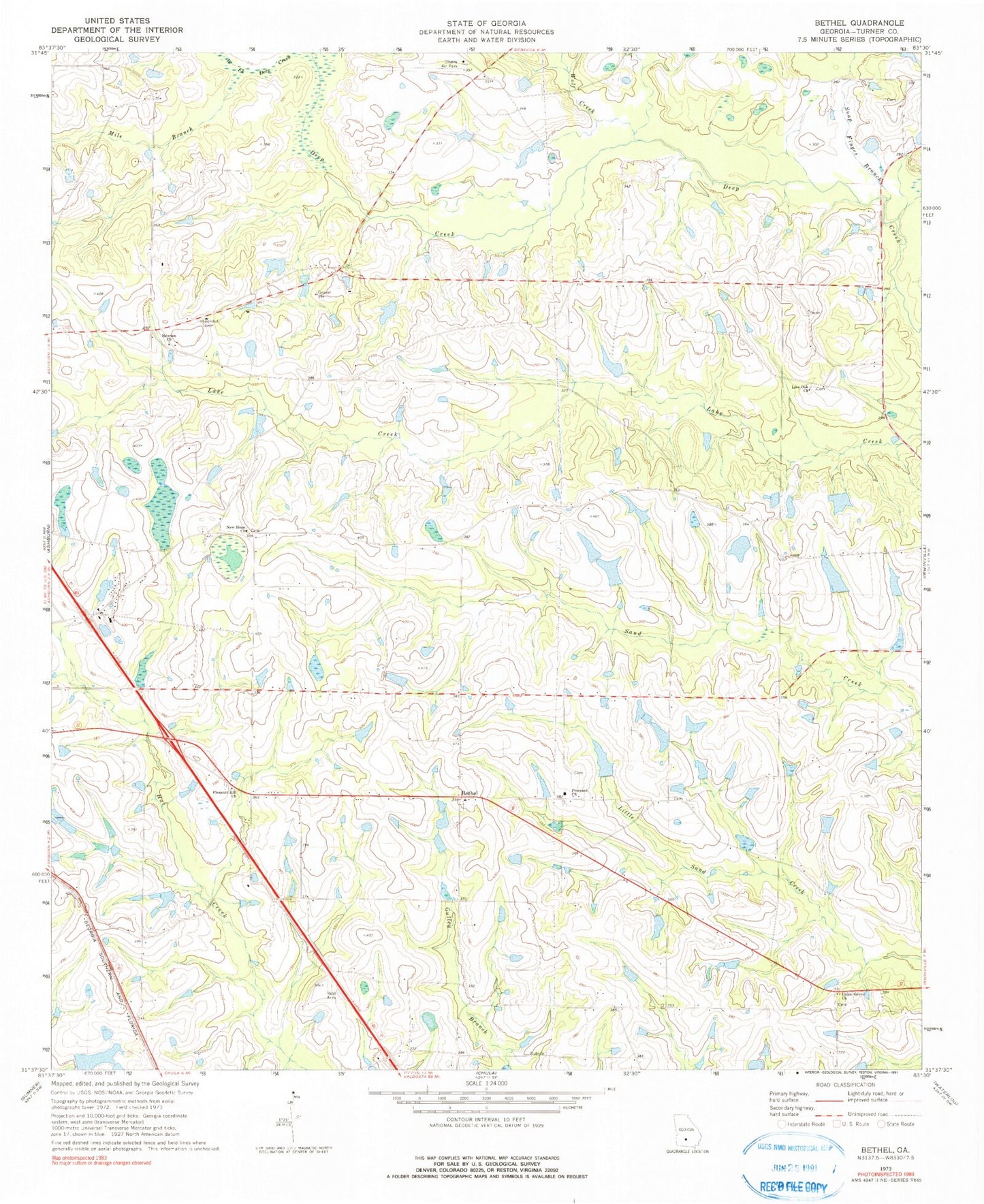
Classic USGS Bethel Georgia 7.5'x7.5' Topo Map
Couldn't load pickup availability
Historical USGS topographic quad map of Bethel in the state of Georgia. Map scale may vary for some years, but is generally around 1:24,000. Print size is approximately 24" x 27"
This quadrangle is in the following counties: Turner.
The map contains contour lines, roads, rivers, towns, and lakes. Printed on high-quality waterproof paper with UV fade-resistant inks, and shipped rolled.
Contains the following named places: Bethel, Bethel Baptist Church, Bethel Cemetery, Bussey School, Busseys Pond, Carter Lake, Carter Lake Dam, Clements Cemetery, Deep Creek Church, Friendship School, Geoghagan Bridge, Gorday Ford, Henderson School, Jones Lake, Jones Lake Dam, Live Oak Church, Metcalf School, Mile Branch, New Hope Church, Newton Church, Pilgrims Home Church, Pleasant Hill Cemetery, Pleasant Hill Church, Prospect Church, Prospects Cemetery, Rainey Ford, Rebecca-Sycamore Division, Reinhardt Lake, Reinhardt Lake Dam, Richter Airpark, Ross Cemetery, Shivers Bridge, Smith Pond, Snap Finger Branch, Sycamore Division, Turner County, Turner County Fire and Rescue Bethel Station, Turner County Fire and Rescue Inaha Station, Union Grove Church, Wells Lake, Wells Lake Dam, West Fork Deep Creek, Wolf Creek, Wynne Lake, Wynne Lake Dam, ZIP Code: 31790