MyTopo
Classic USGS Bethel Missouri 7.5'x7.5' Topo Map
Couldn't load pickup availability
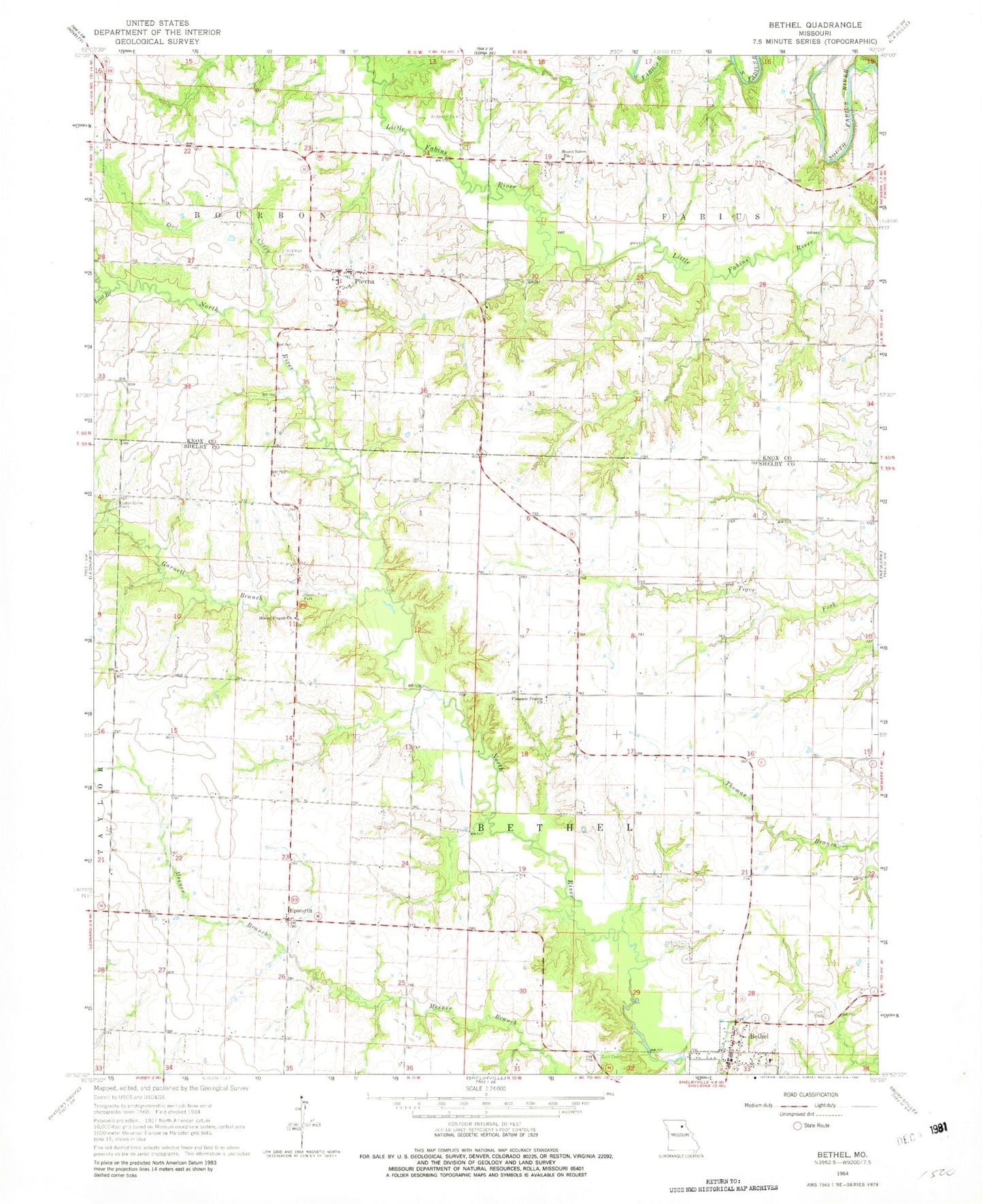
Historical USGS topographic quad map of Bethel in the state of Missouri. Map scale may vary for some years, but is generally around 1:24,000. Print size is approximately 24" x 27"
This quadrangle is in the following counties: Knox, Shelby.
The map contains contour lines, roads, rivers, towns, and lakes. Printed on high-quality waterproof paper with UV fade-resistant inks, and shipped rolled.
Contains the following named places: Anderson Cemetery, Applegate School, Baldwin Family Cemetery, Bethel, Brick School, Campbell School, Cedar Grove Cemetery, Day School, Deer Cemetery, Drennan School, Epworth, Epworth Methodist Church, Garnett Branch, Hebron, Hebron Cemetery, Hickman Cemetery, Lost Branch, Mann Lake Dam, Mount Pisgah Church, Mount Pisgah Park, Mount Salem Cemetery, Mount Salem Church, Owl Creek, Palmer Airport, Pence Cemetery, Pickett Cemetery, Pleasant Prairie Church, Plevna, Plevna Census Designated Place, Plevna Post Office, Plevna Rural Fire Department, Short School, Township of Bethel, Township of Bourbon, Township of Fabius, Village of Bethel, Zion Cemetery, Zion Evangelical Church, ZIP Codes: 63458, 63464