MyTopo
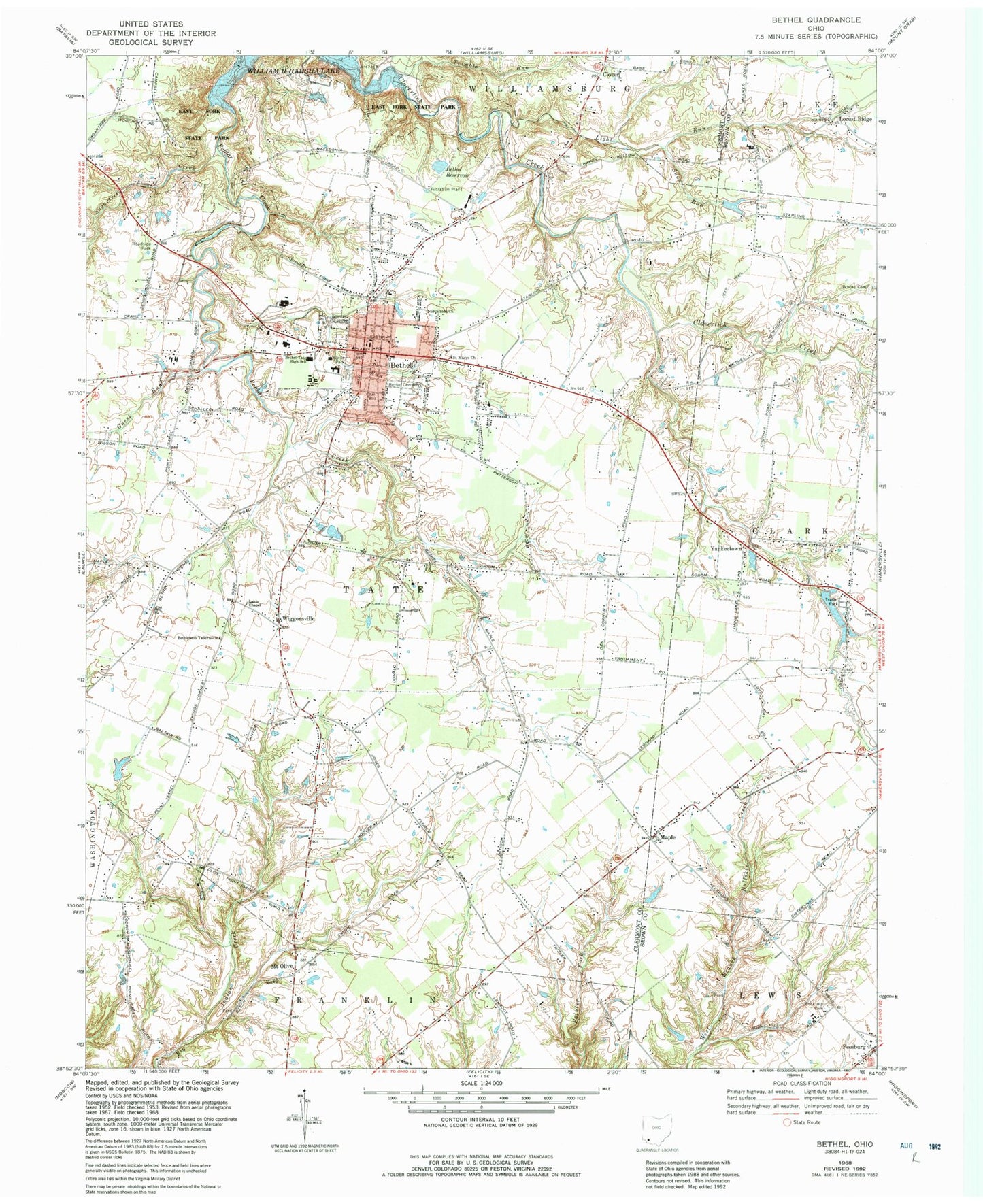
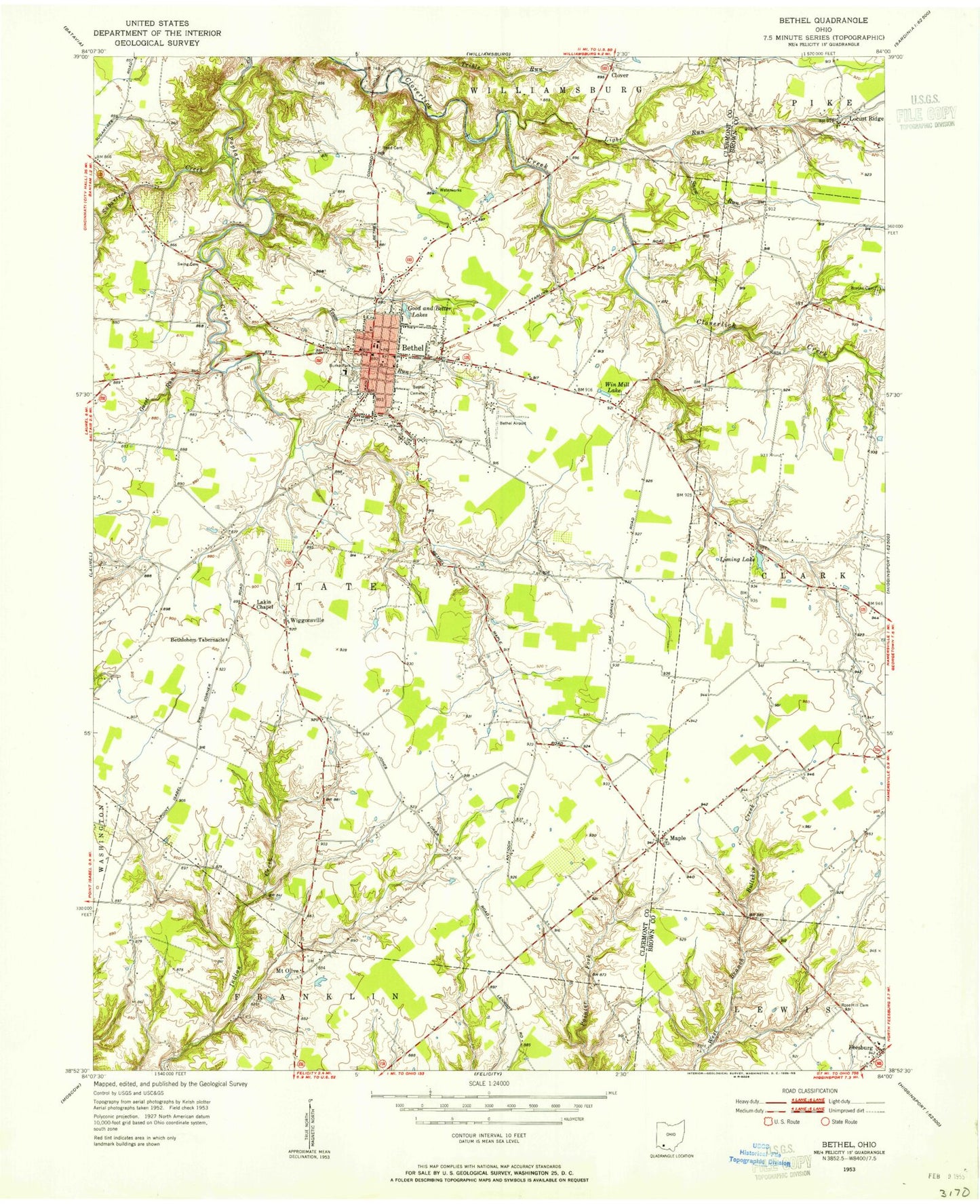
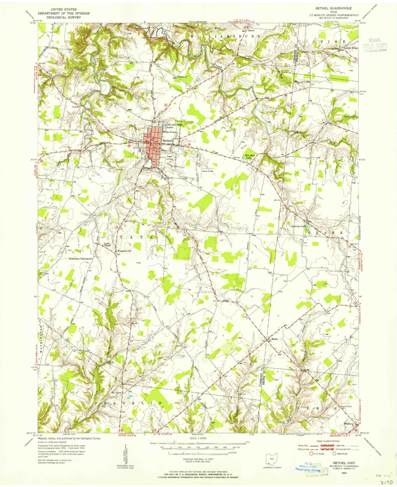
Classic USGS Bethel Ohio 7.5'x7.5' Topo Map
Couldn't load pickup availability
Historical USGS topographic quad map of Bethel in the state of Ohio. Typical map scale is 1:24,000, but may vary for certain years, if available. Print size: 24" x 27"
This quadrangle is in the following counties: Brown, Clermont.
The map contains contour lines, roads, rivers, towns, and lakes. Printed on high-quality waterproof paper with UV fade-resistant inks, and shipped rolled.
Contains the following named places: Bethel Cemetery, Bethel-Tate High School, Bethlehem Tabernacle, Brooks Cemetery, Burke Park, Guest Run, Light Run, North Side Church, Rose Hill Cemetery, Saint Marys Church, Snow Run, Trimble Run, Yankeetown, Bethel United Methodist Church, Bethel Church of the Nazarene, Bethel Church of Christ, Bethel Baptist Church, Friendly Meadows Golf Course, Mount Liberty School (historical), Pride Hill School (historical), Antioch School (historical), Poplar School (historical), Spring Grove School (historical), Republican School (historical), Macedonia School (historical), Crane School (historical), Canter School (historical), Mount Olive School (historical), William Bick Elementary School, Ebon C Hill East Middle School, Lakin Chapel United Methodist Church, Locust Ridge, Wiggonsville, Clover, Mount Olive, Bethel, Pinhook, Sugartree Creek, Town Run, Better Lake, Maple, Brodie Lake Dam, Brodie Lake, Bethel Reservoir Dam, Bethel Reservoir, William A Harsha Lake Dam, East Fork Lake Saddle Dam, Bethel Post Office, JBR Airport (historical), Kelch Airport, Township of Tate, Bethel High School (historical), Bethel Public School (historical), Grant Memorial Community Building, School Number 1 (historical), School Number 2 (historical), Bethel Branch Clermont County Public Library, Brown Cemetery, Clover Cemetery, Locustridge Post Office (historical), Maple Post Office (historical), Mount Olive Post Office (historical), Wiggonsville Post Office (historical), Village of Bethel, Bethel - Tate Fire Department, Bethel Village Police Department, Reed Field