MyTopo
Classic USGS Bethel Oklahoma 7.5'x7.5' Topo Map
Regular price
$16.95
Regular price
Sale price
$16.95
Unit price
per
Couldn't load pickup availability
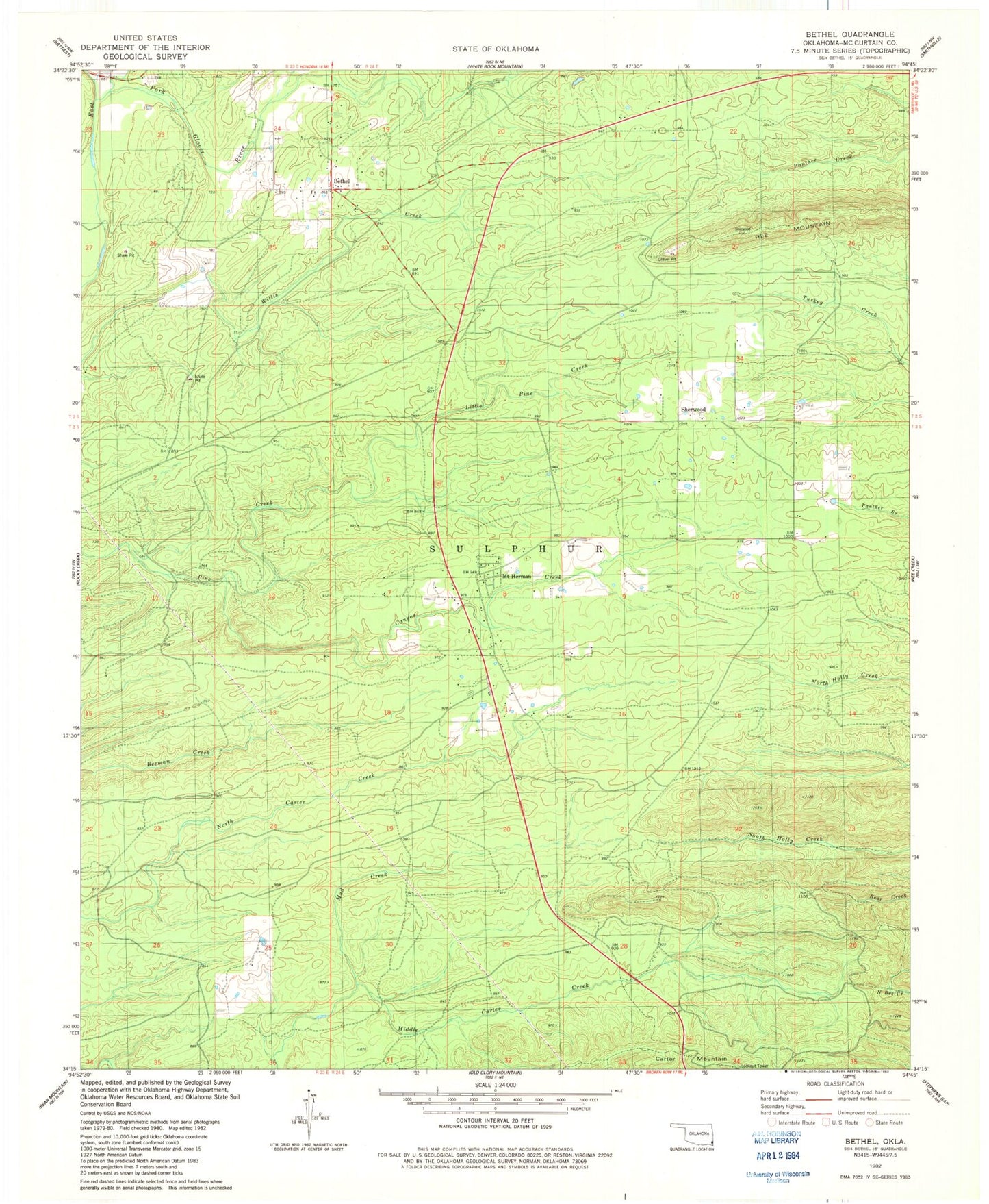
Historical USGS topographic quad map of Bethel in the state of Oklahoma. Map scale is 1:24000. Print size is approximately 24" x 27"
This quadrangle is in the following counties: McCurtain.
The map contains contour lines, roads, rivers, towns, and lakes. Printed on high-quality waterproof paper with UV fade-resistant inks, and shipped rolled.
Contains the following named places: Bethel, Bethel Cemetery, Bethel Post Office, Bethel Volunteer Fire Fighters Association, Canyon Creek, Carpenter Branch, Carter Mountain, Coon Creek, Little Pine Creek, Mount Herman, Mud Creek, Sherwood, Sherwood Cemetery, Sherwood Volunteer Fire Department