MyTopo
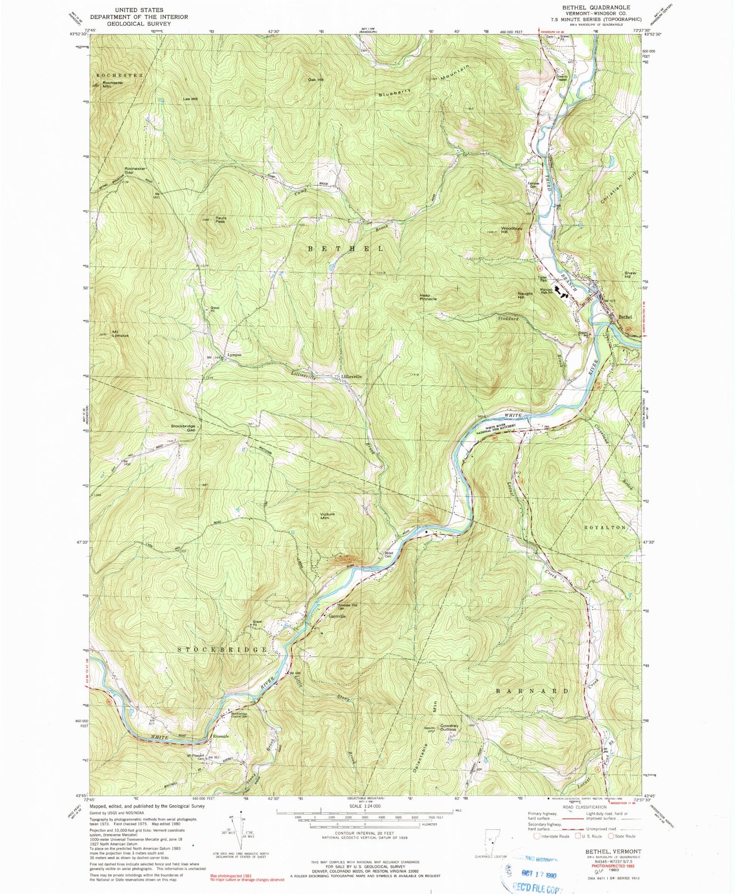
Classic USGS Bethel Vermont 7.5'x7.5' Topo Map
Couldn't load pickup availability
Historical USGS topographic quad map of Bethel in the state of Vermont. Typical map scale is 1:24,000, but may vary for certain years, if available. Print size: 24" x 27"
This quadrangle is in the following counties: Windsor.
The map contains contour lines, roads, rivers, towns, and lakes. Printed on high-quality waterproof paper with UV fade-resistant inks, and shipped rolled.
Contains the following named places: Bethel, Blueberry Mountain, Camp Brook, Camp Brook, Christian Hill, Cleveland Brook, Cowdrey Outlook, Delectable Mountain, Fairview Cemetery, Flynn School, Gaysville, Heap Pinnacle, Lee Hill, Lilliesville, Lilliesville Brook, Little Stony Brook, Locust Creek, Locust Creek School, Mount Lympus, Naught Hill, Oak Hill, Lympus, Pauls Peak, Pond Brook, Riverside, Rochester Gap, Rochester Mountain, Rood State Park, Shaw Hill, Stockbridge Gap, Stoddard Brook, Stony Brook, Vulture Mountain, Whitcomb Junior / Senior High School, Woodbury Hill, Gilead Brook, Third Branch White River, Mount Pleasant Cemetery, Town of Bethel, Town of Stockbridge, Bethel Mills Dam, Abbott Cemetery, Bethel Elementary School, Bethel Post Office, Bethel Town Forest, Bethel Village Historic District, Gaysville Post Office, Gilead Brook Covered Bridge, Gilead Cemetery, Lympus Cemetery, Old Church Cemetery, Stockbridge Central School, Sylvester Plot Cemetery, West Bethel, White River National Fish Hatchery, White River Valley Camping Area, Bethel Fire Department, White River Valley Ambulance, Bethel Census Designated Place, Randall Drive-In