MyTopo
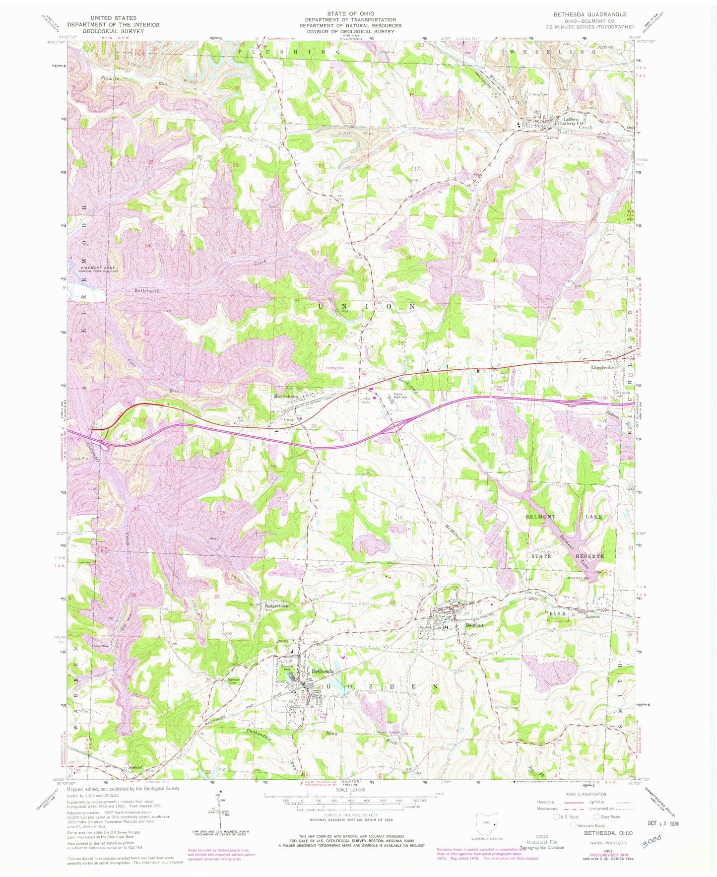
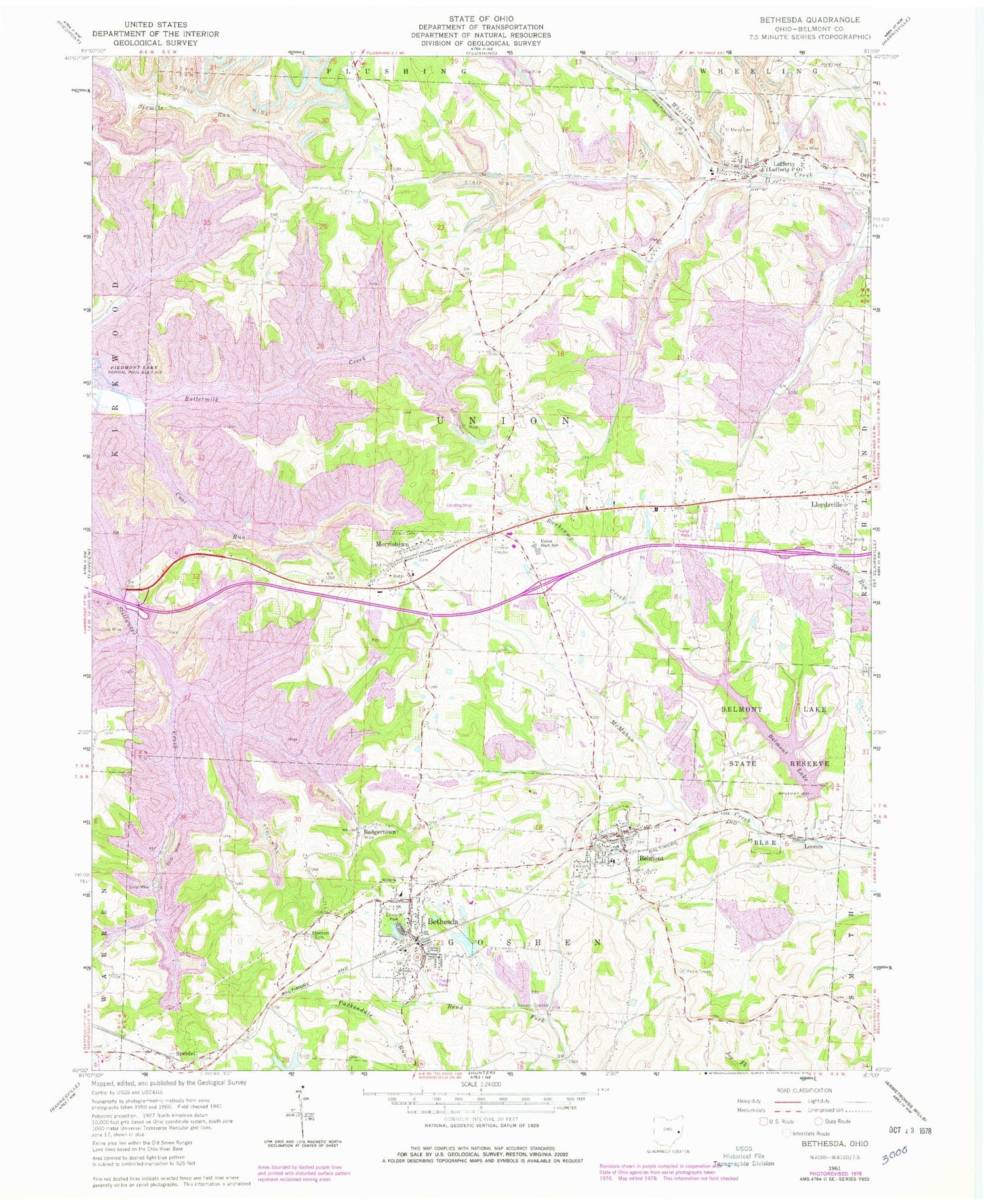
Classic USGS Bethesda Ohio 7.5'x7.5' Topo Map
Couldn't load pickup availability
Historical USGS topographic quad map of Bethesda in the state of Ohio. Map scale is 1:24000. Print size is approximately 24" x 27"
This quadrangle is in the following counties: Belmont.
The map contains contour lines, roads, rivers, towns, and lakes. Printed on high-quality waterproof paper with UV fade-resistant inks, and shipped rolled.
Contains the following named places: Badgertown, Barkcamp Creek, Belmont, Belmont Elementary School, Belmont Historic District, Belmont Lake, Belmont Lake Dam, Belmont Lake State Reserve, Belmont Post Office, Belmont Town Cemetery, Belmont Volunteer Fire Department Station 17, Bethesda, Bethesda Cemetery, Bethesda Elementary School, Bethesda Fire and Rescue Station 18, Bethesda Post Office, Bethesda Reservoir, Bethesda Reservoir Dam, Coal Run, Ebenezer Cemetery, Epworth Park, Lafferty, Lafferty Census Designated Place, Lafferty Fire Station and Emergency Medical Services Station 27, Lafferty Post Office, Loomis, Mil-mar Trailer Court, Morristown, Morristown Elementary School, Morristown Fire Department Station 31, Morristown First Cemetery, Morristown Historic District, Morristown Post Office, Plainfield Cemetery, Saint Marys Cemetery, Speidel, Speidel Cemetery, Speidel Post Office (historical), Township of Union, Union Cemetery, Union High School, Village of Belmont, Village of Bethesda, Village of Morristown