
MyTopo
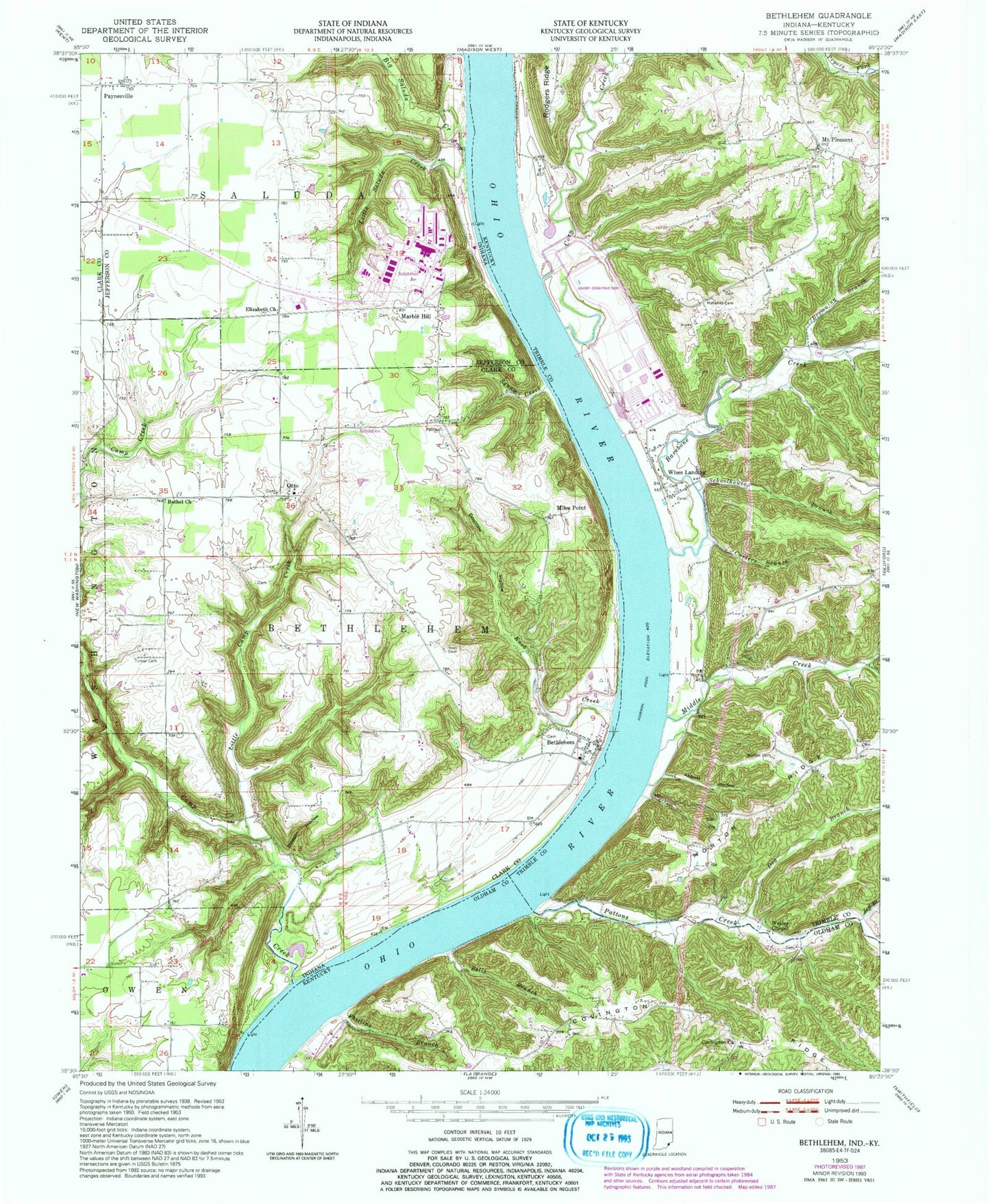
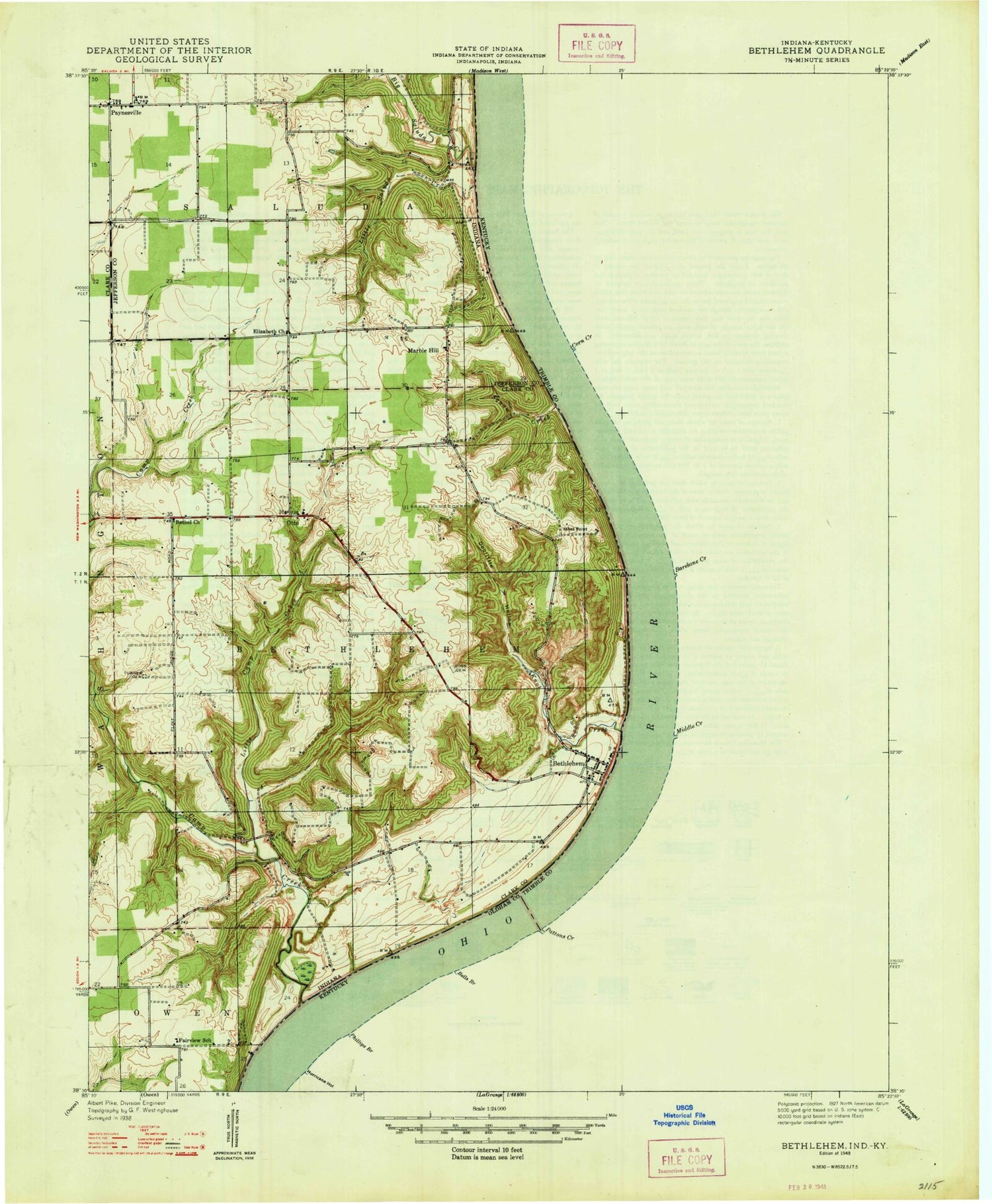
Classic USGS Bethlehem Indiana 7.5'x7.5' Topo Map
Couldn't load pickup availability
Historical USGS topographic quad map of Bethlehem in the states of Indiana, Kentucky. Typical map scale is 1:24,000, but may vary for certain years, if available. Print size: 24" x 27"
This quadrangle is in the following counties: Clark, Jefferson, Oldham, Trimble.
The map contains contour lines, roads, rivers, towns, and lakes. Printed on high-quality waterproof paper with UV fade-resistant inks, and shipped rolled.
Contains the following named places: Bethel Church, Bethlehem, Big Saluda Creek, Dodson Hollow, Doolittle Hollow, Elizabeth Church, Knob Creek, Little Camp Creek, Little Saluda Creek, Marble Hill, Otto, Paynesville, Squaw Creek, Turner Cemetery, Marble Hill Nuclear Power Station, Pattersons Landing, Miles Point, Township of Bethlehem, King Landing, Abbott Hollow, Barebone Creek, Bells Branch, Browning Branch, Carters Branch, Corn Creek, Covington Church, Covington Ridge, Dog Branch, Jeff Branch, Mahoney Cemetery, Middle Creek, Morton Cemetery, Pattons Creek, Phillips Branch, Ralston Cemetery, Schoolhouse Branch, Wesley Chapel, Bethlehem Reach, Mount Pleasant, Wises Landing, Trimble County Emergency Response Team - Louisville Gas and Electric, Corn Creek (historical), Wentworth Ridge, Hurricane Hollow, Bethel Church, Bethlehem, Big Saluda Creek, Dodson Hollow, Doolittle Hollow, Elizabeth Church, Knob Creek, Little Camp Creek, Little Saluda Creek, Marble Hill, Otto, Paynesville, Squaw Creek, Turner Cemetery, Marble Hill Nuclear Power Station, Pattersons Landing, Miles Point, Township of Bethlehem, King Landing, Abbott Hollow, Barebone Creek, Bells Branch, Browning Branch, Carters Branch, Corn Creek, Covington Church, Covington Ridge, Dog Branch, Jeff Branch, Mahoney Cemetery, Middle Creek, Morton Cemetery, Pattons Creek, Phillips Branch, Ralston Cemetery, Schoolhouse Branch, Wesley Chapel, Bethlehem Reach, Mount Pleasant, Wises Landing, Trimble County Emergency Response Team - Louisville Gas and Electric, Corn Creek (historical), Wentworth Ridge, Hurricane Hollow