
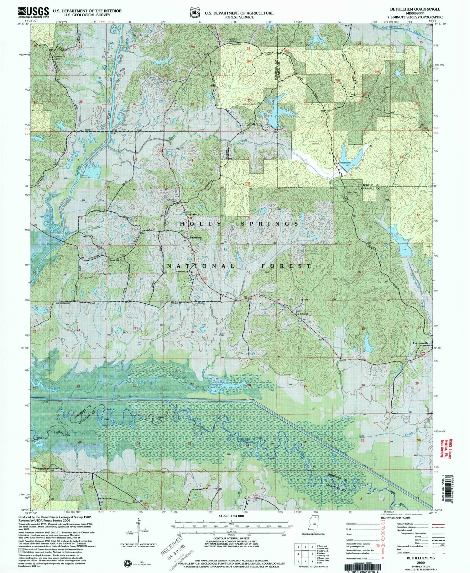
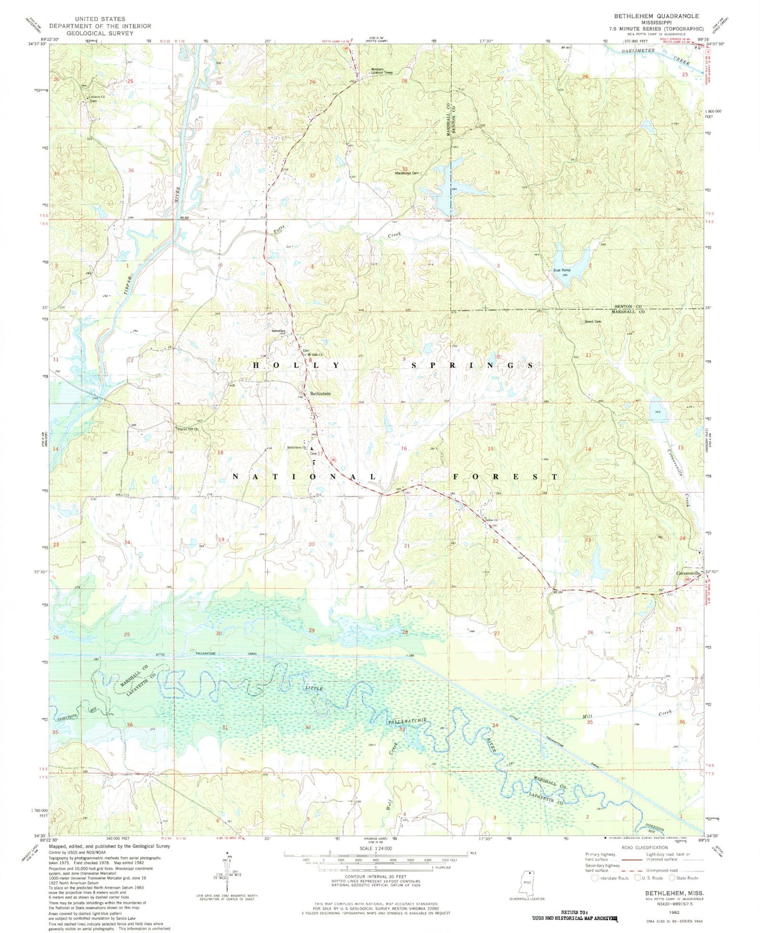
MyTopo
Classic USGS Bethlehem Mississippi 7.5'x7.5' Topo Map
Couldn't load pickup availability
Historical USGS topographic quad map of Bethlehem in the state of Mississippi. Map scale may vary for some years, but is generally around 1:24,000. Print size is approximately 24" x 27"
This quadrangle is in the following counties: Benton, Lafayette, Marshall.
The map contains contour lines, roads, rivers, towns, and lakes. Printed on high-quality waterproof paper with UV fade-resistant inks, and shipped rolled.
Contains the following named places: Baker and Maxie Mill, Baptist Hill Cemetery, Baptist Hill Church, Bethlehem, Bethlehem Cemetery, Bethlehem Census Designated Place, Bethlehem Church, Bethlehem School, Brent Cemetery, Brents Lake, Cornersville, Cornersville Cemetery, Cypress Creek, Goodmans Ferry, Holly Springs National Forest, Lebanon Cemetery, Little Tallahatchie Canal, Macedonia Cemetery, Macedonia Church, Mill Creek, Mount Ollie Church, Oaklimeter Watershed LT-8-21 Dam, Overton School, Potts Camp Volunteer Fire Department Bethlehem Station, Potts Creek, Rhea Lake Dam, Riverside, Riverside Church, Riverside School, Robinson Lake Dam, Salem Cemetery, Salem Church, Spence Branch, Taylor Lake Dam, Tippah River Watershed LT-7-21 Dam, Wares Bridge, Winborn Lookout Tower, Wolf Creek, ZIP Code: 38659


