MyTopo
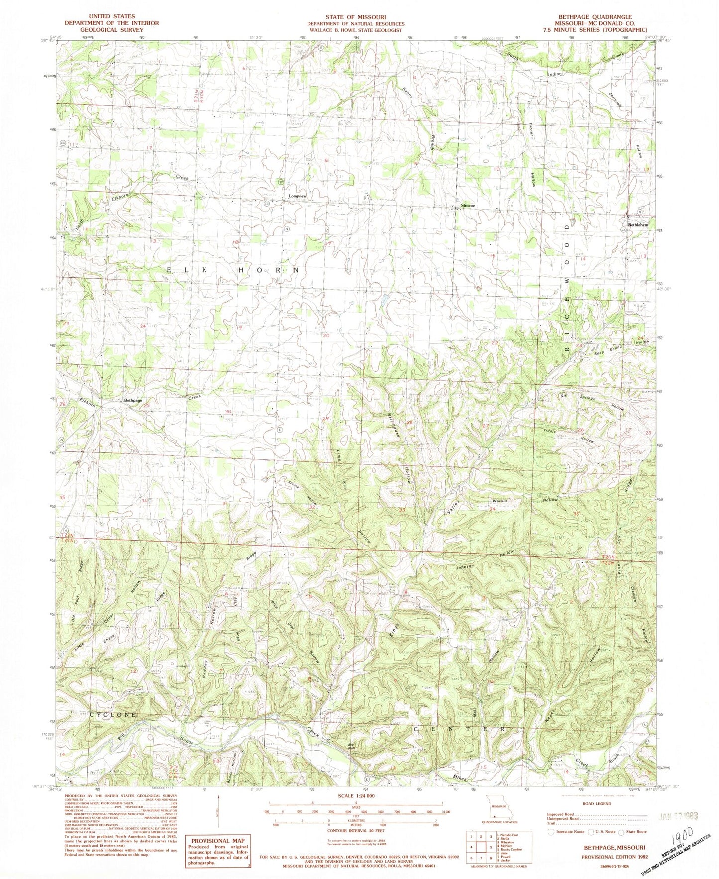
Classic USGS Bethpage Missouri 7.5'x7.5' Topo Map
Couldn't load pickup availability
Historical USGS topographic quad map of Bethpage in the state of Missouri. Map scale is 1:24000. Print size is approximately 24" x 27"
This quadrangle is in the following counties: McDonald, Newton.
The map contains contour lines, roads, rivers, towns, and lakes. Printed on high-quality waterproof paper with UV fade-resistant inks, and shipped rolled.
Contains the following named places: Bee Bluff, Bethlehem, Bethpage, Blue Clay Hollow, Blue Clay Ridge, Boone Hollow, Brush Creek, Chase Ridge, Christian Hollow, Crossroad Church, Crossroad School (historical), Elkhorn Springs, Fairview School (historical), Fox School (historical), Hadday Hollow, Hayes Hollow, He Hanken Spring, Horton School (historical), Howe, Johnson Hollow, Kings Valley, Kings Valley School (historical), Lime Kiln Hollow, Longview, Love School (historical), Mail Hollow, Mount Zion Church, Oak Grove School (historical), Old Foot Ridge, Pine Log Ridge, Rocky Comfort Elementary School, Seep Spring Hollow, Shiloh Church (historical), Simcoe, Six Springs Hollow, Spring Hill School (historical), Spring Hollow, Stella Rural Volunteer Fire Department Station 1 Longview Headquarters, Stella Rural Volunteer Fire Department Station 2 Pine Log, Stella Rural Volunteer Fire Department Station 4, Stillhouse Hollow, Success School (historical), Tiddle Hollow, Township of Elk Horn, Turner Hollow, Union Church, Walnut Hollow