
MyTopo
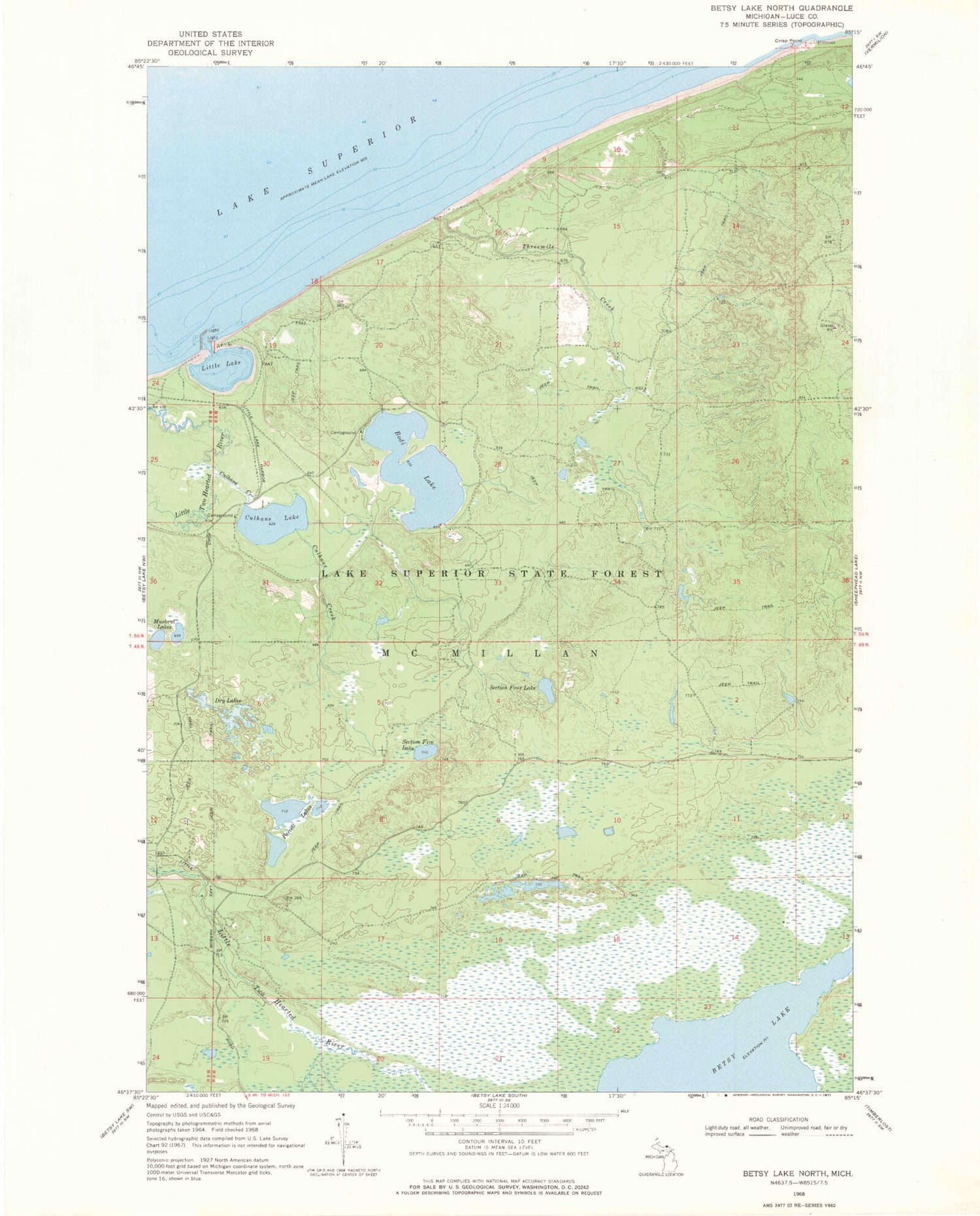
Classic USGS Betsy Lake North Michigan 7.5'x7.5' Topo Map
Couldn't load pickup availability
Historical USGS topographic quad map of Betsy Lake North in the state of Michigan. Typical map scale is 1:24,000, but may vary for certain years, if available. Print size: 24" x 27"
This quadrangle is in the following counties: Luce.
The map contains contour lines, roads, rivers, towns, and lakes. Printed on high-quality waterproof paper with UV fade-resistant inks, and shipped rolled.
Contains the following named places: Betsy Lake, Bodi Lake, Culhane Creek, Culhane Lake, Dry Lakes, Little Lake, Muskrat Lakes, Parcell Lakes, Section Five Lake, Section Four Lake, Threemile Creek, Seminole Lodge, Little Lake Harbor, Chippewa Lodge, State Waterways Commission Dock, Carp River, Bodi Lake State Forest Campground, Culhane Lake State Forest Campground


