MyTopo
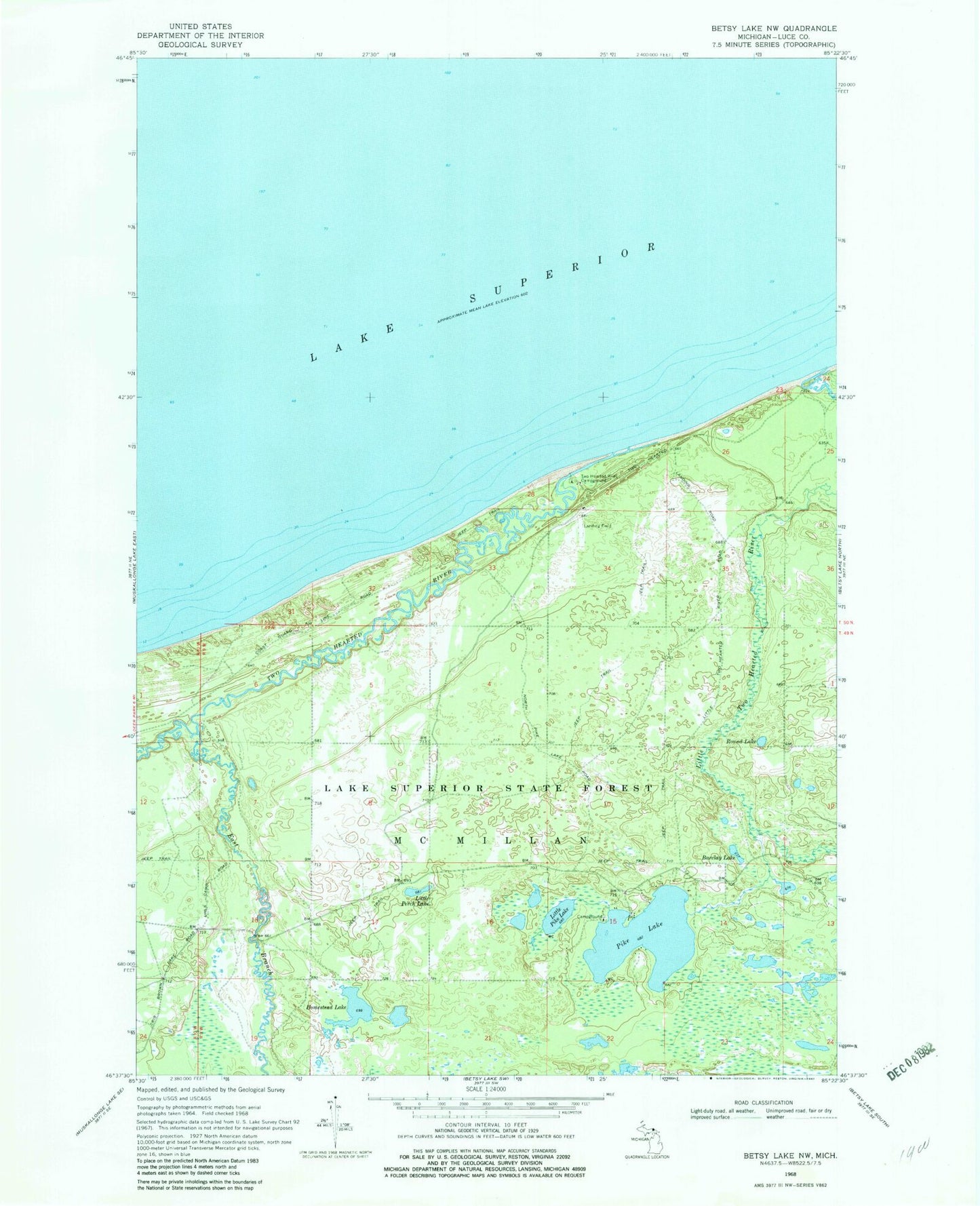
Classic USGS Betsy Lake NW Michigan 7.5'x7.5' Topo Map
Couldn't load pickup availability
Historical USGS topographic quad map of Betsy Lake NW in the state of Michigan. Typical map scale is 1:24,000, but may vary for certain years, if available. Print size: 24" x 27"
This quadrangle is in the following counties: Luce.
The map contains contour lines, roads, rivers, towns, and lakes. Printed on high-quality waterproof paper with UV fade-resistant inks, and shipped rolled.
Contains the following named places: Barclay Lake, East Branch Two Hearted River, Homestead Lake, Little Perch Lake, Little Pike Lake, Little Two Hearted River, Pike Lake, Round Lake, Two Hearted River, Mouth of Two Hearted River State Forest Campground, Pike Lake State Forest Campground, Life Saving Station Historical Marker, Two Hearted Airstrip