MyTopo
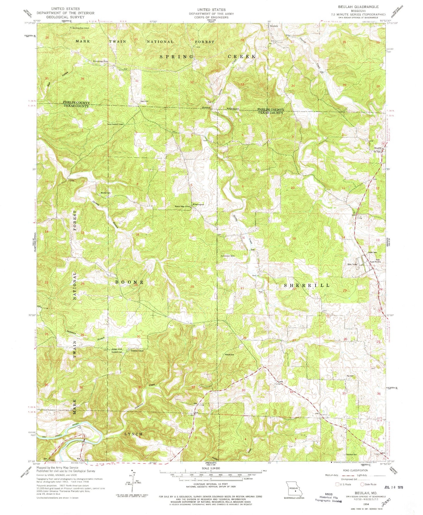
Classic USGS Beulah Missouri 7.5'x7.5' Topo Map
Couldn't load pickup availability
Historical USGS topographic quad map of Beulah in the state of Missouri. Map scale may vary for some years, but is generally around 1:24,000. Print size is approximately 24" x 27"
This quadrangle is in the following counties: Phelps, Texas.
The map contains contour lines, roads, rivers, towns, and lakes. Printed on high-quality waterproof paper with UV fade-resistant inks, and shipped rolled.
Contains the following named places: Anderson Creek, Bethlehem School, Beulah, Beulah Cemetery, Blooming Rose, Blooming Rose School, Craddock Cemetery, Craddock Field, Craddock School, Davis Cemetery, Dent, Harke Lake, Harke Lake Dam, Kinderpost, Licking State Forest Nursery, Mason Bridge River Access and Boat Launch, Mitchell Cemetery, Ray Cemetery, Shafer Cemetery, Sherrill, Sherrill School, South Sherrill Creek, Texas Lookout Tower, Vancleve Cemetery, Walnut Ridge School, Willhite Cemetery, Zenender Sink, ZIP Code: 65436