MyTopo
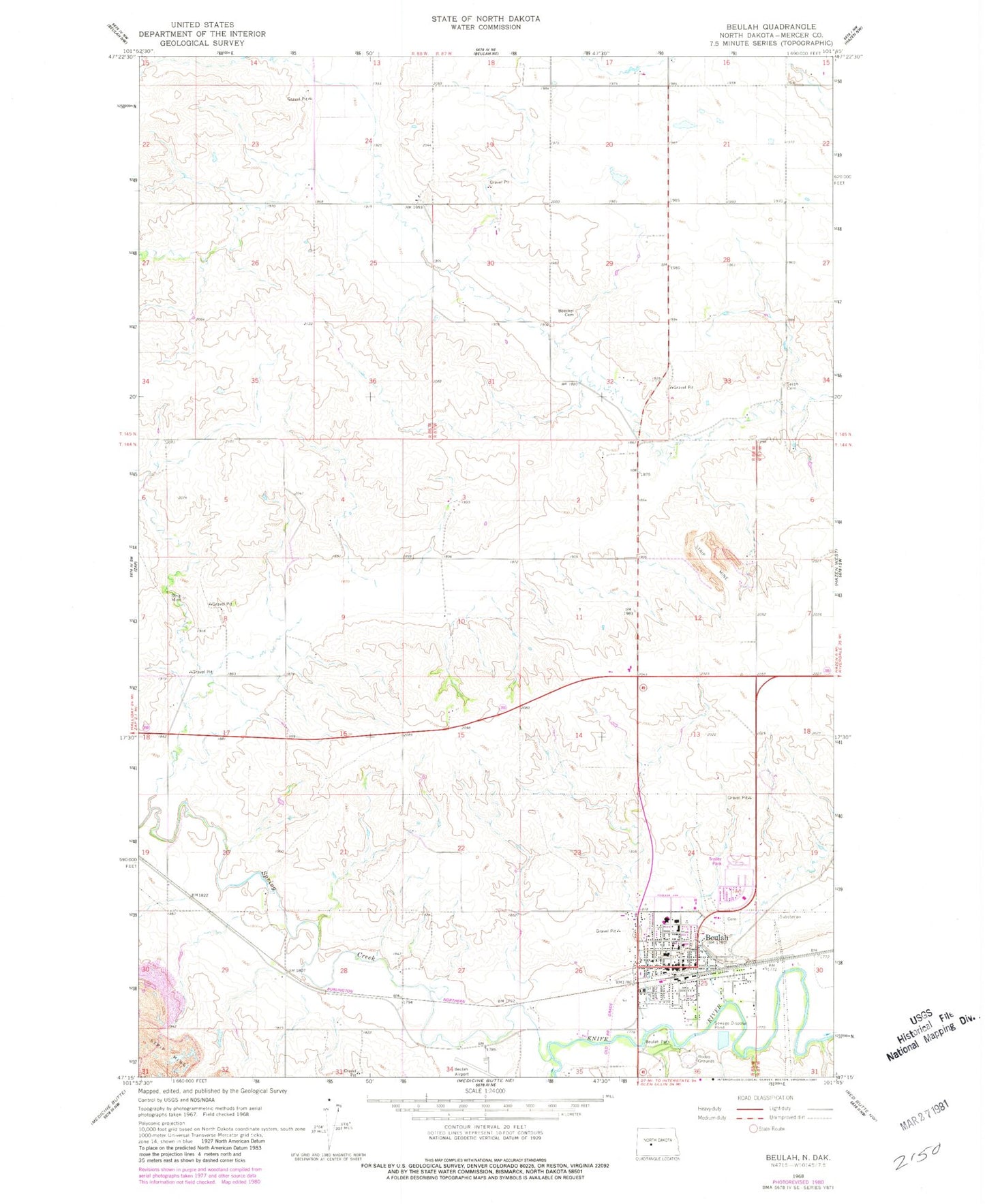
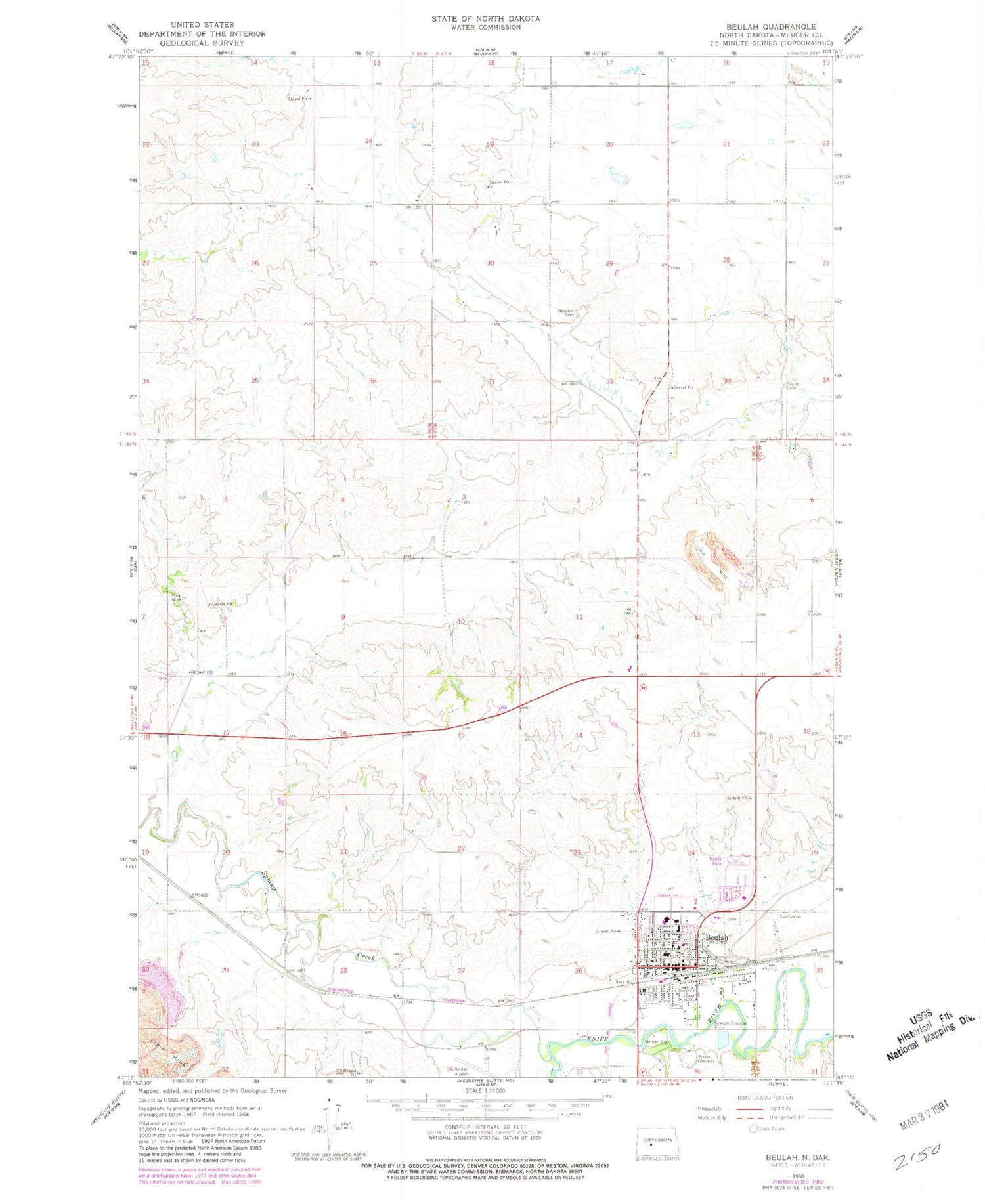
Classic USGS Beulah North Dakota 7.5'x7.5' Topo Map
Couldn't load pickup availability
Historical USGS topographic quad map of Beulah in the state of North Dakota. Map scale may vary for some years, but is generally around 1:24,000. Print size is approximately 24" x 27"
This quadrangle is in the following counties: Mercer.
The map contains contour lines, roads, rivers, towns, and lakes. Printed on high-quality waterproof paper with UV fade-resistant inks, and shipped rolled.
Contains the following named places: Beulah, Beulah Airport, Beulah City Cemetery, Beulah City Hall, Beulah Elementary School, Beulah High School, Beulah Middle School, Beulah Park, Beulah Police Department, Beulah Post Office, Beulah Public Library, Beulah Rural Fire Station, Boeckel Cemetery, City of Beulah, Colt Dam, Dakota Gasification Company Ambulance Service, KHOL-AM (Beulah), Knife River Care Center, Mercer County, Mercer County Ambulance Service Beulah, Mercer County Historical Museum, Pfennig Wildlife Museum, Spring Creek, Wally Dresskell Lake, Williston Basin, Zaron Cemetery, Zion Lutheran Church Cemetery, ZIP Code: 58523