MyTopo
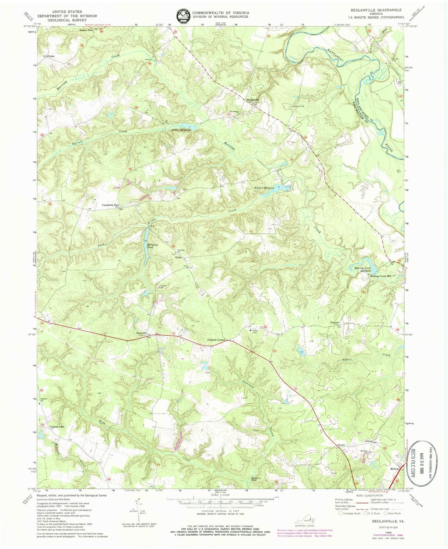
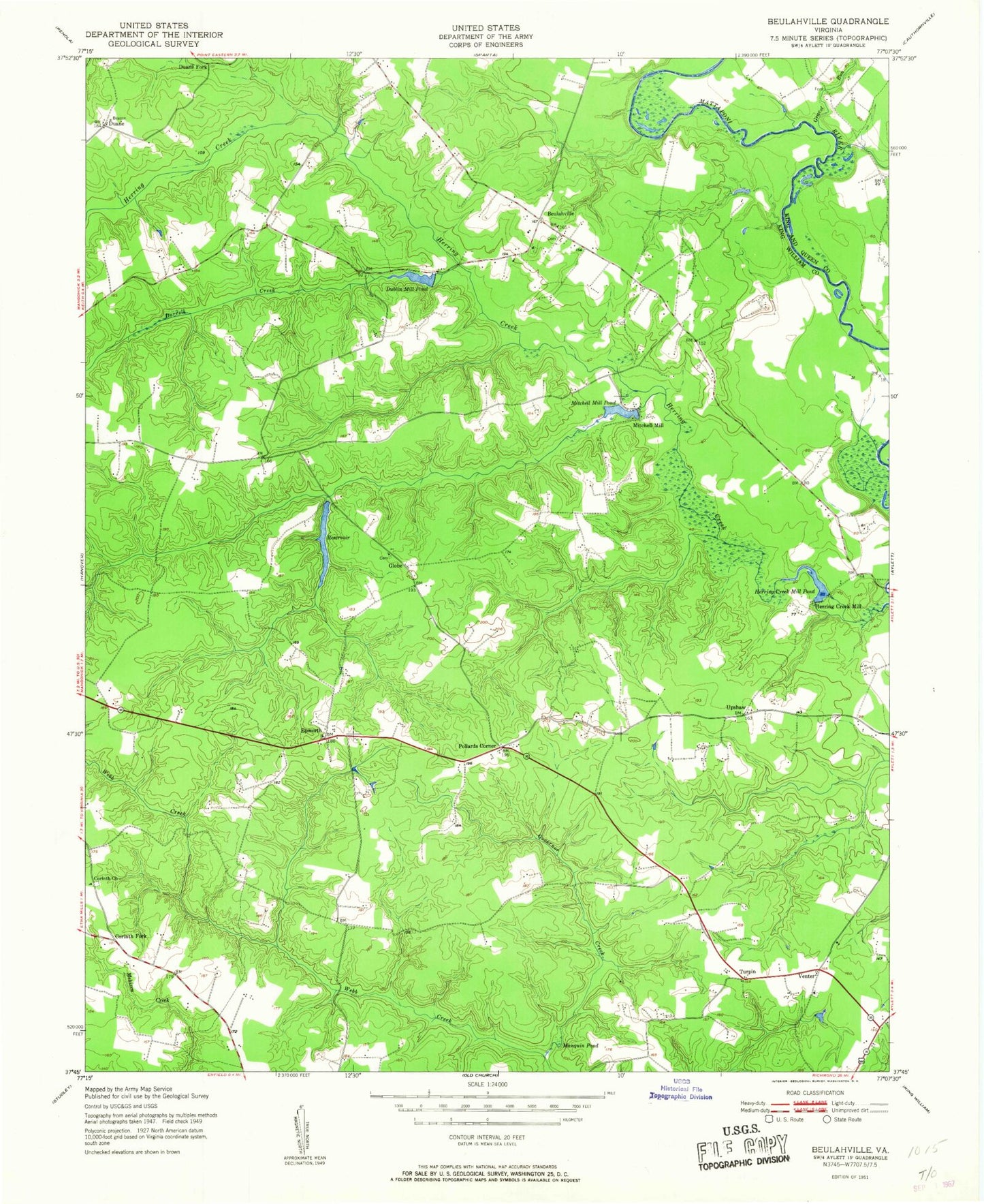
Classic USGS Beulahville Virginia 7.5'x7.5' Topo Map
Couldn't load pickup availability
Historical USGS topographic quad map of Beulahville in the state of Virginia. Typical map scale is 1:24,000, but may vary for certain years, if available. Print size: 24" x 27"
This quadrangle is in the following counties: Caroline, King William, King and Queen.
The map contains contour lines, roads, rivers, towns, and lakes. Printed on high-quality waterproof paper with UV fade-resistant inks, and shipped rolled.
Contains the following named places: Campbells Fork, Corinth Church, Dorrell Creek, Fork Bridge Creek, Governor Swamp, Gravel Run, Herring Creek Mill, McGeorge Pond, Moncuin Pond, Mount Sinai Church, Providence Church, Saint Pauls Church, Corinth Fork, Duane, Duane Fork, Epworth, Midway, Turpin, Upshaw, Venter, Gutherie Dam, Gutherie Pond, Dublin Millpond Dam, Mitchell Millpond Dam, Herring Creek Millpond Dam, Kellys Dam, Hall Dam, Beulahville, Globe, Pollards Corner, Dublin Millpond, Herring Creek Millpond, Mitchell Millpond, Beulah Church, Beulahville School (historical), Beulahville School (historical), Mitchell Mill, Venter School (historical), Mangohick District, Beulah Baptist Church Cemetery, Epworth United Methodist Church Cemetery