MyTopo
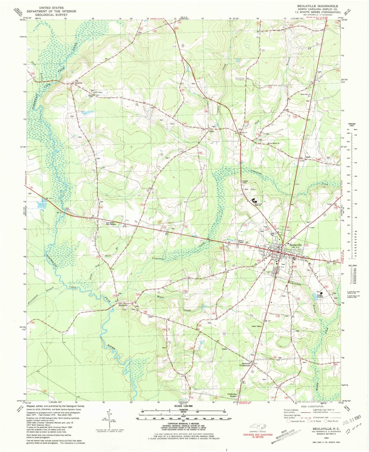
Classic USGS Beulaville North Carolina 7.5'x7.5' Topo Map
Couldn't load pickup availability
Historical USGS topographic quad map of Beulaville in the state of North Carolina. Map scale may vary for some years, but is generally around 1:24,000. Print size is approximately 24" x 27"
This quadrangle is in the following counties: Duplin.
The map contains contour lines, roads, rivers, towns, and lakes. Printed on high-quality waterproof paper with UV fade-resistant inks, and shipped rolled.
Contains the following named places: Beulaville, Beulaville Baptist Church, Beulaville Elementary School, Beulaville Fire Department, Beulaville Free Will Baptist Church, Beulaville Pentecostal Free Will Baptist Church, Beulaville Police Department, Beulaville Post Office, Beulaville Presbyterian Church, Beulaville United Methodist Church, Beulaville Wastewater Treatment Plant, Bible Believers Fellowship Church, Cabin, Cabin Church, Cabin Creek, Catherine Square, Dark Branch, Duplin County Emergency Medical Services Medic 5, Duplin County Library - Phillip Leff Memorial Branch, East Duplin High School, East Duplin Memorial Gardens, Freewill Baptist Church, Grey Run, Grim Chapel, Grove Creek, Gum Branch, Gum Branch Church, Hallsville, Hallsville Church, Jacksons Crossroads, Jones Free Will Baptist Church, Jump and Run Branch, Limestone Creek, Macedonia Holiness Church, Maple Creek, Masses Chapel, Pentecostal Church of God, Persimmon Branch, Petersburg Crossing, Sanderson Fish Pond, Sandy Plain Church, Sarecta, Sarecta Fire Department, Town of Beulaville, Township of Limestone