
MyTopo
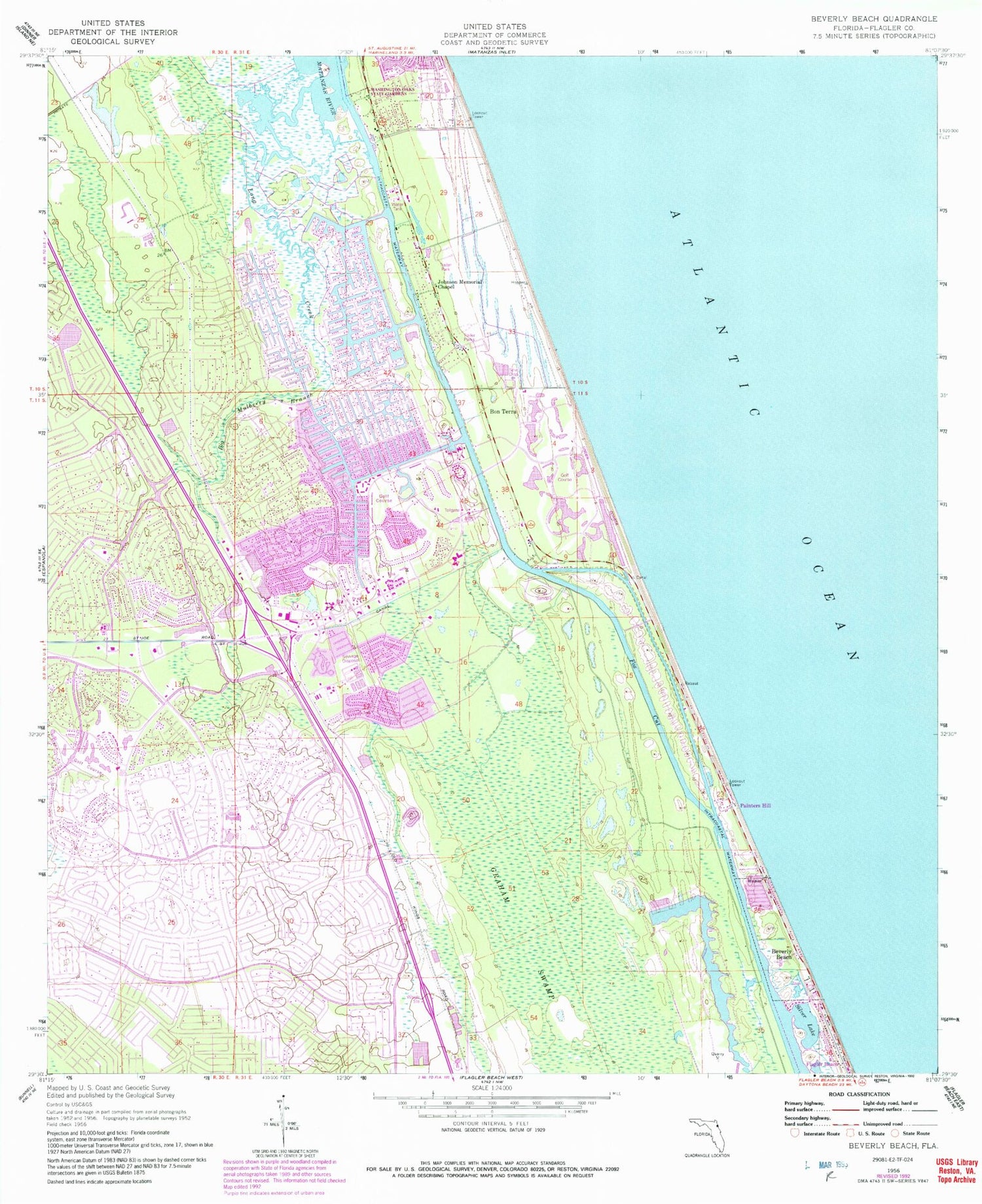
Classic USGS Beverly Beach Florida 7.5'x7.5' Topo Map
Couldn't load pickup availability
Historical USGS topographic quad map of Beverly Beach in the state of Florida. Map scale is 1:24000. Print size is approximately 24" x 27"
This quadrangle is in the following counties: Flagler.
The map contains contour lines, roads, rivers, towns, and lakes. Printed on high-quality waterproof paper with UV fade-resistant inks, and shipped rolled.
Contains the following named places: Beverly Beach, Beverly Beach Trailer Park, Big Mulberry Branch, Bon Terra, City of Palm Coast, Flagler Beach Division, Flagler by the Sea Mobile Home Park, Flagler County Fire Department Station 41 Hammock, Flagler County Fire Rescue 21, Flagler County Fire Rescue 21, Flagler County Fire Rescue 22, Flagler County Fire Rescue Station 41, Flagler County Palm Coast Community Center, Flagler County Sheriff's Office Beverly Beach Substation, Flagler County Sheriff's Office Hammock Substation, Flagler County Sheriff's Office Palm Coast Substation, Fox Cut, Graham Swamp, Johnson Memorial Chapel, Lake Rayonier Two, Little Mulberry Branch, Long Creek, Painters Hill, Palm Coast, Palm Coast Fire Department Station 21, Palm Coast Fire Department Station 21, Palm Coast Fire Department Station 22, Palm Coast Marina, Palm Coast Post Office, Royal Wood Golf and Country Club, Sabal Palm Golf Course, Saint Andrews Country Club, Saint Augustine Shores Golf Club, Saint Joe Canal, Silver Lake, Surfside Estates Mobile Home Park, Town of Beverly Beach, United Christian School


