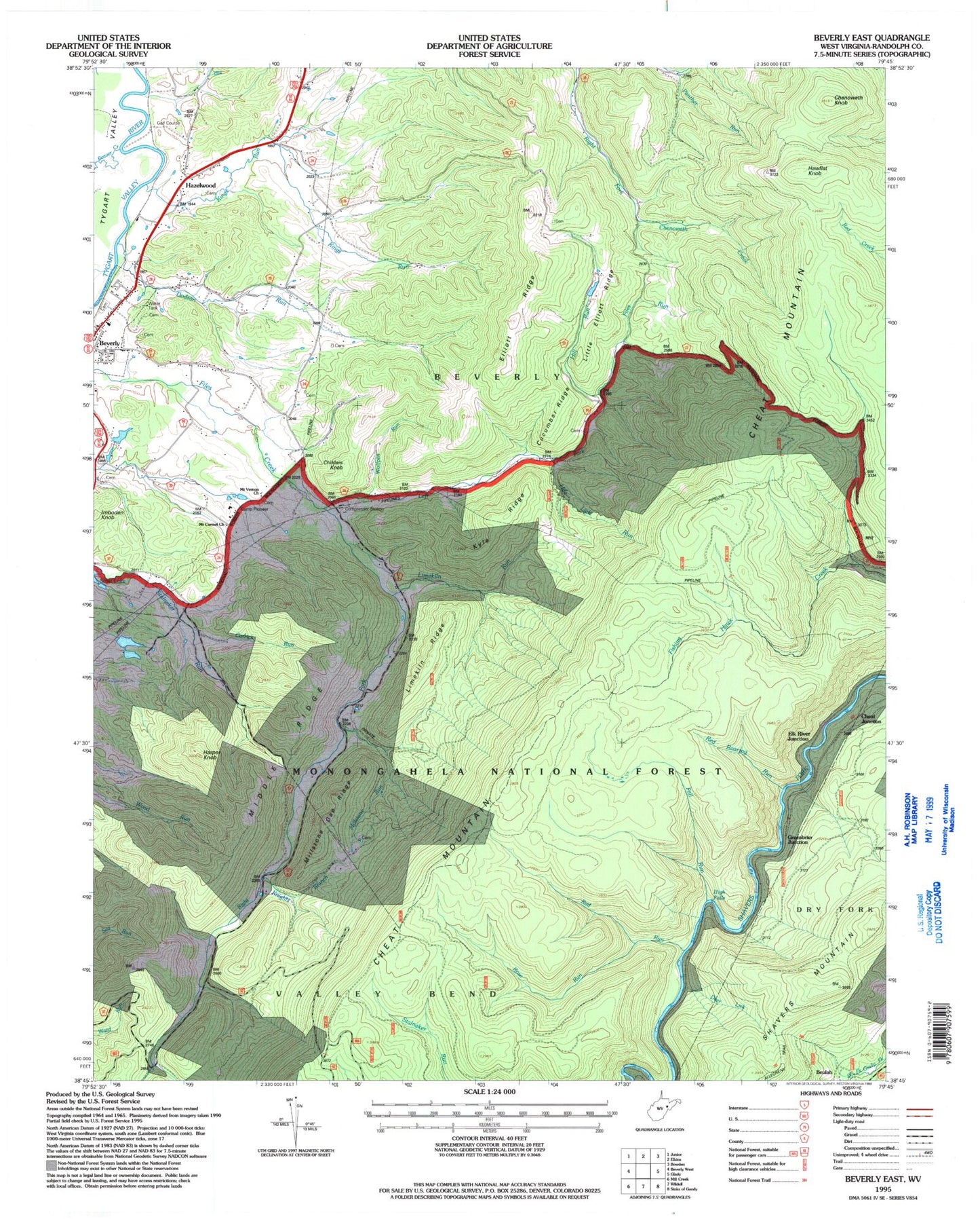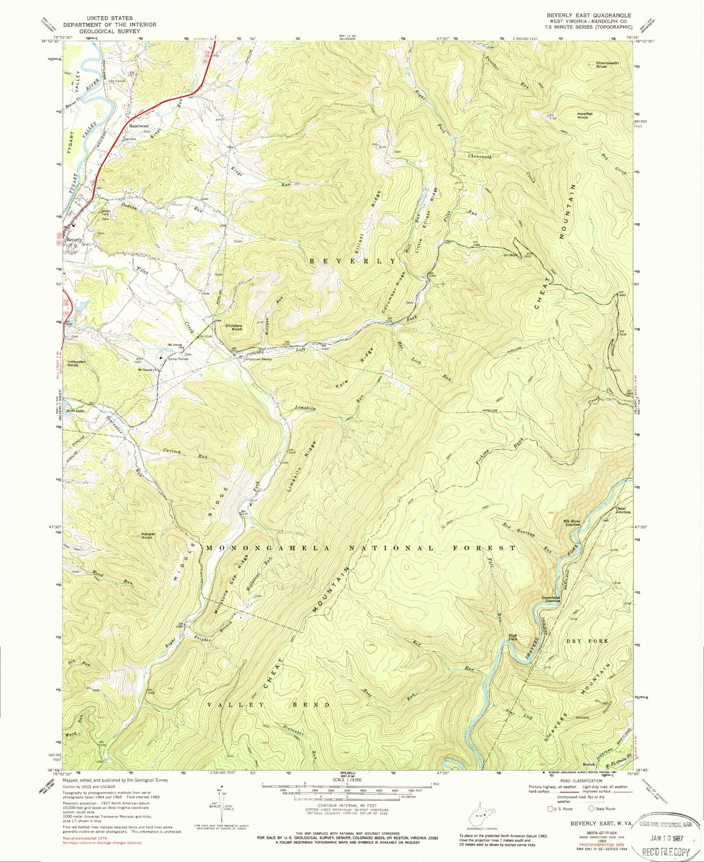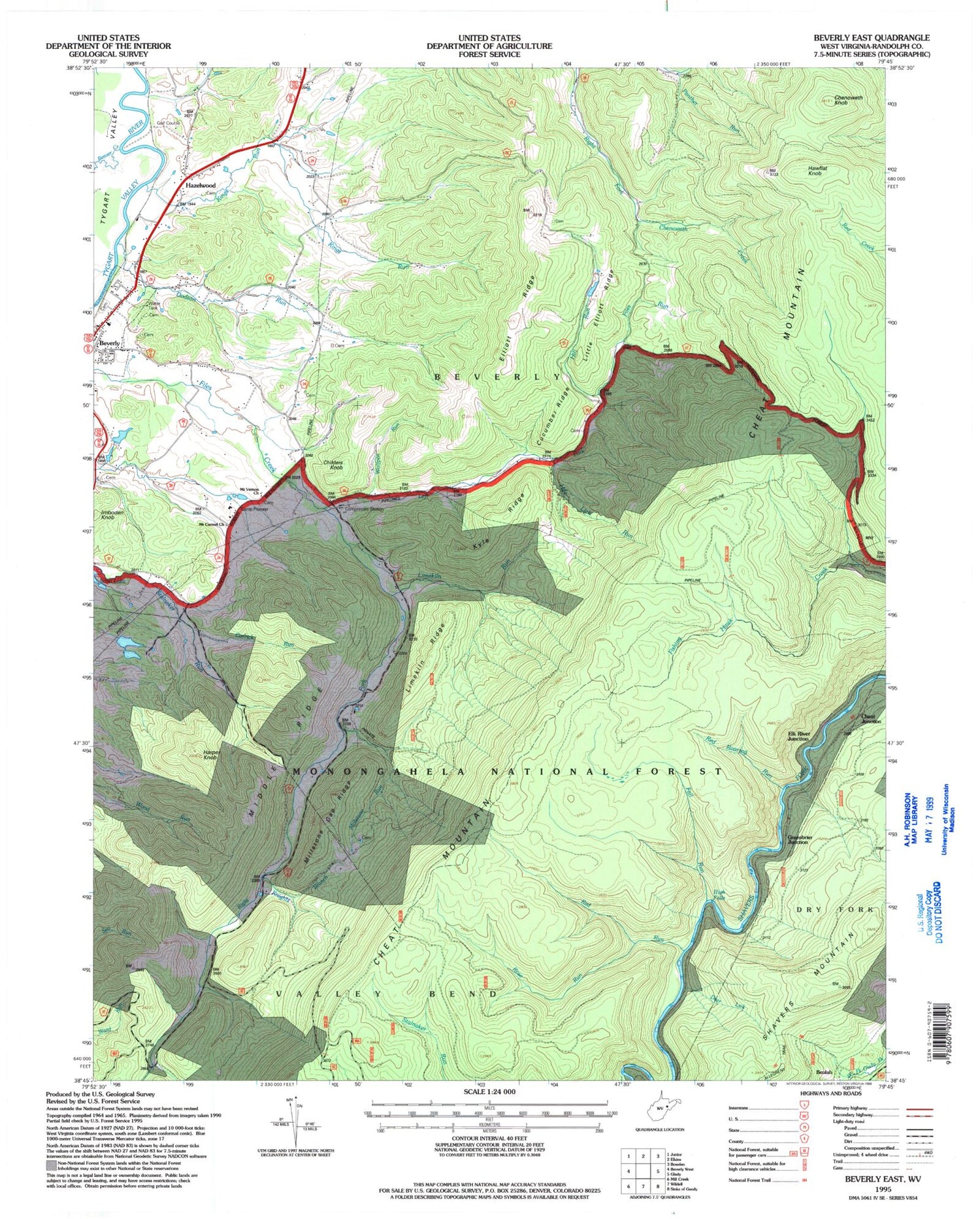

MyTopo
Classic USGS Beverly East West Virginia 7.5'x7.5' Topo Map
Couldn't load pickup availability
Historical USGS topographic quad map of Beverly East in the state of West Virginia. Typical map scale is 1:24,000, but may vary for certain years, if available. Print size: 24" x 27"
This quadrangle is in the following counties: Randolph.
The map contains contour lines, roads, rivers, towns, and lakes. Printed on high-quality waterproof paper with UV fade-resistant inks, and shipped rolled.
Contains the following named places: Beaver Creek, Camp Pioneer, Carrick Run, Chenoweth Knob, Cucumber Ridge, Deer Lick, Dodson Run, Elliott Ridge, Fall Run, Files Run, Harper Knob, High Falls, Hill Run, Hoe Lick Run, Kings Run, Knights Branch, Kyle Ridge, Left Fork Files Creek, Limekiln Ridge, Limekiln Run, Little Elliott Ridge, Middle Ridge, Millstone Gap Ridge, Millstone Run, Mount Carmel Church, Mount Vernon Church, Panther Run, Red Roaring Run, Red Run, Right Fork Files Creek, Rose Run, Wolfpen Run, Beulah, Cheat Junction, Childers Knob, Elk River Junction, Greenbrier Junction, Hawflat Knob, Hazelwood, Imboden Knob, Sherwan Lake Dam, WDNE-FM (Elkins), Scott Lake Dam, Beverly Cemetery, Beverly Elementary School, Beverly Post Office, Elkhorn School (historical), Hazelwood School (historical), Millstone School (historical), Mount Iser Cemetery, Pleasant View School (historical), Mount Vernon School (historical), Beverly District, Valley Bend District, Abundant Life Christian Academy, Town of Beverly, Lazy J Aerodrome, Beverly Volunteer Fire Department, Stalnaker Cemetery, Elks Golf Course, West Virginia State Police Troop 3 - Headquarters