MyTopo
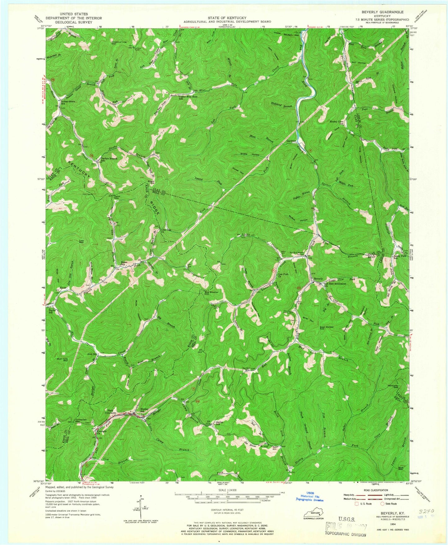
Classic USGS Beverly Kentucky 7.5'x7.5' Topo Map
Couldn't load pickup availability
Historical USGS topographic quad map of Beverly in the state of Kentucky. Map scale is 1:24000. Print size is approximately 24" x 27"
This quadrangle is in the following counties: Bell, Clay, Knox, Leslie.
The map contains contour lines, roads, rivers, towns, and lakes. Printed on high-quality waterproof paper with UV fade-resistant inks, and shipped rolled.
Contains the following named places: Alex Creek, Alex School, Asher Cemetery, Baker Branch, Bear Wallow Gap, Bear Wallow Hollow, Bell Branch, Bell Lookout, Ben Carrol Branch, Beverly, Beverly Post Office, Beverly Post Office (historical), Big Branch, Big Branch, Birch Lick Branch, Bloss Branch, Blue Hole Creek, Board Tree Branch, Bob Slusher Gap, Briar Hollow, Briar Hollow, Britts Railroad Station (historical), Buck Hollow, Buffalo Branch, Butcher Branch, Camp Branch, Carter Roark Branch, Chestnut Log Gap, Clay Gap Church, Coon Branch, Cove Hollow, Cow Branch, Cow Fork, Cow Fork Church, Cow Hollow, Crockett Church, Darbs Branch, Darbys Branch School, Dry Branch, Dry Branch, East Branch Phillips Fork, Eros Post Office (historical), Erose, Erose School, Field, Garden Hollow, Gardner, Gardner Post Office (historical), Gardner Railroad Station (historical), Harbon Railroad Station (historical), Horse Hollow, Ice Cliff Post Office (historical), Indian Grave Branch, Indian Grave School, Jackson Branch, Jim Branch, Kentucky Gap, Kentucky Ridge, Laurel Branch, Laurel Fork, Lawson Branch, Lawson Creek, Left Fork Blue Hole Creek, Left Fork Indian Grave Branch, Left Fork Spruce Branch, Lick Fork, Little Camp Branch, Little Cow Fork, Little Creek, Little Rocky Point Branch, Long Branch, Long Hollow, Low Gap, Low Gap Branch, McRoe Hollow, Middle Fork Spruce Branch, Mill Hollow, Mosley Cove, Mosley Cove School, Mud Gap, Mud Hole Gap, Mud Lick Branch, Neal Hollow, Nugym (historical), Old Field Branch, Old House Branch, Orchard Hollow, Orchard Hollow, Paint Gap, Paint Gap Branch, Paw Paw Cove, Peach Orchard Branch, Phillips Fork Church, Pigeon Fork, Pups Branch, Red Bird Mission Hospital, Red Bird Settlement School, Redbud Railroad Station (historical), Rich Branch, Richland Branch, Right Fork Indian Grave Branch, Rock House Branch, Rocky Hollow, Rocky Point Branch, Sal North Branch, Sand Fork Post Office (historical), Sandy Fork, Sandy Fork Coal Preparation Plant, Sandy Fork School (historical), Saw Pit Hollow, Saylor School, Shep Hollow, Short Hollow, Skidmore Post Office (historical), Slusher School, Snake Hollow, Spice Lick Branch, Spruce Branch, Steel Trap Branch, Straight Creek Branch, Sugar Gap, Sugar Gap Branch, Taylor School, The Wetherby Trail, Thompson Hollow, Toms Branch, Turkeypen Gap, Upper Blue Hole School, Upper DeZarn Hollow, Wilson Branch, Witch Hollow