MyTopo
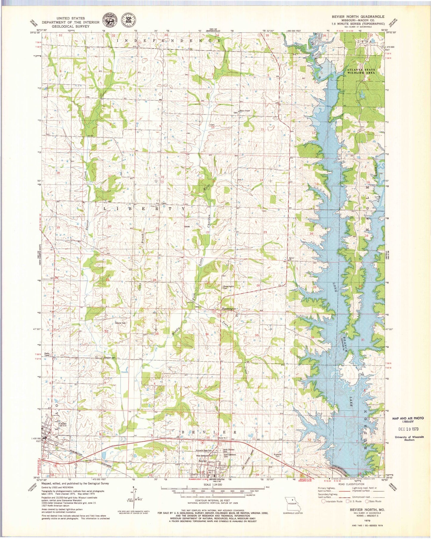
Classic USGS Bevier North Missouri 7.5'x7.5' Topo Map
Couldn't load pickup availability
Historical USGS topographic quad map of Bevier North in the state of Missouri. Map scale may vary for some years, but is generally around 1:24,000. Print size is approximately 24" x 27"
This quadrangle is in the following counties: Macon.
The map contains contour lines, roads, rivers, towns, and lakes. Printed on high-quality waterproof paper with UV fade-resistant inks, and shipped rolled.
Contains the following named places: Bethel Church, Bloomington, Bloomington Cemetery, Callao, Callao Town and Country Fire Department, Camp Branch, Centerville School, City of Bevier, City of Callao, Claude Bloomberg Dam, Claude Bloomberg Lake, East Oakwood Cemetery, Enon Church, Fletcher School, Freedom Cemetery, Hazel Grove School, Lick Creek, Long Branch, Long Branch Dam, Long Branch Lake, Macon County, McVicker Lake Dam, Milam Chapel, Milam Chapel Cemetery, New Fairview School, Old Callao Cemetery, Prairie School, Richards Dale Cemetery, Saint Charles Cemetery, Seney, Seney Post Office, Seny School, Skinner Cemetery, Sweezer Creek, Town Creek, Township of Liberty, Walnut Grove School, West Oakwood Cemetery, ZIP Code: 63532