MyTopo
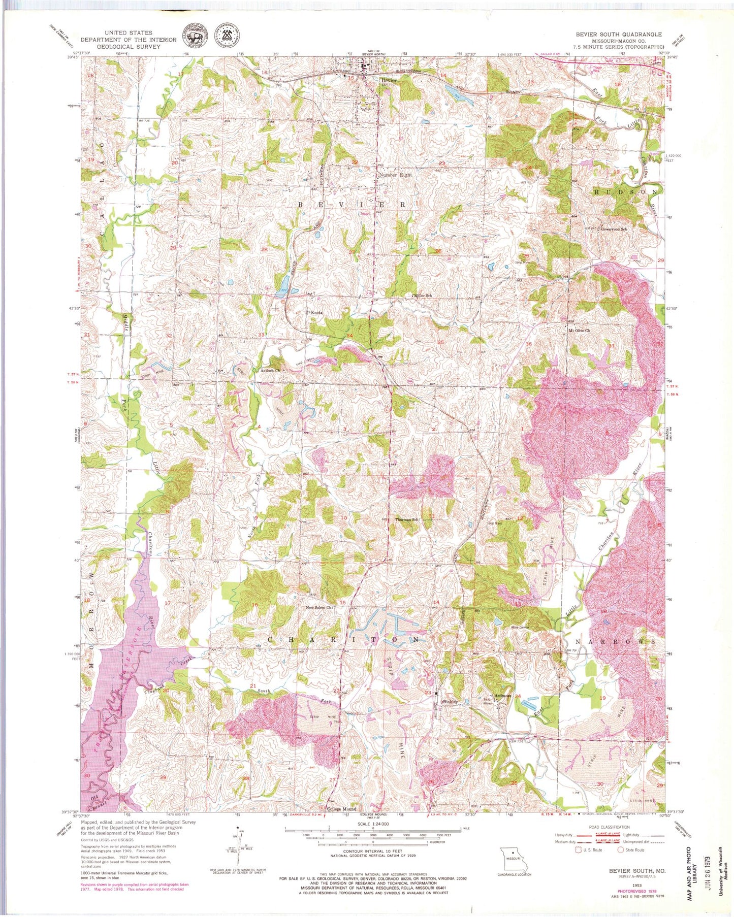
Classic USGS Bevier South Missouri 7.5'x7.5' Topo Map
Couldn't load pickup availability
Historical USGS topographic quad map of Bevier South in the state of Missouri. Map scale may vary for some years, but is generally around 1:24,000. Print size is approximately 24" x 27"
This quadrangle is in the following counties: Macon.
The map contains contour lines, roads, rivers, towns, and lakes. Printed on high-quality waterproof paper with UV fade-resistant inks, and shipped rolled.
Contains the following named places: Antioch Church, Ardmore, Ardmore School, Bevier, Bevier Fire Department, Bevier Lake, Bevier Post Office, Binkley, Brammer School, Burris School, Central Coal and Coke Corporation Lake Dam, Chariton, Claybank Creek, Dewey School, Duck Creek, Elk Fork School, Gipson School, Greenwood School, Keota, Keota Lake, Keota Lake Dam, Keota School, Leathers School, Miller School, Mount Olive Church, New Salem Church, North Fork Claybank Creek, Northwestern, Number Eight, South Fork Claybank Creek, Thurman School, Township of Bevier, Township of Chariton, Union Cemetery, Winkle School