MyTopo
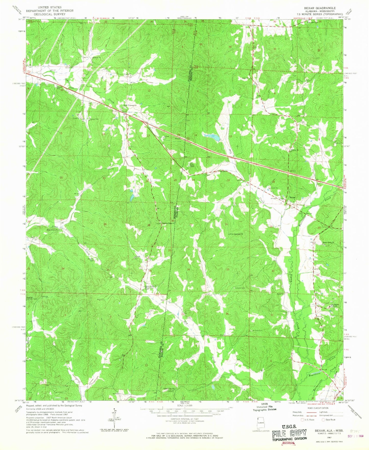
Classic USGS Bexar Alabama 7.5'x7.5' Topo Map
Couldn't load pickup availability
Historical USGS topographic quad map of Bexar in the states of Alabama, Mississippi. Map scale may vary for some years, but is generally around 1:24,000. Print size is approximately 24" x 27"
This quadrangle is in the following counties: Itawamba, Marion.
The map contains contour lines, roads, rivers, towns, and lakes. Printed on high-quality waterproof paper with UV fade-resistant inks, and shipped rolled.
Contains the following named places: Ada Hanna High School, Bexar, Bexar Cemetery, Bexar Church, Bexar United Methodist Church, Boardtree Creek, Byrd Volunteer Fire Department, Concord Cemetery, Dry Creek, Elksville, Elvis Spearman Church, Gann Cemetery, Guthrie Cut Church, Hurricane Creek, James Creek Church, Liberty Grove Volunteer Fire Department, McRae Dam, McRae Lake, Mount Pleasant Cemetery, Mount Pleasant Church, Mount Zion Cemetery, Piney Grove Church, Pleasant Ridge Cemetery, Pleasant Ridge Church, Robinson Cemetery, Rocky Grove Cemetery, Rocky Grove Missionary Baptist Church, Salem Church, Smith Temple Church, Stevens Cemetery, Wiggington Cemetery, ZIP Code: 38876