MyTopo
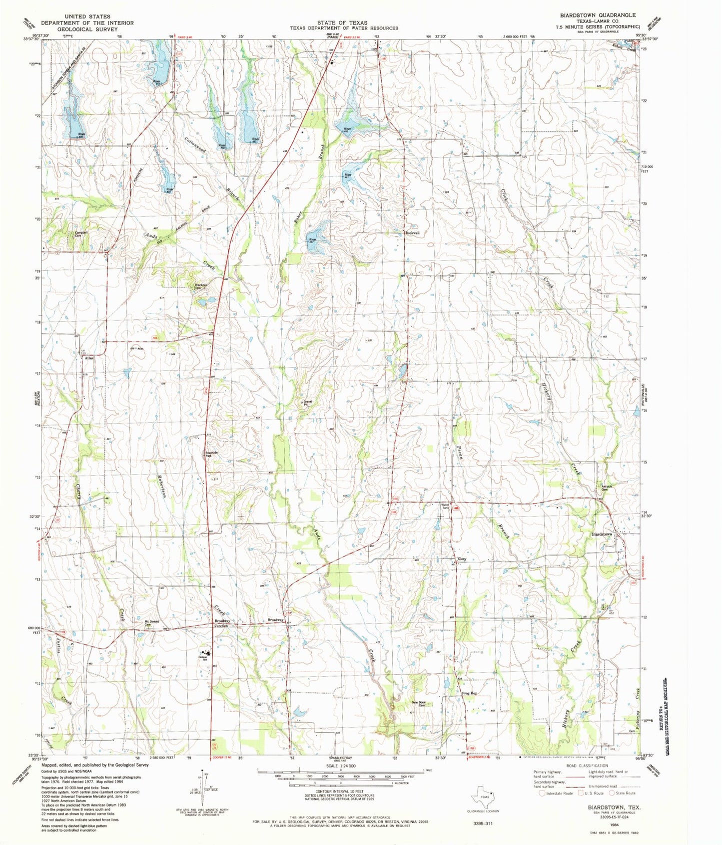
Classic USGS Biardstown Texas 7.5'x7.5' Topo Map
Couldn't load pickup availability
Historical USGS topographic quad map of Biardstown in the state of Texas. Map scale may vary for some years, but is generally around 1:24,000. Print size is approximately 24" x 27"
This quadrangle is in the following counties: Lamar.
The map contains contour lines, roads, rivers, towns, and lakes. Printed on high-quality waterproof paper with UV fade-resistant inks, and shipped rolled.
Contains the following named places: Antioch Cemetery, Atlas, Baker Branch, Biardstown, Biardstown Division, Biardstown Volunteer Fire Department, Brackeen Cemetery, Broadway, Broadway Junction, Campbell Cemetery, Center Grove School, Click Creek, Cottonwood Branch, Delmar High School, Friendship Church, Frog Hop, Glory, KZJF-TV (Paris), Lamar County Midway Volunteer Fire Department, Limekiln School, McDonald Cemetery, Midway Church, New Dora Cemetery, New Dora School, Pecan Branch, Pleasant Valley Church, Rockwell, Soil Conservation Service Site 10 Dam, Soil Conservation Service Site 10 Reservoir, Soil Conservation Service Site 11 Reservoir, Soil Conservation Service Site 12 Dam, Soil Conservation Service Site 12 Reservoir, Soil Conservation Service Site 13 Dam, Soil Conservation Service Site 13 Reservoir, Soil Conservation Service Site 14 Dam, Soil Conservation Service Site 14 Reservoir, Soil Conservation Service Site 6a Dam, Soil Conservation Service Site 6a Reservoir, Soil Conservation Service Site 7 Dam, Soil Conservation Service Site 7 Reservoir, Soil Conservation Service Site 8a Dam, Soil Conservation Service Site 8a Reservoir, Soil Conservation Service Site Ii Dam, Trinity School, Viewpoint School