MyTopo
Classic USGS Bible Grove Missouri 7.5'x7.5' Topo Map
Couldn't load pickup availability
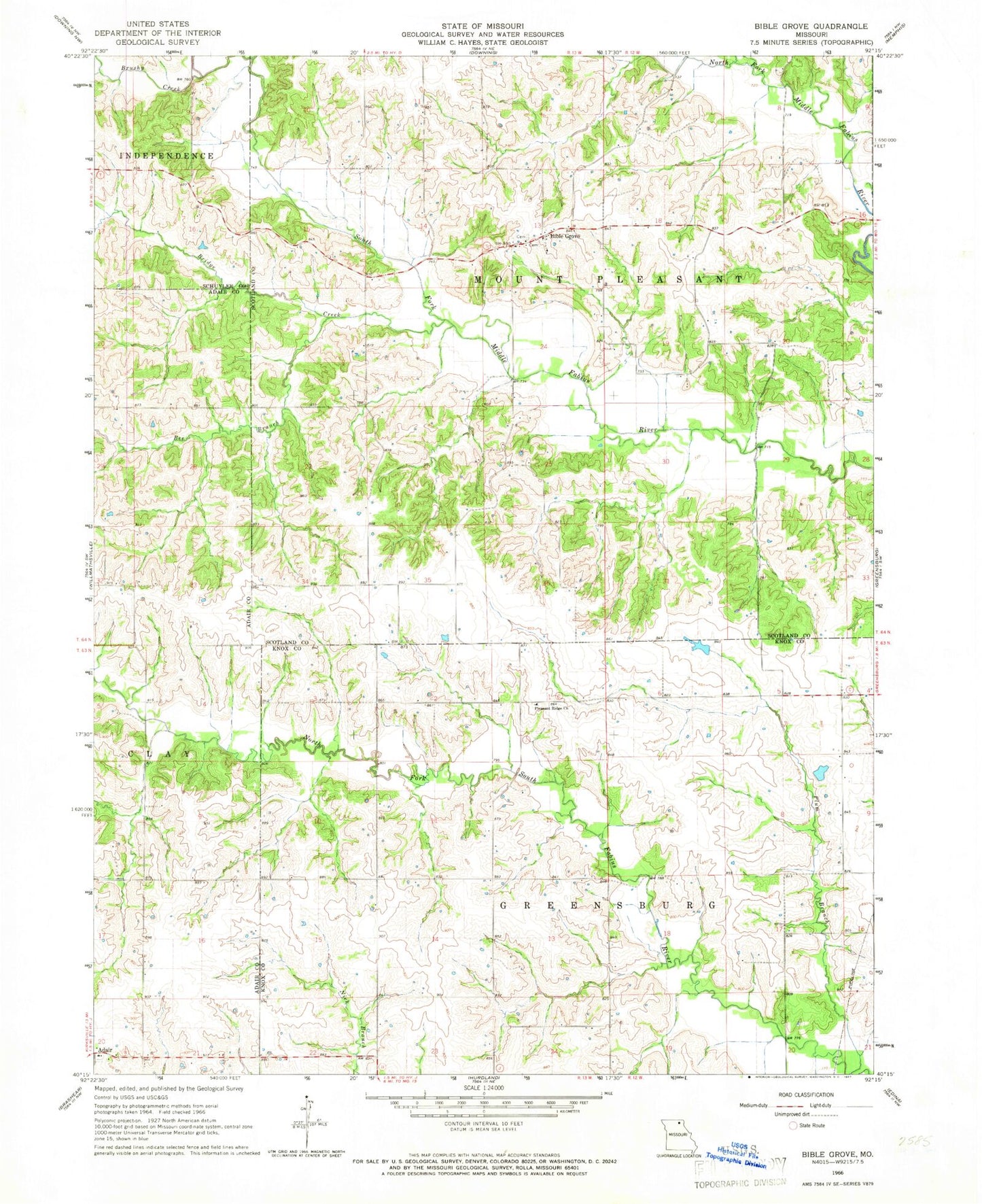
Historical USGS topographic quad map of Bible Grove in the state of Missouri. Map scale may vary for some years, but is generally around 1:24,000. Print size is approximately 24" x 27"
This quadrangle is in the following counties: Adair, Knox, Schuyler, Scotland.
The map contains contour lines, roads, rivers, towns, and lakes. Printed on high-quality waterproof paper with UV fade-resistant inks, and shipped rolled.
Contains the following named places: Bee Branch, Bible Grove, Bible Grove Christian Church Cemetery, Bible Grove Church of Christ Cemetery, Bridge Creek, Brushy Creek, Gaylen Hill Dam, Hazelville, Knob View School, Meadow Brook, Meadow Brook School, Miller School, Old Buzzard School, Pleasant Ridge Church, Plum Branch, Rowland-Klopfenstein Lake Dam, Slocum Cemetery, Swearingen Lake Dam, Township of Greensburg, Township of Mount Pleasant, Walter R Tompson Dam